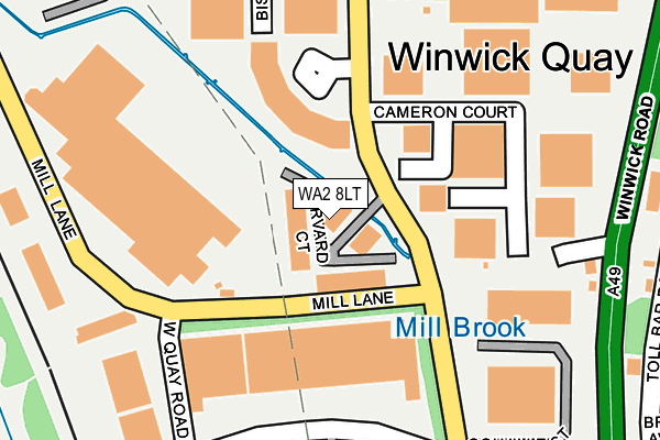
WA2 8LT lies on Harvard Court in Warrington. WA2 8LT is located in the Poplars and Hulme electoral ward, within the unitary authority of Warrington and the English Parliamentary constituency of Warrington North. The Sub Integrated Care Board (ICB) Location is NHS Cheshire and Merseyside ICB - 02E and the police force is Cheshire. This postcode has been in use since January 1992.


GetTheData
Source: OS OpenMap – Local (Ordnance Survey)
Source: OS VectorMap District (Ordnance Survey)
Licence: Open Government Licence (requires attribution)
| Easting | 360053 |
| Northing | 391468 |
| Latitude | 53.418491 |
| Longitude | -2.602522 |
GetTheData
Source: Open Postcode Geo
Licence: Open Government Licence
| Street | Harvard Court |
| Town/City | Warrington |
| Country | England |
| Postcode District | WA2 |
➜ See where WA2 is on a map ➜ Where is Warrington? | |
GetTheData
Source: Land Registry Price Paid Data
Licence: Open Government Licence
Elevation or altitude of WA2 8LT as distance above sea level:
| Metres | Feet | |
|---|---|---|
| Elevation | 10m | 33ft |
Elevation is measured from the approximate centre of the postcode, to the nearest point on an OS contour line from OS Terrain 50, which has contour spacing of ten vertical metres.
➜ How high above sea level am I? Find the elevation of your current position using your device's GPS.
GetTheData
Source: Open Postcode Elevation
Licence: Open Government Licence
| Ward | Poplars And Hulme |
| Constituency | Warrington North |
GetTheData
Source: ONS Postcode Database
Licence: Open Government Licence
| Mill Lane (Newton Road) | Hulme | 262m |
| Mill Lane (Newton Road) | Hulme | 322m |
| Fordton Leisure (Winwick Road) | Hulme | 333m |
| Chiltern Road (Cotswold Road) | Hulme | 519m |
| Chiltern Road (Cotswold Road) | Hulme | 520m |
| Warrington Central Station | 3km |
| Padgate Station | 3.4km |
| Warrington Bank Quay Station | 3.6km |
GetTheData
Source: NaPTAN
Licence: Open Government Licence
| Median download speed | 40.0Mbps |
| Average download speed | 41.8Mbps |
| Maximum download speed | 80.00Mbps |
| Median upload speed | 10.0Mbps |
| Average upload speed | 10.3Mbps |
| Maximum upload speed | 20.00Mbps |
GetTheData
Source: Ofcom
Licence: Ofcom Terms of Use (requires attribution)
Estimated total energy consumption in WA2 8LT by fuel type, 2015.
| Consumption (kWh) | 207,301 |
|---|---|
| Meter count | 10 |
| Mean (kWh/meter) | 20,730 |
| Median (kWh/meter) | 8,641 |
GetTheData
Source: Postcode level gas estimates: 2015 (experimental)
Source: Postcode level electricity estimates: 2015 (experimental)
Licence: Open Government Licence
GetTheData
Source: ONS Postcode Database
Licence: Open Government Licence


➜ Get more ratings from the Food Standards Agency
GetTheData
Source: Food Standards Agency
Licence: FSA terms & conditions
| Last Collection | |||
|---|---|---|---|
| Location | Mon-Fri | Sat | Distance |
| Calver Road | 16:00 | 11:00 | 122m |
| Calver Road | 18:30 | 130m | |
| Birch Avenue | 16:00 | 11:00 | 434m |
GetTheData
Source: Dracos
Licence: Creative Commons Attribution-ShareAlike
The below table lists the International Territorial Level (ITL) codes (formerly Nomenclature of Territorial Units for Statistics (NUTS) codes) and Local Administrative Units (LAU) codes for WA2 8LT:
| ITL 1 Code | Name |
|---|---|
| TLD | North West (England) |
| ITL 2 Code | Name |
| TLD6 | Cheshire |
| ITL 3 Code | Name |
| TLD61 | Warrington |
| LAU 1 Code | Name |
| E06000007 | Warrington |
GetTheData
Source: ONS Postcode Directory
Licence: Open Government Licence
The below table lists the Census Output Area (OA), Lower Layer Super Output Area (LSOA), and Middle Layer Super Output Area (MSOA) for WA2 8LT:
| Code | Name | |
|---|---|---|
| OA | E00063239 | |
| LSOA | E01012539 | Warrington 006E |
| MSOA | E02002595 | Warrington 006 |
GetTheData
Source: ONS Postcode Directory
Licence: Open Government Licence
| WA2 8QZ | Bowood Court | 85m |
| WA2 8UE | Woburn Road | 244m |
| WA2 8QS | Winwick Road | 245m |
| WA2 8QH | Winwick Road | 294m |
| WA2 8QG | Winwick Road | 301m |
| WA2 9TB | Toll Bar Road | 326m |
| WA2 9TD | Toll Bar Road | 342m |
| WA2 9SS | Crawley Avenue | 346m |
| WA2 9SP | Chiltern Road | 384m |
| WA2 9TE | Toll Bar Place | 387m |
GetTheData
Source: Open Postcode Geo; Land Registry Price Paid Data
Licence: Open Government Licence