WA2 8AA maps, stats, and open data
WA2 8AA is located in the Bewsey and Whitecross electoral ward, within the unitary authority of Warrington and the English Parliamentary constituency of Warrington South. The Sub Integrated Care Board (ICB) Location is NHS Cheshire and Merseyside ICB - 02E and the police force is Cheshire. This postcode has been in use since December 1997.
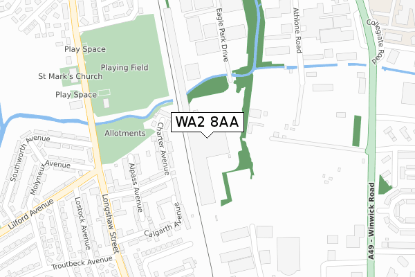
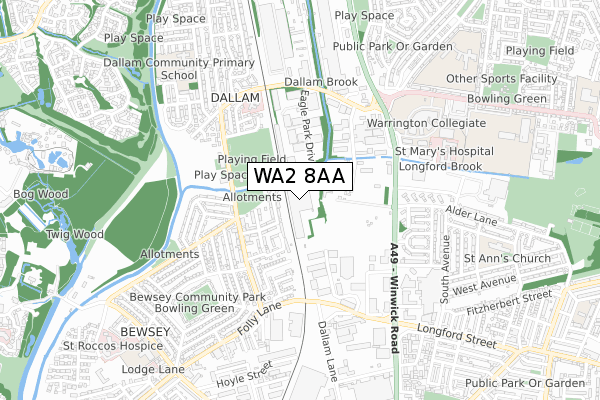
WA2 8AA maps


Licence: Open Government Licence (requires attribution)
Attribution: Contains OS data © Crown copyright and database right 2025
Source: Open Postcode Geo
Licence: Open Government Licence (requires attribution)
Attribution: Contains OS data © Crown copyright and database right 2025; Contains Royal Mail data © Royal Mail copyright and database right 2025; Source: Office for National Statistics licensed under the Open Government Licence v.3.0
WA2 8AA geodata
| Easting | 360185 |
| Northing | 389904 |
| Latitude | 53.404444 |
| Longitude | -2.600338 |
Where is WA2 8AA?
| Country | England |
| Postcode District | WA2 |
WA2 8AA Elevation
Elevation or altitude of WA2 8AA as distance above sea level:
| Metres | Feet | |
|---|---|---|
| Elevation | 10m | 33ft |
Elevation is measured from the approximate centre of the postcode, to the nearest point on an OS contour line from OS Terrain 50, which has contour spacing of ten vertical metres.
➜ How high above sea level am I? Find the elevation of your current position using your device's GPS.
Politics
| Ward | Bewsey And Whitecross |
|---|---|
| Constituency | Warrington South |
Transport
Nearest bus stops to WA2 8AA
| Southworth Avenue (Longshaw Street) | Bewsey | 279m |
| Longshaw Belle (Longshaw Street) | Bewsey | 282m |
| Transport Club (Longshaw Street) | Dallam | 289m |
| Transport Club (Longshaw Street) | Dallam | 305m |
| Alder Lane (Winwick Road) | Longford | 382m |
Nearest railway stations to WA2 8AA
| Warrington Central Station | 1.5km |
| Warrington Bank Quay Station | 2.1km |
| Padgate Station | 2.9km |
Deprivation
93.3% of English postcodes are less deprived than WA2 8AA:Food Standards Agency
Three nearest food hygiene ratings to WA2 8AA (metres)


➜ Get more ratings from the Food Standards Agency
Nearest post box to WA2 8AA
| Last Collection | |||
|---|---|---|---|
| Location | Mon-Fri | Sat | Distance |
| Dallam S.o. | 16:00 | 12:00 | 309m |
| Lilford Avenue | 16:00 | 11:00 | 317m |
| Grace Avenue | 16:00 | 11:00 | 550m |
WA2 8AA ITL and WA2 8AA LAU
The below table lists the International Territorial Level (ITL) codes (formerly Nomenclature of Territorial Units for Statistics (NUTS) codes) and Local Administrative Units (LAU) codes for WA2 8AA:
| ITL 1 Code | Name |
|---|---|
| TLD | North West (England) |
| ITL 2 Code | Name |
| TLD6 | Cheshire |
| ITL 3 Code | Name |
| TLD61 | Warrington |
| LAU 1 Code | Name |
| E06000007 | Warrington |
WA2 8AA census areas
The below table lists the Census Output Area (OA), Lower Layer Super Output Area (LSOA), and Middle Layer Super Output Area (MSOA) for WA2 8AA:
| Code | Name | |
|---|---|---|
| OA | E00062822 | |
| LSOA | E01012455 | Warrington 013C |
| MSOA | E02002602 | Warrington 013 |
Nearest postcodes to WA2 8AA
| WA5 0DJ | Charter Avenue | 94m |
| WA5 0DQ | Crosby Avenue | 187m |
| WA5 0DL | Crosby Avenue | 201m |
| WA5 0DH | Alpass Avenue | 207m |
| WA5 0FN | Calgarth Avenue | 216m |
| WA5 0FT | Calgarth Avenue | 232m |
| WA5 0DN | Alpass Avenue | 249m |
| WA5 0DW | Longshaw Street | 260m |
| WA5 0BL | Lilford Avenue | 312m |
| WA5 0DE | Longshaw Street | 313m |