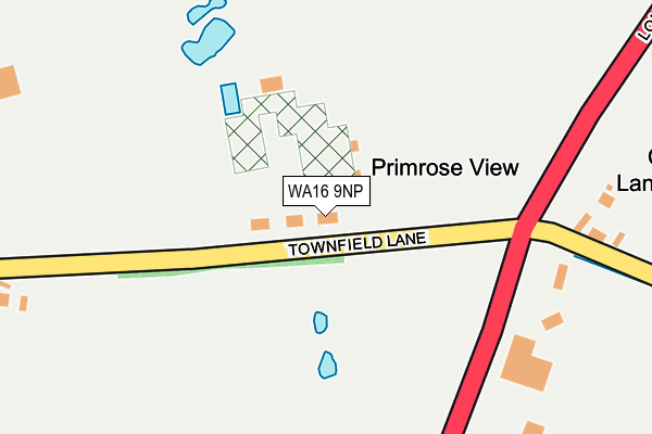
WA16 9NP is located in the Shakerley electoral ward, within the unitary authority of Cheshire West and Chester and the English Parliamentary constituency of Tatton. The Sub Integrated Care Board (ICB) Location is NHS Cheshire and Merseyside ICB - 27D and the police force is Cheshire. This postcode has been in use since January 1980.


GetTheData
Source: OS OpenMap – Local (Ordnance Survey)
Source: OS VectorMap District (Ordnance Survey)
Licence: Open Government Licence (requires attribution)
| Easting | 375126 |
| Northing | 372466 |
| Latitude | 53.248638 |
| Longitude | -2.374235 |
GetTheData
Source: Open Postcode Geo
Licence: Open Government Licence
| Country | England |
| Postcode District | WA16 |
➜ See where WA16 is on a map | |
GetTheData
Source: Land Registry Price Paid Data
Licence: Open Government Licence
Elevation or altitude of WA16 9NP as distance above sea level:
| Metres | Feet | |
|---|---|---|
| Elevation | 40m | 131ft |
Elevation is measured from the approximate centre of the postcode, to the nearest point on an OS contour line from OS Terrain 50, which has contour spacing of ten vertical metres.
➜ How high above sea level am I? Find the elevation of your current position using your device's GPS.
GetTheData
Source: Open Postcode Elevation
Licence: Open Government Licence
| Ward | Shakerley |
| Constituency | Tatton |
GetTheData
Source: ONS Postcode Database
Licence: Open Government Licence
| Townfield Lane (London Road) | Boots Green | 176m |
| Princess Road (Chapel Lane) | Allostock | 1,362m |
| Princess Road (Chapel Lane) | Allostock | 1,381m |
| Post Office (Hulme Lane) | Swan Green | 1,731m |
| Post Office (Hulme Lane) | Swan Green | 1,731m |
| Plumley Station | 4.2km |
| Goostrey Station | 4.3km |
GetTheData
Source: NaPTAN
Licence: Open Government Licence
| Percentage of properties with Next Generation Access | 100.0% |
| Percentage of properties with Superfast Broadband | 100.0% |
| Percentage of properties with Ultrafast Broadband | 50.0% |
| Percentage of properties with Full Fibre Broadband | 50.0% |
Superfast Broadband is between 30Mbps and 300Mbps
Ultrafast Broadband is > 300Mbps
| Percentage of properties unable to receive 2Mbps | 0.0% |
| Percentage of properties unable to receive 5Mbps | 0.0% |
| Percentage of properties unable to receive 10Mbps | 0.0% |
| Percentage of properties unable to receive 30Mbps | 0.0% |
GetTheData
Source: Ofcom
Licence: Ofcom Terms of Use (requires attribution)
GetTheData
Source: ONS Postcode Database
Licence: Open Government Licence


➜ Get more ratings from the Food Standards Agency
GetTheData
Source: Food Standards Agency
Licence: FSA terms & conditions
| Last Collection | |||
|---|---|---|---|
| Location | Mon-Fri | Sat | Distance |
| Long Lane | 16:00 | 09:45 | 1,038m |
| Chapel Lane | 16:00 | 09:30 | 1,377m |
| Lower Peover S.o. | 17:15 | 11:00 | 1,727m |
GetTheData
Source: Dracos
Licence: Creative Commons Attribution-ShareAlike
The below table lists the International Territorial Level (ITL) codes (formerly Nomenclature of Territorial Units for Statistics (NUTS) codes) and Local Administrative Units (LAU) codes for WA16 9NP:
| ITL 1 Code | Name |
|---|---|
| TLD | North West (England) |
| ITL 2 Code | Name |
| TLD6 | Cheshire |
| ITL 3 Code | Name |
| TLD63 | Cheshire West and Chester |
| LAU 1 Code | Name |
| E06000050 | Cheshire West and Chester |
GetTheData
Source: ONS Postcode Directory
Licence: Open Government Licence
The below table lists the Census Output Area (OA), Lower Layer Super Output Area (LSOA), and Middle Layer Super Output Area (MSOA) for WA16 9NP:
| Code | Name | |
|---|---|---|
| OA | E00094507 | |
| LSOA | E01018722 | Cheshire West and Chester 017E |
| MSOA | E02003878 | Cheshire West and Chester 017 |
GetTheData
Source: ONS Postcode Directory
Licence: Open Government Licence
| WA16 9NL | Booth Bed Lane | 224m |
| WA16 9NW | London Road | 323m |
| WA16 9JD | London Road | 475m |
| WA16 9JE | Heath Lane | 542m |
| WA16 9NJ | Booth Bed Lane | 615m |
| WA16 9NF | Booth Bed Lane | 746m |
| WA16 9JA | Holmes Chapel Road | 746m |
| WA16 9QZ | Holmes Chapel Road | 749m |
| WA16 9NH | Boots Green Lane | 806m |
| WA16 9QR | Heath Lane | 807m |
GetTheData
Source: Open Postcode Geo; Land Registry Price Paid Data
Licence: Open Government Licence