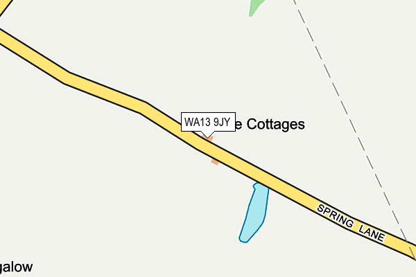
WA13 9JY is located in the Lymm North and Thelwall electoral ward, within the unitary authority of Warrington and the English Parliamentary constituency of Warrington South. The Sub Integrated Care Board (ICB) Location is NHS Cheshire and Merseyside ICB - 02E and the police force is Cheshire. This postcode has been in use since January 1980.


GetTheData
Source: OS OpenMap – Local (Ordnance Survey)
Source: OS VectorMap District (Ordnance Survey)
Licence: Open Government Licence (requires attribution)
| Easting | 371406 |
| Northing | 387326 |
| Latitude | 53.382001 |
| Longitude | -2.431331 |
GetTheData
Source: Open Postcode Geo
Licence: Open Government Licence
| Country | England |
| Postcode District | WA13 |
➜ See where WA13 is on a map | |
GetTheData
Source: Land Registry Price Paid Data
Licence: Open Government Licence
Elevation or altitude of WA13 9JY as distance above sea level:
| Metres | Feet | |
|---|---|---|
| Elevation | 20m | 66ft |
Elevation is measured from the approximate centre of the postcode, to the nearest point on an OS contour line from OS Terrain 50, which has contour spacing of ten vertical metres.
➜ How high above sea level am I? Find the elevation of your current position using your device's GPS.
GetTheData
Source: Open Postcode Elevation
Licence: Open Government Licence
| Ward | Lymm North And Thelwall |
| Constituency | Warrington South |
GetTheData
Source: ONS Postcode Database
Licence: Open Government Licence
| Agden Brook Farm (Lymm Road) | Little Bollington | 869m |
| Agden Brook Farm (Lymm Road) | Little Bollington | 891m |
| Burford Lane | Broomedge | 1,138m |
| Ye Olde No 3 (Lymm Road) | Little Bollington | 1,187m |
| Ye Olde No 3 (Lymm Road) | Little Bollington | 1,203m |
GetTheData
Source: NaPTAN
Licence: Open Government Licence
| Percentage of properties with Next Generation Access | 100.0% |
| Percentage of properties with Superfast Broadband | 0.0% |
| Percentage of properties with Ultrafast Broadband | 0.0% |
| Percentage of properties with Full Fibre Broadband | 0.0% |
Superfast Broadband is between 30Mbps and 300Mbps
Ultrafast Broadband is > 300Mbps
| Percentage of properties unable to receive 2Mbps | 100.0% |
| Percentage of properties unable to receive 5Mbps | 100.0% |
| Percentage of properties unable to receive 10Mbps | 100.0% |
| Percentage of properties unable to receive 30Mbps | 100.0% |
GetTheData
Source: Ofcom
Licence: Ofcom Terms of Use (requires attribution)
GetTheData
Source: ONS Postcode Database
Licence: Open Government Licence


➜ Get more ratings from the Food Standards Agency
GetTheData
Source: Food Standards Agency
Licence: FSA terms & conditions
| Last Collection | |||
|---|---|---|---|
| Location | Mon-Fri | Sat | Distance |
| Wheatsheaf | 16:00 | 07:45 | 1,521m |
| Broomedge S.o. | 17:00 | 12:00 | 1,624m |
| Oughtrington Lane | 16:00 | 12:00 | 1,645m |
GetTheData
Source: Dracos
Licence: Creative Commons Attribution-ShareAlike
The below table lists the International Territorial Level (ITL) codes (formerly Nomenclature of Territorial Units for Statistics (NUTS) codes) and Local Administrative Units (LAU) codes for WA13 9JY:
| ITL 1 Code | Name |
|---|---|
| TLD | North West (England) |
| ITL 2 Code | Name |
| TLD6 | Cheshire |
| ITL 3 Code | Name |
| TLD61 | Warrington |
| LAU 1 Code | Name |
| E06000007 | Warrington |
GetTheData
Source: ONS Postcode Directory
Licence: Open Government Licence
The below table lists the Census Output Area (OA), Lower Layer Super Output Area (LSOA), and Middle Layer Super Output Area (MSOA) for WA13 9JY:
| Code | Name | |
|---|---|---|
| OA | E00063142 | |
| LSOA | E01012518 | Warrington 021F |
| MSOA | E02002610 | Warrington 021 |
GetTheData
Source: ONS Postcode Directory
Licence: Open Government Licence
| WA13 9SL | Wet Gate Lane | 477m |
| WA13 9JT | Spring Lane | 609m |
| WA13 0UH | Warrington Lane | 657m |
| WA13 0UQ | Agden Lane | 888m |
| WA13 9JN | Burford Lane | 977m |
| WA13 0UG | Lymm Road | 992m |
| WA13 9JP | Stage Lane | 1028m |
| WA13 0UE | Agden Brow | 1131m |
| WA13 0SJ | Burford Lane | 1150m |
| WA13 9SH | Wet Gate Lane | 1205m |
GetTheData
Source: Open Postcode Geo; Land Registry Price Paid Data
Licence: Open Government Licence