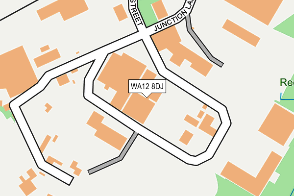
WA12 8DJ is located in the Newton-le-Willows West electoral ward, within the metropolitan district of St. Helens and the English Parliamentary constituency of St Helens North. The Sub Integrated Care Board (ICB) Location is NHS Cheshire and Merseyside ICB - 01X and the police force is Merseyside. This postcode has been in use since July 1990.


GetTheData
Source: OS OpenMap – Local (Ordnance Survey)
Source: OS VectorMap District (Ordnance Survey)
Licence: Open Government Licence (requires attribution)
| Easting | 357473 |
| Northing | 394717 |
| Latitude | 53.447491 |
| Longitude | -2.641779 |
GetTheData
Source: Open Postcode Geo
Licence: Open Government Licence
| Country | England |
| Postcode District | WA12 |
➜ See where WA12 is on a map ➜ Where is Newton-le-Willows? | |
GetTheData
Source: Land Registry Price Paid Data
Licence: Open Government Licence
Elevation or altitude of WA12 8DJ as distance above sea level:
| Metres | Feet | |
|---|---|---|
| Elevation | 30m | 98ft |
Elevation is measured from the approximate centre of the postcode, to the nearest point on an OS contour line from OS Terrain 50, which has contour spacing of ten vertical metres.
➜ How high above sea level am I? Find the elevation of your current position using your device's GPS.
GetTheData
Source: Open Postcode Elevation
Licence: Open Government Licence
| Ward | Newton-le-willows West |
| Constituency | St Helens North |
GetTheData
Source: ONS Postcode Database
Licence: Open Government Licence
| Wellington Street (Earle Street) | Earlestown | 389m |
| Wellington Street (Earle Street) | Earlestown | 399m |
| Viaduct Street (Earle Street) | Earlestown | 419m |
| Viaduct Street (Earle Street) | Earlestown | 464m |
| Queen Street (Railway Street) | Earlestown | 488m |
| Earlestown Station | 0.5km |
| Newton-le-Willows Station | 2km |
| St Helens Junction Station | 4.2km |
GetTheData
Source: NaPTAN
Licence: Open Government Licence
GetTheData
Source: ONS Postcode Database
Licence: Open Government Licence


➜ Get more ratings from the Food Standards Agency
GetTheData
Source: Food Standards Agency
Licence: FSA terms & conditions
| Last Collection | |||
|---|---|---|---|
| Location | Mon-Fri | Sat | Distance |
| Market Street | 18:30 | 11:00 | 471m |
| Wood Court | 16:00 | 11:00 | 541m |
| Caunce Avenue | 16:45 | 11:00 | 610m |
GetTheData
Source: Dracos
Licence: Creative Commons Attribution-ShareAlike
The below table lists the International Territorial Level (ITL) codes (formerly Nomenclature of Territorial Units for Statistics (NUTS) codes) and Local Administrative Units (LAU) codes for WA12 8DJ:
| ITL 1 Code | Name |
|---|---|
| TLD | North West (England) |
| ITL 2 Code | Name |
| TLD7 | Merseyside |
| ITL 3 Code | Name |
| TLD71 | East Merseyside |
| LAU 1 Code | Name |
| E08000013 | St. Helens |
GetTheData
Source: ONS Postcode Directory
Licence: Open Government Licence
The below table lists the Census Output Area (OA), Lower Layer Super Output Area (LSOA), and Middle Layer Super Output Area (MSOA) for WA12 8DJ:
| Code | Name | |
|---|---|---|
| OA | E00034820 | |
| LSOA | E01006865 | St. Helens 013C |
| MSOA | E02001418 | St. Helens 013 |
GetTheData
Source: ONS Postcode Directory
Licence: Open Government Licence
| WA12 8DN | Sankey Valley Industrial Estate | 0m |
| WA12 8ED | Sankey Valley Industrial Estate | 249m |
| WA12 9LT | Wellington Gardens | 393m |
| WA12 9LW | Earle Street | 396m |
| WA12 9LX | Wellington Street | 434m |
| WA12 8QS | Valley View | 434m |
| WA12 9AT | Chemical Street | 437m |
| WA12 9AS | Queen Street | 443m |
| WA12 9LU | Wellington Close | 451m |
| WA12 9AZ | Queen Street | 469m |
GetTheData
Source: Open Postcode Geo; Land Registry Price Paid Data
Licence: Open Government Licence