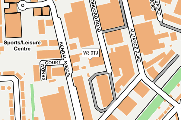
W3 0TJ is located in the North Acton electoral ward, within the London borough of Ealing and the English Parliamentary constituency of Ealing Central and Acton. The Sub Integrated Care Board (ICB) Location is NHS North West London ICB - W2U3Z and the police force is Metropolitan Police. This postcode has been in use since September 1991.


GetTheData
Source: OS OpenMap – Local (Ordnance Survey)
Source: OS VectorMap District (Ordnance Survey)
Licence: Open Government Licence (requires attribution)
| Easting | 519586 |
| Northing | 181928 |
| Latitude | 51.523616 |
| Longitude | -0.277669 |
GetTheData
Source: Open Postcode Geo
Licence: Open Government Licence
| Country | England |
| Postcode District | W3 |
➜ See where W3 is on a map ➜ Where is Acton? | |
GetTheData
Source: Land Registry Price Paid Data
Licence: Open Government Licence
Elevation or altitude of W3 0TJ as distance above sea level:
| Metres | Feet | |
|---|---|---|
| Elevation | 40m | 131ft |
Elevation is measured from the approximate centre of the postcode, to the nearest point on an OS contour line from OS Terrain 50, which has contour spacing of ten vertical metres.
➜ How high above sea level am I? Find the elevation of your current position using your device's GPS.
GetTheData
Source: Open Postcode Elevation
Licence: Open Government Licence
| Ward | North Acton |
| Constituency | Ealing Central And Acton |
GetTheData
Source: ONS Postcode Database
Licence: Open Government Licence
| Alliance Road | North Acton | 311m |
| Concord Road (Western Avenue) | North Acton | 353m |
| Kendal Avenue | North Acton | 373m |
| Walton Way (Westfields Road) | North Acton | 390m |
| Northfields Road | North Acton | 443m |
| Park Royal Underground Station | Park Royal | 605m |
| West Acton Underground Station | West Acton | 666m |
| North Ealing Underground Station | North Ealing | 1,033m |
| North Acton Underground Station | North Acton | 1,243m |
| Hanger Lane Underground Station | Hanger Lane | 1,273m |
| Acton Main Line Station | 1km |
| Ealing Broadway Station | 1.9km |
| Acton Central Station | 1.9km |
GetTheData
Source: NaPTAN
Licence: Open Government Licence
Estimated total energy consumption in W3 0TJ by fuel type, 2015.
| Consumption (kWh) | 184,891 |
|---|---|
| Meter count | 14 |
| Mean (kWh/meter) | 13,206 |
| Median (kWh/meter) | 11,501 |
GetTheData
Source: Postcode level gas estimates: 2015 (experimental)
Source: Postcode level electricity estimates: 2015 (experimental)
Licence: Open Government Licence
GetTheData
Source: ONS Postcode Database
Licence: Open Government Licence


➜ Get more ratings from the Food Standards Agency
GetTheData
Source: Food Standards Agency
Licence: FSA terms & conditions
| Last Collection | |||
|---|---|---|---|
| Location | Mon-Fri | Sat | Distance |
| Westfields Road | 17:30 | 12:00 | 341m |
| Princes Gardens North | 17:30 | 12:00 | 356m |
| Corringway | 17:30 | 12:00 | 492m |
GetTheData
Source: Dracos
Licence: Creative Commons Attribution-ShareAlike
The below table lists the International Territorial Level (ITL) codes (formerly Nomenclature of Territorial Units for Statistics (NUTS) codes) and Local Administrative Units (LAU) codes for W3 0TJ:
| ITL 1 Code | Name |
|---|---|
| TLI | London |
| ITL 2 Code | Name |
| TLI7 | Outer London - West and North West |
| ITL 3 Code | Name |
| TLI73 | Ealing |
| LAU 1 Code | Name |
| E09000009 | Ealing |
GetTheData
Source: ONS Postcode Directory
Licence: Open Government Licence
The below table lists the Census Output Area (OA), Lower Layer Super Output Area (LSOA), and Middle Layer Super Output Area (MSOA) for W3 0TJ:
| Code | Name | |
|---|---|---|
| OA | E00006194 | |
| LSOA | E01001247 | Ealing 015E |
| MSOA | E02000252 | Ealing 015 |
GetTheData
Source: ONS Postcode Directory
Licence: Open Government Licence
| W3 0XA | Kendal Avenue | 183m |
| W3 0RA | Alliance Road | 193m |
| W3 0LR | Princes Gardens | 285m |
| W3 0LS | Princes Gardens | 290m |
| W3 0NR | Saxon Drive | 299m |
| W3 0LL | Princes Gardens | 308m |
| W3 0LJ | Princes Gardens | 308m |
| W3 0NU | Saxon Drive | 336m |
| W3 0LN | Princes Gardens | 353m |
| W3 0AJ | Highfield Road | 360m |
GetTheData
Source: Open Postcode Geo; Land Registry Price Paid Data
Licence: Open Government Licence