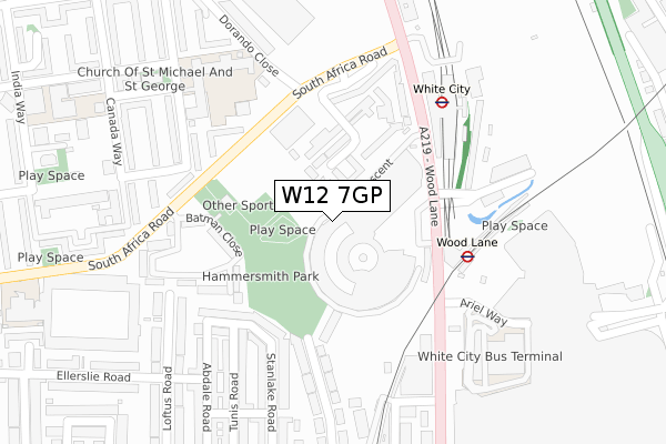
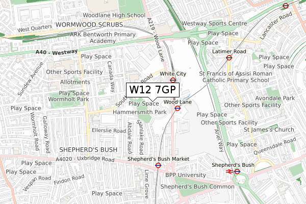
W12 7GP is located in the White City electoral ward, within the London borough of Hammersmith and Fulham and the English Parliamentary constituency of Hammersmith. The Sub Integrated Care Board (ICB) Location is NHS North West London ICB - W2U3Z and the police force is Metropolitan Police. This postcode has been in use since May 2018.


GetTheData
Source: OS Open Zoomstack (Ordnance Survey)
Licence: Open Government Licence (requires attribution)
Attribution: Contains OS data © Crown copyright and database right 2024
Source: Open Postcode Geo
Licence: Open Government Licence (requires attribution)
Attribution: Contains OS data © Crown copyright and database right 2024; Contains Royal Mail data © Royal Mail copyright and database right 2024; Source: Office for National Statistics licensed under the Open Government Licence v.3.0
| Easting | 523149 |
| Northing | 180550 |
| Latitude | 51.510468 |
| Longitude | -0.226795 |
GetTheData
Source: Open Postcode Geo
Licence: Open Government Licence
| Country | England |
| Postcode District | W12 |
| ➜ W12 open data dashboard ➜ See where W12 is on a map ➜ Where is London? | |
GetTheData
Source: Land Registry Price Paid Data
Licence: Open Government Licence
| Ward | White City |
| Constituency | Hammersmith |
GetTheData
Source: ONS Postcode Database
Licence: Open Government Licence
| January 2024 | Anti-social behaviour | On or near Batman Close | 234m |
| January 2024 | Violence and sexual offences | On or near Batman Close | 234m |
| January 2024 | Violence and sexual offences | On or near Batman Close | 234m |
| ➜ Get more crime data in our Crime section | |||
GetTheData
Source: data.police.uk
Licence: Open Government Licence
| White City (Wood Lane) | White City | 208m |
| White City (Wood Lane) | White City | 211m |
| Queens Park Rangers Fc | White City | 228m |
| Mandela Close (South Africa Road) | White City | 229m |
| White City Bus Station | White City | 268m |
| Wood Lane Underground Station | Shepherd's Bush | 182m |
| White City Underground Station | White City | 241m |
| Shepherd's Bush Market Underground Station | Shepherd's Bush | 545m |
| Latimer Road Underground Station | Latimer Road | 705m |
| Shepherd's Bush (Central) Underground Station | Shepherd's Bush | 876m |
| Shepherds Bush Station | 0.9km |
| Kensington (Olympia) Station | 1.8km |
| Kensal Green Station | 2.2km |
GetTheData
Source: NaPTAN
Licence: Open Government Licence
➜ Broadband speed and availability dashboard for W12 7GP
| Percentage of properties with Next Generation Access | 100.0% |
| Percentage of properties with Superfast Broadband | 100.0% |
| Percentage of properties with Ultrafast Broadband | 100.0% |
| Percentage of properties with Full Fibre Broadband | 100.0% |
Superfast Broadband is between 30Mbps and 300Mbps
Ultrafast Broadband is > 300Mbps
Ofcom does not currently provide download speed data for W12 7GP. This is because there are less than four broadband connections in this postcode.
Ofcom does not currently provide upload speed data for W12 7GP. This is because there are less than four broadband connections in this postcode.
| Percentage of properties unable to receive 2Mbps | 0.0% |
| Percentage of properties unable to receive 5Mbps | 0.0% |
| Percentage of properties unable to receive 10Mbps | 0.0% |
| Percentage of properties unable to receive 30Mbps | 0.0% |
➜ Broadband speed and availability dashboard for W12 7GP
GetTheData
Source: Ofcom
Licence: Ofcom Terms of Use (requires attribution)
GetTheData
Source: ONS Postcode Database
Licence: Open Government Licence


➜ Get more ratings from the Food Standards Agency
GetTheData
Source: Food Standards Agency
Licence: FSA terms & conditions
| Last Collection | |||
|---|---|---|---|
| Location | Mon-Fri | Sat | Distance |
| White City Station (L.u.l.) | 18:30 | 12:00 | 188m |
| Australia Road | 17:30 | 12:00 | 316m |
| Tunis Road | 17:30 | 12:00 | 323m |
GetTheData
Source: Dracos
Licence: Creative Commons Attribution-ShareAlike
| Facility | Distance |
|---|---|
| Hammersmith Park White City Estate, London Outdoor Tennis Courts | 118m |
| Powerleague (Shepherd's Bush) South Africa Road, London Artificial Grass Pitch | 155m |
| Gymbox (Westfield London) Ariel Way, London Health and Fitness Gym, Studio | 346m |
GetTheData
Source: Active Places
Licence: Open Government Licence
| School | Phase of Education | Distance |
|---|---|---|
| Ark White City Primary Academy Australia Road, London, W12 7PT | Primary | 258m |
| Randolph Beresford Early Years Centre Australia Road, White City, Australia Road, London, W12 7PH | Nursery | 391m |
| St John XXIII Catholic Primary School 1 India Way, London, W12 7QT | Primary | 453m |
GetTheData
Source: Edubase
Licence: Open Government Licence
The below table lists the International Territorial Level (ITL) codes (formerly Nomenclature of Territorial Units for Statistics (NUTS) codes) and Local Administrative Units (LAU) codes for W12 7GP:
| ITL 1 Code | Name |
|---|---|
| TLI | London |
| ITL 2 Code | Name |
| TLI3 | Inner London - West |
| ITL 3 Code | Name |
| TLI33 | Kensington & Chelsea and Hammersmith & Fulham |
| LAU 1 Code | Name |
| E09000013 | Hammersmith and Fulham |
GetTheData
Source: ONS Postcode Directory
Licence: Open Government Licence
The below table lists the Census Output Area (OA), Lower Layer Super Output Area (LSOA), and Middle Layer Super Output Area (MSOA) for W12 7GP:
| Code | Name | |
|---|---|---|
| OA | E00009730 | |
| LSOA | E01001946 | Hammersmith and Fulham 004D |
| MSOA | E02000375 | Hammersmith and Fulham 004 |
GetTheData
Source: ONS Postcode Directory
Licence: Open Government Licence
| W12 7DZ | White City Close | 75m |
| W12 7EA | White City Close | 109m |
| W12 7EE | Exhibition Close | 140m |
| W12 7EB | White City Close | 173m |
| W12 7NU | Batman Close | 177m |
| W12 7EQ | White City Road | 187m |
| W12 7EF | Exhibition Close | 193m |
| W12 7HQ | Stanlake Road | 197m |
| W12 7PS | White City Estate | 211m |
| W12 7HH | Stanlake Road | 211m |
GetTheData
Source: Open Postcode Geo; Land Registry Price Paid Data
Licence: Open Government Licence