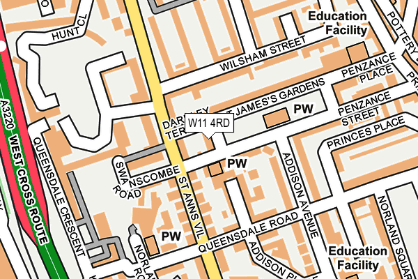
W11 4RD lies on St James's Gardens in London. W11 4RD is located in the Norland electoral ward, within the London borough of Kensington and Chelsea and the English Parliamentary constituency of Kensington. The Sub Integrated Care Board (ICB) Location is NHS North West London ICB - W2U3Z and the police force is Metropolitan Police. This postcode has been in use since January 1980.


GetTheData
Source: OS OpenMap – Local (Ordnance Survey)
Source: OS VectorMap District (Ordnance Survey)
Licence: Open Government Licence (requires attribution)
| Easting | 524006 |
| Northing | 180297 |
| Latitude | 51.508006 |
| Longitude | -0.214565 |
GetTheData
Source: Open Postcode Geo
Licence: Open Government Licence
| Street | St James's Gardens |
| Town/City | London |
| Country | England |
| Postcode District | W11 |
➜ See where W11 is on a map ➜ Where is Kensington? | |
GetTheData
Source: Land Registry Price Paid Data
Licence: Open Government Licence
Elevation or altitude of W11 4RD as distance above sea level:
| Metres | Feet | |
|---|---|---|
| Elevation | 10m | 33ft |
Elevation is measured from the approximate centre of the postcode, to the nearest point on an OS contour line from OS Terrain 50, which has contour spacing of ten vertical metres.
➜ How high above sea level am I? Find the elevation of your current position using your device's GPS.
GetTheData
Source: Open Postcode Elevation
Licence: Open Government Licence
| Ward | Norland |
| Constituency | Kensington |
GetTheData
Source: ONS Postcode Database
Licence: Open Government Licence
| Queensdale Road (St Ann's Villas) | Holland Park | 119m |
| Wilsham Street (St Anns Road) | Latimer Road | 126m |
| Wilsham Street (St Ann's Road) | Latimer Road | 132m |
| Queensdale Road (St Ann's Villas) | Holland Park | 201m |
| Royal Crescent (Holland Park Avenue) | Holland Park | 307m |
| Shepherd's Bush (Central) Underground Station | Shepherd's Bush | 500m |
| Holland Park Underground Station | Holland Park | 624m |
| Latimer Road Underground Station | Latimer Road | 639m |
| Wood Lane Underground Station | Shepherd's Bush | 716m |
| White City Underground Station | White City | 806m |
| Shepherds Bush Station | 0.4km |
| Kensington (Olympia) Station | 1.2km |
| Kensal Green Station | 2.6km |
GetTheData
Source: NaPTAN
Licence: Open Government Licence
| Percentage of properties with Next Generation Access | 100.0% |
| Percentage of properties with Superfast Broadband | 100.0% |
| Percentage of properties with Ultrafast Broadband | 100.0% |
| Percentage of properties with Full Fibre Broadband | 0.0% |
Superfast Broadband is between 30Mbps and 300Mbps
Ultrafast Broadband is > 300Mbps
| Percentage of properties unable to receive 2Mbps | 0.0% |
| Percentage of properties unable to receive 5Mbps | 0.0% |
| Percentage of properties unable to receive 10Mbps | 0.0% |
| Percentage of properties unable to receive 30Mbps | 0.0% |
GetTheData
Source: Ofcom
Licence: Ofcom Terms of Use (requires attribution)
GetTheData
Source: ONS Postcode Database
Licence: Open Government Licence


➜ Get more ratings from the Food Standards Agency
GetTheData
Source: Food Standards Agency
Licence: FSA terms & conditions
| Last Collection | |||
|---|---|---|---|
| Location | Mon-Fri | Sat | Distance |
| Saint James's Gardens | 17:30 | 12:00 | 99m |
| Swanscombe Road | 17:30 | 12:00 | 106m |
| Post Office | 17:30 | 12:00 | 148m |
GetTheData
Source: Dracos
Licence: Creative Commons Attribution-ShareAlike
The below table lists the International Territorial Level (ITL) codes (formerly Nomenclature of Territorial Units for Statistics (NUTS) codes) and Local Administrative Units (LAU) codes for W11 4RD:
| ITL 1 Code | Name |
|---|---|
| TLI | London |
| ITL 2 Code | Name |
| TLI3 | Inner London - West |
| ITL 3 Code | Name |
| TLI33 | Kensington & Chelsea and Hammersmith & Fulham |
| LAU 1 Code | Name |
| E09000020 | Kensington and Chelsea |
GetTheData
Source: ONS Postcode Directory
Licence: Open Government Licence
The below table lists the Census Output Area (OA), Lower Layer Super Output Area (LSOA), and Middle Layer Super Output Area (MSOA) for W11 4RD:
| Code | Name | |
|---|---|---|
| OA | E00014424 | |
| LSOA | E01002873 | Kensington and Chelsea 007C |
| MSOA | E02000583 | Kensington and Chelsea 007 |
GetTheData
Source: ONS Postcode Directory
Licence: Open Government Licence
| W11 4RL | Darnley Terrace | 40m |
| W11 4RB | St James's Gardens | 42m |
| W11 4SR | St Anns Road | 56m |
| W11 4RE | St James's Gardens | 81m |
| W11 4SS | St Anns Road | 82m |
| W11 4SQ | Queensdale Place | 84m |
| W11 4AU | Wilsham Street | 85m |
| W11 4RS | St Anns Villas | 87m |
| W11 4JY | Queensdale Crescent | 97m |
| W11 4SX | Swanscombe Road | 100m |
GetTheData
Source: Open Postcode Geo; Land Registry Price Paid Data
Licence: Open Government Licence