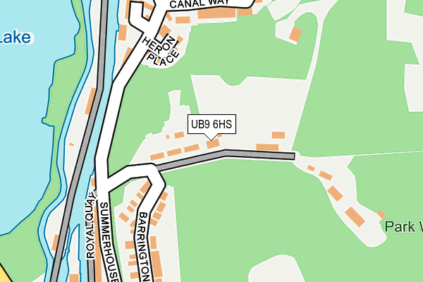
UB9 6HS is located in the Harefield Village electoral ward, within the London borough of Hillingdon and the English Parliamentary constituency of Ruislip, Northwood and Pinner. The Sub Integrated Care Board (ICB) Location is NHS North West London ICB - W2U3Z and the police force is Metropolitan Police. This postcode has been in use since January 1980.


GetTheData
Source: OS OpenMap – Local (Ordnance Survey)
Source: OS VectorMap District (Ordnance Survey)
Licence: Open Government Licence (requires attribution)
| Easting | 504277 |
| Northing | 191445 |
| Latitude | 51.612191 |
| Longitude | -0.495405 |
GetTheData
Source: Open Postcode Geo
Licence: Open Government Licence
| Country | England |
| Postcode District | UB9 |
➜ See where UB9 is on a map | |
GetTheData
Source: Land Registry Price Paid Data
Licence: Open Government Licence
Elevation or altitude of UB9 6HS as distance above sea level:
| Metres | Feet | |
|---|---|---|
| Elevation | 60m | 197ft |
Elevation is measured from the approximate centre of the postcode, to the nearest point on an OS contour line from OS Terrain 50, which has contour spacing of ten vertical metres.
➜ How high above sea level am I? Find the elevation of your current position using your device's GPS.
GetTheData
Source: Open Postcode Elevation
Licence: Open Government Licence
| Ward | Harefield Village |
| Constituency | Ruislip, Northwood And Pinner |
GetTheData
Source: ONS Postcode Database
Licence: Open Government Licence
| Harefield West Belfry Avenue (Shelley Lane) | Harefield | 527m |
| Mount Pleasant Park Lane (Park Lane) | Harefield | 718m |
| Dunster Close (Park Lane) | Harefield | 1,025m |
| Dunster Close (Park Lane) | Harefield | 1,032m |
| Harefield Hospital | Harefield | 1,076m |
| Rickmansworth Station | 3.5km |
| Denham Station | 3.7km |
| Denham Golf Club Station | 3.8km |
GetTheData
Source: NaPTAN
Licence: Open Government Licence
| Percentage of properties with Next Generation Access | 100.0% |
| Percentage of properties with Superfast Broadband | 100.0% |
| Percentage of properties with Ultrafast Broadband | 100.0% |
| Percentage of properties with Full Fibre Broadband | 100.0% |
Superfast Broadband is between 30Mbps and 300Mbps
Ultrafast Broadband is > 300Mbps
| Percentage of properties unable to receive 2Mbps | 0.0% |
| Percentage of properties unable to receive 5Mbps | 0.0% |
| Percentage of properties unable to receive 10Mbps | 0.0% |
| Percentage of properties unable to receive 30Mbps | 0.0% |
GetTheData
Source: Ofcom
Licence: Ofcom Terms of Use (requires attribution)
GetTheData
Source: ONS Postcode Database
Licence: Open Government Licence


➜ Get more ratings from the Food Standards Agency
GetTheData
Source: Food Standards Agency
Licence: FSA terms & conditions
| Last Collection | |||
|---|---|---|---|
| Location | Mon-Fri | Sat | Distance |
| Salamander Quays | 16:30 | 12:00 | 441m |
| Hill End Road | 17:15 | 12:40 | 754m |
| Mount Pleasant | 17:10 | 12:00 | 755m |
GetTheData
Source: Dracos
Licence: Creative Commons Attribution-ShareAlike
The below table lists the International Territorial Level (ITL) codes (formerly Nomenclature of Territorial Units for Statistics (NUTS) codes) and Local Administrative Units (LAU) codes for UB9 6HS:
| ITL 1 Code | Name |
|---|---|
| TLI | London |
| ITL 2 Code | Name |
| TLI7 | Outer London - West and North West |
| ITL 3 Code | Name |
| TLI74 | Harrow and Hillingdon |
| LAU 1 Code | Name |
| E09000017 | Hillingdon |
GetTheData
Source: ONS Postcode Directory
Licence: Open Government Licence
The below table lists the Census Output Area (OA), Lower Layer Super Output Area (LSOA), and Middle Layer Super Output Area (MSOA) for UB9 6HS:
| Code | Name | |
|---|---|---|
| OA | E00012166 | |
| LSOA | E01002438 | Hillingdon 003A |
| MSOA | E02000496 | Hillingdon 003 |
GetTheData
Source: ONS Postcode Directory
Licence: Open Government Licence
| UB9 6HT | Belle Vue Terrace | 59m |
| UB9 6TA | Heron Place | 137m |
| UB9 6TG | Canal Way | 173m |
| UB9 6JA | Coppermill Lock | 178m |
| UB9 6HX | Summerhouse Lane | 208m |
| UB9 6FE | Royal Quay | 223m |
| UB9 6TB | Bankside Close | 224m |
| UB9 6FB | Summerhouse Lane | 228m |
| UB9 6TQ | Linden Square | 228m |
| UB9 6TH | Canal Way | 245m |
GetTheData
Source: Open Postcode Geo; Land Registry Price Paid Data
Licence: Open Government Licence