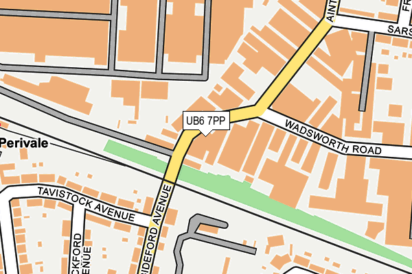
UB6 7PP lies on Bideford Avenue in Perivale, Greenford. UB6 7PP is located in the Perivale electoral ward, within the London borough of Ealing and the English Parliamentary constituency of Ealing North. The Sub Integrated Care Board (ICB) Location is NHS North West London ICB - W2U3Z and the police force is Metropolitan Police. This postcode has been in use since January 1980.


GetTheData
Source: OS OpenMap – Local (Ordnance Survey)
Source: OS VectorMap District (Ordnance Survey)
Licence: Open Government Licence (requires attribution)
| Easting | 516696 |
| Northing | 183272 |
| Latitude | 51.536300 |
| Longitude | -0.318839 |
GetTheData
Source: Open Postcode Geo
Licence: Open Government Licence
| Street | Bideford Avenue |
| Locality | Perivale |
| Town/City | Greenford |
| Country | England |
| Postcode District | UB6 |
➜ See where UB6 is on a map ➜ Where is London? | |
GetTheData
Source: Land Registry Price Paid Data
Licence: Open Government Licence
Elevation or altitude of UB6 7PP as distance above sea level:
| Metres | Feet | |
|---|---|---|
| Elevation | 30m | 98ft |
Elevation is measured from the approximate centre of the postcode, to the nearest point on an OS contour line from OS Terrain 50, which has contour spacing of ten vertical metres.
➜ How high above sea level am I? Find the elevation of your current position using your device's GPS.
GetTheData
Source: Open Postcode Elevation
Licence: Open Government Licence
| Ward | Perivale |
| Constituency | Ealing North |
GetTheData
Source: ONS Postcode Database
Licence: Open Government Licence
55 - 57, BIDEFORD AVENUE, PERIVALE, GREENFORD, UB6 7PP 2007 7 NOV £345,000 |
59, BIDEFORD AVENUE, PERIVALE, GREENFORD, UB6 7PP 2005 8 NOV £490,000 |
INTEGRATION HOUSE, 61, BIDEFORD AVENUE, PERIVALE, GREENFORD, UB6 7PP 2000 2 JUN £135,000 |
INTEGRATION HOUSE, 61, BIDEFORD AVENUE, PERIVALE, GREENFORD, UB6 7PP 1998 26 AUG £140,000 |
59, BIDEFORD AVENUE, PERIVALE, GREENFORD, UB6 7PP 1998 24 MAR £135,000 |
GetTheData
Source: HM Land Registry Price Paid Data
Licence: Contains HM Land Registry data © Crown copyright and database right 2025. This data is licensed under the Open Government Licence v3.0.
| Perivale Tesco | Perivale | 237m |
| Perivale Tesco | Perivale | 315m |
| Perivale (Horsenden Lane South) | Perivale | 366m |
| Perivale (Horsenden Lane South) | Perivale | 374m |
| Bideford Avenue (Teignmouth Gardens) | Perivale | 393m |
| Perivale Underground Station | Perivale | 321m |
| Alperton Underground Station | Alperton | 1,420m |
| South Greenford Station | 1.3km |
| Castle Bar Park Station | 1.7km |
| Greenford Station | 2km |
GetTheData
Source: NaPTAN
Licence: Open Government Licence
| Percentage of properties with Next Generation Access | 100.0% |
| Percentage of properties with Superfast Broadband | 100.0% |
| Percentage of properties with Ultrafast Broadband | 100.0% |
| Percentage of properties with Full Fibre Broadband | 100.0% |
Superfast Broadband is between 30Mbps and 300Mbps
Ultrafast Broadband is > 300Mbps
| Percentage of properties unable to receive 2Mbps | 0.0% |
| Percentage of properties unable to receive 5Mbps | 0.0% |
| Percentage of properties unable to receive 10Mbps | 0.0% |
| Percentage of properties unable to receive 30Mbps | 0.0% |
GetTheData
Source: Ofcom
Licence: Ofcom Terms of Use (requires attribution)
GetTheData
Source: ONS Postcode Database
Licence: Open Government Licence


➜ Get more ratings from the Food Standards Agency
GetTheData
Source: Food Standards Agency
Licence: FSA terms & conditions
| Last Collection | |||
|---|---|---|---|
| Location | Mon-Fri | Sat | Distance |
| Tavistock Avenue | 17:00 | 12:30 | 136m |
| Outside Perivale Station | 18:00 | 11:45 | 359m |
| Teignmouth Gardens | 16:30 | 12:00 | 384m |
GetTheData
Source: Dracos
Licence: Creative Commons Attribution-ShareAlike
The below table lists the International Territorial Level (ITL) codes (formerly Nomenclature of Territorial Units for Statistics (NUTS) codes) and Local Administrative Units (LAU) codes for UB6 7PP:
| ITL 1 Code | Name |
|---|---|
| TLI | London |
| ITL 2 Code | Name |
| TLI7 | Outer London - West and North West |
| ITL 3 Code | Name |
| TLI73 | Ealing |
| LAU 1 Code | Name |
| E09000009 | Ealing |
GetTheData
Source: ONS Postcode Directory
Licence: Open Government Licence
The below table lists the Census Output Area (OA), Lower Layer Super Output Area (LSOA), and Middle Layer Super Output Area (MSOA) for UB6 7PP:
| Code | Name | |
|---|---|---|
| OA | E00006681 | |
| LSOA | E01001347 | Ealing 007C |
| MSOA | E02000244 | Ealing 007 |
GetTheData
Source: ONS Postcode Directory
Licence: Open Government Licence
| UB6 7PY | Bideford Avenue | 34m |
| UB6 7QB | Bideford Avenue | 57m |
| UB6 8DE | Bideford Avenue | 124m |
| UB6 8AL | Tavistock Avenue | 179m |
| UB6 8DF | Bideford Avenue | 186m |
| UB6 8AN | Tavistock Avenue | 201m |
| UB6 8DD | Bideford Avenue | 205m |
| UB6 7LD | Fleetway Business Park | 224m |
| UB6 8AH | Rockford Avenue | 249m |
| UB6 8EA | Rydal Crescent | 257m |
GetTheData
Source: Open Postcode Geo; Land Registry Price Paid Data
Licence: Open Government Licence