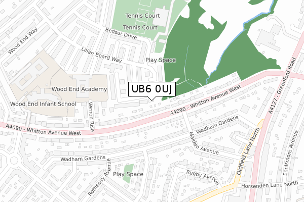
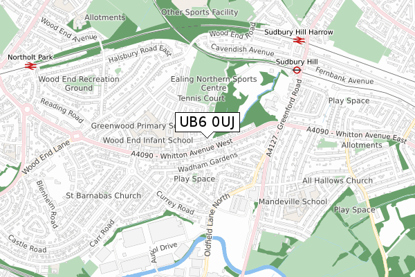
UB6 0UJ is located in the North Greenford electoral ward, within the London borough of Ealing and the English Parliamentary constituency of Ealing North. The Sub Integrated Care Board (ICB) Location is NHS North West London ICB - W2U3Z and the police force is Metropolitan Police. This postcode has been in use since August 1993.


GetTheData
Source: OS Open Zoomstack (Ordnance Survey)
Licence: Open Government Licence (requires attribution)
Attribution: Contains OS data © Crown copyright and database right 2025
Source: Open Postcode Geo
Licence: Open Government Licence (requires attribution)
Attribution: Contains OS data © Crown copyright and database right 2025; Contains Royal Mail data © Royal Mail copyright and database right 2025; Source: Office for National Statistics licensed under the Open Government Licence v.3.0
| Easting | 514896 |
| Northing | 185125 |
| Latitude | 51.553322 |
| Longitude | -0.344198 |
GetTheData
Source: Open Postcode Geo
Licence: Open Government Licence
| Country | England |
| Postcode District | UB6 |
➜ See where UB6 is on a map ➜ Where is Greenford? | |
GetTheData
Source: Land Registry Price Paid Data
Licence: Open Government Licence
Elevation or altitude of UB6 0UJ as distance above sea level:
| Metres | Feet | |
|---|---|---|
| Elevation | 50m | 164ft |
Elevation is measured from the approximate centre of the postcode, to the nearest point on an OS contour line from OS Terrain 50, which has contour spacing of ten vertical metres.
➜ How high above sea level am I? Find the elevation of your current position using your device's GPS.
GetTheData
Source: Open Postcode Elevation
Licence: Open Government Licence
| Ward | North Greenford |
| Constituency | Ealing North |
GetTheData
Source: ONS Postcode Database
Licence: Open Government Licence
| Malden Avenue | Northolt | 66m |
| Malden Avenue | Northolt | 68m |
| Hemery Road | Northolt | 210m |
| Greenford Road | Sudbury Hill | 331m |
| Oldfield Close | Northolt | 347m |
| Sudbury Hill Underground Station | Sudbury Hill | 672m |
| Greenford Underground Station | Greenford | 1,219m |
| South Harrow Underground Station | South Harrow | 1,409m |
| Sudbury Hill Harrow Station | 0.8km |
| Northolt Park Station | 1.2km |
| Greenford Station | 1.2km |
GetTheData
Source: NaPTAN
Licence: Open Government Licence
| Percentage of properties with Next Generation Access | 100.0% |
| Percentage of properties with Superfast Broadband | 100.0% |
| Percentage of properties with Ultrafast Broadband | 100.0% |
| Percentage of properties with Full Fibre Broadband | 0.0% |
Superfast Broadband is between 30Mbps and 300Mbps
Ultrafast Broadband is > 300Mbps
| Percentage of properties unable to receive 2Mbps | 0.0% |
| Percentage of properties unable to receive 5Mbps | 0.0% |
| Percentage of properties unable to receive 10Mbps | 0.0% |
| Percentage of properties unable to receive 30Mbps | 0.0% |
GetTheData
Source: Ofcom
Licence: Ofcom Terms of Use (requires attribution)
Estimated total energy consumption in UB6 0UJ by fuel type, 2015.
| Consumption (kWh) | 59,010 |
|---|---|
| Meter count | 10 |
| Mean (kWh/meter) | 5,901 |
| Median (kWh/meter) | 5,358 |
| Consumption (kWh) | 18,881 |
|---|---|
| Meter count | 8 |
| Mean (kWh/meter) | 2,360 |
| Median (kWh/meter) | 1,981 |
GetTheData
Source: Postcode level gas estimates: 2015 (experimental)
Source: Postcode level electricity estimates: 2015 (experimental)
Licence: Open Government Licence
GetTheData
Source: ONS Postcode Database
Licence: Open Government Licence


➜ Get more ratings from the Food Standards Agency
GetTheData
Source: Food Standards Agency
Licence: FSA terms & conditions
| Last Collection | |||
|---|---|---|---|
| Location | Mon-Fri | Sat | Distance |
| Lillian Board Way | 15:00 | 12:45 | 203m |
| Oldfield Lane North | 16:30 | 11:30 | 391m |
| Oldfield Circus Post Office | 18:00 | 12:30 | 470m |
GetTheData
Source: Dracos
Licence: Creative Commons Attribution-ShareAlike
The below table lists the International Territorial Level (ITL) codes (formerly Nomenclature of Territorial Units for Statistics (NUTS) codes) and Local Administrative Units (LAU) codes for UB6 0UJ:
| ITL 1 Code | Name |
|---|---|
| TLI | London |
| ITL 2 Code | Name |
| TLI7 | Outer London - West and North West |
| ITL 3 Code | Name |
| TLI73 | Ealing |
| LAU 1 Code | Name |
| E09000009 | Ealing |
GetTheData
Source: ONS Postcode Directory
Licence: Open Government Licence
The below table lists the Census Output Area (OA), Lower Layer Super Output Area (LSOA), and Middle Layer Super Output Area (MSOA) for UB6 0UJ:
| Code | Name | |
|---|---|---|
| OA | E00006554 | |
| LSOA | E01001311 | Ealing 001E |
| MSOA | E02000238 | Ealing 001 |
GetTheData
Source: ONS Postcode Directory
Licence: Open Government Licence
| UB6 0SF | Matthews Road | 73m |
| UB6 0SA | Lilian Board Way | 84m |
| UB6 0EF | Whitton Avenue West | 85m |
| UB6 0SJ | Dimmock Drive | 87m |
| UB6 0SB | Lilian Board Way | 90m |
| UB6 0DY | Whitton Avenue West | 92m |
| UB6 0SH | Hendren Close | 100m |
| UB6 0SG | Matthews Road | 101m |
| UB6 0SQ | Hendren Close | 141m |
| UB6 0BU | Wadham Gardens | 162m |
GetTheData
Source: Open Postcode Geo; Land Registry Price Paid Data
Licence: Open Government Licence