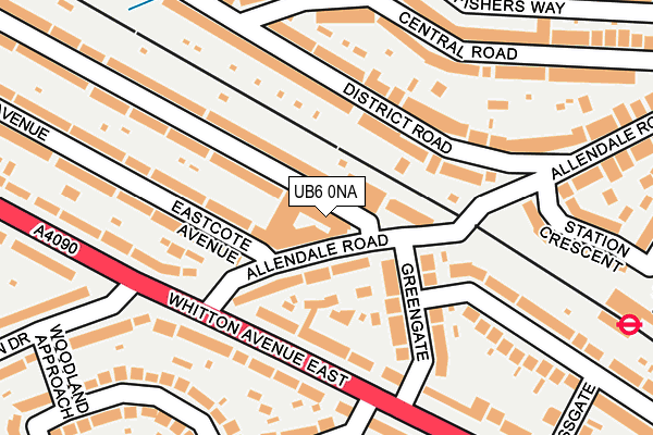
UB6 0NA is located in the North Greenford electoral ward, within the London borough of Ealing and the English Parliamentary constituency of Ealing North. The Sub Integrated Care Board (ICB) Location is NHS North West London ICB - W2U3Z and the police force is Metropolitan Police. This postcode has been in use since January 1980.


GetTheData
Source: OS OpenMap – Local (Ordnance Survey)
Source: OS VectorMap District (Ordnance Survey)
Licence: Open Government Licence (requires attribution)
| Easting | 516609 |
| Northing | 184980 |
| Latitude | 51.551669 |
| Longitude | -0.319527 |
GetTheData
Source: Open Postcode Geo
Licence: Open Government Licence
| Country | England |
| Postcode District | UB6 |
➜ See where UB6 is on a map ➜ Where is London? | |
GetTheData
Source: Land Registry Price Paid Data
Licence: Open Government Licence
Elevation or altitude of UB6 0NA as distance above sea level:
| Metres | Feet | |
|---|---|---|
| Elevation | 50m | 164ft |
Elevation is measured from the approximate centre of the postcode, to the nearest point on an OS contour line from OS Terrain 50, which has contour spacing of ten vertical metres.
➜ How high above sea level am I? Find the elevation of your current position using your device's GPS.
GetTheData
Source: Open Postcode Elevation
Licence: Open Government Licence
| Ward | North Greenford |
| Constituency | Ealing North |
GetTheData
Source: ONS Postcode Database
Licence: Open Government Licence
| Allendale Road | Sudbury | 124m |
| Whitton Drive | Sudbury | 209m |
| Sudbury Town | Sudbury Town | 273m |
| Sudbury Town | Sudbury Town | 284m |
| Sudbury Town | Sudbury Town | 285m |
| Sudbury Town Underground Station | Sudbury Town | 280m |
| Sudbury Hill Underground Station | Sudbury Hill | 1,310m |
| North Wembley Underground Station | North Wembley | 1,621m |
| Alperton Underground Station | Alperton | 1,850m |
| Sudbury & Harrow Road Station | 0.4km |
| Sudbury Hill Harrow Station | 1.4km |
| Wembley Central Station | 1.6km |
GetTheData
Source: NaPTAN
Licence: Open Government Licence
| Percentage of properties with Next Generation Access | 100.0% |
| Percentage of properties with Superfast Broadband | 100.0% |
| Percentage of properties with Ultrafast Broadband | 100.0% |
| Percentage of properties with Full Fibre Broadband | 100.0% |
Superfast Broadband is between 30Mbps and 300Mbps
Ultrafast Broadband is > 300Mbps
| Percentage of properties unable to receive 2Mbps | 0.0% |
| Percentage of properties unable to receive 5Mbps | 0.0% |
| Percentage of properties unable to receive 10Mbps | 0.0% |
| Percentage of properties unable to receive 30Mbps | 0.0% |
GetTheData
Source: Ofcom
Licence: Ofcom Terms of Use (requires attribution)
GetTheData
Source: ONS Postcode Database
Licence: Open Government Licence


➜ Get more ratings from the Food Standards Agency
GetTheData
Source: Food Standards Agency
Licence: FSA terms & conditions
| Last Collection | |||
|---|---|---|---|
| Location | Mon-Fri | Sat | Distance |
| Sudbury Heights Post Office | 18:30 | 11:45 | 27m |
| Central Road | 17:00 | 12:00 | 174m |
| Ashness Gardens | 17:30 | 11:30 | 230m |
GetTheData
Source: Dracos
Licence: Creative Commons Attribution-ShareAlike
The below table lists the International Territorial Level (ITL) codes (formerly Nomenclature of Territorial Units for Statistics (NUTS) codes) and Local Administrative Units (LAU) codes for UB6 0NA:
| ITL 1 Code | Name |
|---|---|
| TLI | London |
| ITL 2 Code | Name |
| TLI7 | Outer London - West and North West |
| ITL 3 Code | Name |
| TLI73 | Ealing |
| LAU 1 Code | Name |
| E09000009 | Ealing |
GetTheData
Source: ONS Postcode Directory
Licence: Open Government Licence
The below table lists the Census Output Area (OA), Lower Layer Super Output Area (LSOA), and Middle Layer Super Output Area (MSOA) for UB6 0NA:
| Code | Name | |
|---|---|---|
| OA | E00006534 | |
| LSOA | E01001308 | Ealing 002B |
| MSOA | E02000239 | Ealing 002 |
GetTheData
Source: ONS Postcode Directory
Licence: Open Government Licence
| UB6 0RS | Odeon Parade | 1m |
| UB6 0LZ | The Parade | 37m |
| UB6 0RA | Allendale Road | 57m |
| UB6 0BF | Sudbury Heights Avenue | 70m |
| UB6 0QJ | Greengate | 87m |
| UB6 0PY | Whitton Avenue East | 118m |
| HA0 2LG | District Road | 124m |
| UB6 0LX | Sudbury Heights Avenue | 127m |
| HA0 2LF | District Road | 141m |
| UB6 0QH | Greengate | 144m |
GetTheData
Source: Open Postcode Geo; Land Registry Price Paid Data
Licence: Open Government Licence