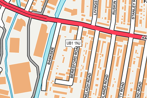
UB1 1NJ lies on Beresford Road in Southall. UB1 1NJ is located in the Southall West electoral ward, within the London borough of Ealing and the English Parliamentary constituency of Ealing, Southall. The Sub Integrated Care Board (ICB) Location is NHS North West London ICB - W2U3Z and the police force is Metropolitan Police. This postcode has been in use since January 1980.


GetTheData
Source: OS OpenMap – Local (Ordnance Survey)
Source: OS VectorMap District (Ordnance Survey)
Licence: Open Government Licence (requires attribution)
| Easting | 511860 |
| Northing | 180473 |
| Latitude | 51.512120 |
| Longitude | -0.389445 |
GetTheData
Source: Open Postcode Geo
Licence: Open Government Licence
| Street | Beresford Road |
| Town/City | Southall |
| Country | England |
| Postcode District | UB1 |
➜ See where UB1 is on a map ➜ Where is Southall? | |
GetTheData
Source: Land Registry Price Paid Data
Licence: Open Government Licence
Elevation or altitude of UB1 1NJ as distance above sea level:
| Metres | Feet | |
|---|---|---|
| Elevation | 30m | 98ft |
Elevation is measured from the approximate centre of the postcode, to the nearest point on an OS contour line from OS Terrain 50, which has contour spacing of ten vertical metres.
➜ How high above sea level am I? Find the elevation of your current position using your device's GPS.
GetTheData
Source: Open Postcode Elevation
Licence: Open Government Licence
| Ward | Southall West |
| Constituency | Ealing, Southall |
GetTheData
Source: ONS Postcode Database
Licence: Open Government Licence
| Hayes Bridge (Uxbridge Road) | Southall | 118m |
| Hayes Bridge | Southall | 170m |
| Delamere Road | Yeading | 171m |
| Trinity Road (Ub1) (Uxbridge Road) | Southall | 200m |
| Trinity Road (Ub1) (The Broadway) | Southall | 224m |
| Southall Station | 1km |
| Hayes & Harlington Station | 2.4km |
| Hanwell Station | 3.5km |
GetTheData
Source: NaPTAN
Licence: Open Government Licence
| Percentage of properties with Next Generation Access | 100.0% |
| Percentage of properties with Superfast Broadband | 100.0% |
| Percentage of properties with Ultrafast Broadband | 0.0% |
| Percentage of properties with Full Fibre Broadband | 0.0% |
Superfast Broadband is between 30Mbps and 300Mbps
Ultrafast Broadband is > 300Mbps
| Median download speed | 55.0Mbps |
| Average download speed | 40.6Mbps |
| Maximum download speed | 80.00Mbps |
| Median upload speed | 10.0Mbps |
| Average upload speed | 10.8Mbps |
| Maximum upload speed | 20.00Mbps |
| Percentage of properties unable to receive 2Mbps | 0.0% |
| Percentage of properties unable to receive 5Mbps | 0.0% |
| Percentage of properties unable to receive 10Mbps | 0.0% |
| Percentage of properties unable to receive 30Mbps | 0.0% |
GetTheData
Source: Ofcom
Licence: Ofcom Terms of Use (requires attribution)
Estimated total energy consumption in UB1 1NJ by fuel type, 2015.
| Consumption (kWh) | 605,600 |
|---|---|
| Meter count | 38 |
| Mean (kWh/meter) | 15,937 |
| Median (kWh/meter) | 15,225 |
| Consumption (kWh) | 175,068 |
|---|---|
| Meter count | 42 |
| Mean (kWh/meter) | 4,168 |
| Median (kWh/meter) | 3,718 |
GetTheData
Source: Postcode level gas estimates: 2015 (experimental)
Source: Postcode level electricity estimates: 2015 (experimental)
Licence: Open Government Licence
GetTheData
Source: ONS Postcode Database
Licence: Open Government Licence


➜ Get more ratings from the Food Standards Agency
GetTheData
Source: Food Standards Agency
Licence: FSA terms & conditions
| Last Collection | |||
|---|---|---|---|
| Location | Mon-Fri | Sat | Distance |
| Livingstone Road | 18:30 | 12:15 | 132m |
| Hambrough Road | 18:30 | 12:30 | 428m |
| Beaconsfield Road | 18:30 | 12:15 | 430m |
GetTheData
Source: Dracos
Licence: Creative Commons Attribution-ShareAlike
The below table lists the International Territorial Level (ITL) codes (formerly Nomenclature of Territorial Units for Statistics (NUTS) codes) and Local Administrative Units (LAU) codes for UB1 1NJ:
| ITL 1 Code | Name |
|---|---|
| TLI | London |
| ITL 2 Code | Name |
| TLI7 | Outer London - West and North West |
| ITL 3 Code | Name |
| TLI73 | Ealing |
| LAU 1 Code | Name |
| E09000009 | Ealing |
GetTheData
Source: ONS Postcode Directory
Licence: Open Government Licence
The below table lists the Census Output Area (OA), Lower Layer Super Output Area (LSOA), and Middle Layer Super Output Area (MSOA) for UB1 1NJ:
| Code | Name | |
|---|---|---|
| OA | E00006776 | |
| LSOA | E01001363 | Ealing 026D |
| MSOA | E02000263 | Ealing 026 |
GetTheData
Source: ONS Postcode Directory
Licence: Open Government Licence
| UB1 1DQ | Ranelagh Road | 67m |
| UB1 1NQ | Bankside | 72m |
| UB1 1NG | The Broadway | 85m |
| UB1 1DH | Ranelagh Road | 102m |
| UB1 1NL | Beresford Road | 117m |
| UB1 1PL | The Broadway | 132m |
| UB1 1ND | The Broadway | 140m |
| UB1 1EF | Woodlands Road | 143m |
| UB1 1NH | Bankside | 158m |
| UB1 1PJ | The Broadway | 158m |
GetTheData
Source: Open Postcode Geo; Land Registry Price Paid Data
Licence: Open Government Licence