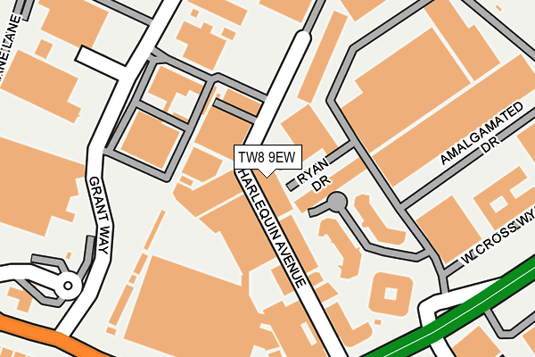
TW8 9EW is located in the Osterley & Spring Grove electoral ward, within the London borough of Hounslow and the English Parliamentary constituency of Brentford and Isleworth. The Sub Integrated Care Board (ICB) Location is NHS North West London ICB - W2U3Z and the police force is Metropolitan Police. This postcode has been in use since January 1980.


GetTheData
Source: OS OpenMap – Local (Ordnance Survey)
Source: OS VectorMap District (Ordnance Survey)
Licence: Open Government Licence (requires attribution)
| Easting | 516313 |
| Northing | 177636 |
| Latitude | 51.485724 |
| Longitude | -0.326239 |
GetTheData
Source: Open Postcode Geo
Licence: Open Government Licence
| Country | England |
| Postcode District | TW8 |
➜ See where TW8 is on a map ➜ Where is London? | |
GetTheData
Source: Land Registry Price Paid Data
Licence: Open Government Licence
Elevation or altitude of TW8 9EW as distance above sea level:
| Metres | Feet | |
|---|---|---|
| Elevation | 20m | 66ft |
Elevation is measured from the approximate centre of the postcode, to the nearest point on an OS contour line from OS Terrain 50, which has contour spacing of ten vertical metres.
➜ How high above sea level am I? Find the elevation of your current position using your device's GPS.
GetTheData
Source: Open Postcode Elevation
Licence: Open Government Licence
| Ward | Osterley & Spring Grove |
| Constituency | Brentford And Isleworth |
GetTheData
Source: ONS Postcode Database
Licence: Open Government Licence
| West Cross Centre | Brentford End | 228m |
| Gillette Corner (Great West Road) | Brentford End | 268m |
| Gillette Corner Tesco | Brentford End | 298m |
| Gillette Corner | Brentford End | 322m |
| West Cross House | Brentford End | 383m |
| Boston Manor Underground Station | Boston Manor | 1,106m |
| Syon Lane Station | 0.4km |
| Brentford Station | 1.2km |
| Isleworth Station | 1.4km |
GetTheData
Source: NaPTAN
Licence: Open Government Licence
| Median download speed | 8.1Mbps |
| Average download speed | 11.1Mbps |
| Maximum download speed | 17.91Mbps |
| Median upload speed | 0.6Mbps |
| Average upload speed | 0.7Mbps |
| Maximum upload speed | 1.27Mbps |
GetTheData
Source: Ofcom
Licence: Ofcom Terms of Use (requires attribution)
GetTheData
Source: ONS Postcode Database
Licence: Open Government Licence


➜ Get more ratings from the Food Standards Agency
GetTheData
Source: Food Standards Agency
Licence: FSA terms & conditions
| Last Collection | |||
|---|---|---|---|
| Location | Mon-Fri | Sat | Distance |
| Syon Lane | 18:30 | 11:30 | 288m |
| Tesco Stores, Grant Way | 17:15 | 11:30 | 306m |
| Otterburn Gardens | 17:00 | 11:15 | 476m |
GetTheData
Source: Dracos
Licence: Creative Commons Attribution-ShareAlike
The below table lists the International Territorial Level (ITL) codes (formerly Nomenclature of Territorial Units for Statistics (NUTS) codes) and Local Administrative Units (LAU) codes for TW8 9EW:
| ITL 1 Code | Name |
|---|---|
| TLI | London |
| ITL 2 Code | Name |
| TLI7 | Outer London - West and North West |
| ITL 3 Code | Name |
| TLI75 | Hounslow and Richmond upon Thames |
| LAU 1 Code | Name |
| E09000018 | Hounslow |
GetTheData
Source: ONS Postcode Directory
Licence: Open Government Licence
The below table lists the Census Output Area (OA), Lower Layer Super Output Area (LSOA), and Middle Layer Super Output Area (MSOA) for TW8 9EW:
| Code | Name | |
|---|---|---|
| OA | E00013306 | |
| LSOA | E01002678 | Hounslow 009B |
| MSOA | E02000534 | Hounslow 009 |
GetTheData
Source: ONS Postcode Directory
Licence: Open Government Licence
| TW7 5NQ | Syon Lane | 320m |
| TW7 5NG | Great West Road | 368m |
| TW7 5NT | Northumberland Gardens | 371m |
| TW7 5JN | Warkworth Gardens | 381m |
| TW7 5JR | Hexham Gardens | 417m |
| TW7 5JJ | Otterburn Gardens | 435m |
| TW7 5JL | Otterburn Gardens | 455m |
| TW7 5JP | Warkworth Gardens | 466m |
| TW7 5NE | Syon Park Gardens | 468m |
| TW7 5JB | Redesdale Gardens | 471m |
GetTheData
Source: Open Postcode Geo; Land Registry Price Paid Data
Licence: Open Government Licence