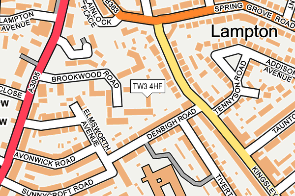
TW3 4HF lies on Brookwood Road in Hounslow. TW3 4HF is located in the Hounslow Central electoral ward, within the London borough of Hounslow and the English Parliamentary constituency of Brentford and Isleworth. The Sub Integrated Care Board (ICB) Location is NHS North West London ICB - W2U3Z and the police force is Metropolitan Police. This postcode has been in use since January 1980.


GetTheData
Source: OS OpenMap – Local (Ordnance Survey)
Source: OS VectorMap District (Ordnance Survey)
Licence: Open Government Licence (requires attribution)
| Easting | 513916 |
| Northing | 176458 |
| Latitude | 51.475624 |
| Longitude | -0.361125 |
GetTheData
Source: Open Postcode Geo
Licence: Open Government Licence
| Street | Brookwood Road |
| Town/City | Hounslow |
| Country | England |
| Postcode District | TW3 |
➜ See where TW3 is on a map ➜ Where is London? | |
GetTheData
Source: Land Registry Price Paid Data
Licence: Open Government Licence
Elevation or altitude of TW3 4HF as distance above sea level:
| Metres | Feet | |
|---|---|---|
| Elevation | 20m | 66ft |
Elevation is measured from the approximate centre of the postcode, to the nearest point on an OS contour line from OS Terrain 50, which has contour spacing of ten vertical metres.
➜ How high above sea level am I? Find the elevation of your current position using your device's GPS.
GetTheData
Source: Open Postcode Elevation
Licence: Open Government Licence
| Ward | Hounslow Central |
| Constituency | Brentford And Isleworth |
GetTheData
Source: ONS Postcode Database
Licence: Open Government Licence
| Denbigh Road (Tw3) | Lampton | 71m |
| Kings Avenue | Lampton | 123m |
| Lampton Avenue | Lampton | 254m |
| Hounslow Civic Centre (Lampton Road) | Lampton | 350m |
| Spring Grove Crescent | Hounslow East | 351m |
| Hounslow East Underground Station | Hounslow East | 420m |
| Hounslow Central Underground Station | Hounslow Central | 613m |
| Osterley Underground Station | Osterley | 881m |
| Hounslow Station | 1.5km |
| Isleworth Station | 1.7km |
| Syon Lane Station | 2.6km |
GetTheData
Source: NaPTAN
Licence: Open Government Licence
| Median download speed | 50.0Mbps |
| Average download speed | 67.4Mbps |
| Maximum download speed | 200.00Mbps |
| Median upload speed | 9.7Mbps |
| Average upload speed | 8.2Mbps |
| Maximum upload speed | 20.00Mbps |
GetTheData
Source: Ofcom
Licence: Ofcom Terms of Use (requires attribution)
Estimated total energy consumption in TW3 4HF by fuel type, 2015.
| Consumption (kWh) | 99,304 |
|---|---|
| Meter count | 36 |
| Mean (kWh/meter) | 2,758 |
| Median (kWh/meter) | 2,498 |
GetTheData
Source: Postcode level gas estimates: 2015 (experimental)
Source: Postcode level electricity estimates: 2015 (experimental)
Licence: Open Government Licence
GetTheData
Source: ONS Postcode Database
Licence: Open Government Licence


➜ Get more ratings from the Food Standards Agency
GetTheData
Source: Food Standards Agency
Licence: FSA terms & conditions
| Last Collection | |||
|---|---|---|---|
| Location | Mon-Fri | Sat | Distance |
| Denbeigh Road | 17:15 | 11:30 | 95m |
| Lampton Avenue | 17:15 | 11:45 | 252m |
| Elmsworth Avenue | 17:15 | 11:30 | 260m |
GetTheData
Source: Dracos
Licence: Creative Commons Attribution-ShareAlike
The below table lists the International Territorial Level (ITL) codes (formerly Nomenclature of Territorial Units for Statistics (NUTS) codes) and Local Administrative Units (LAU) codes for TW3 4HF:
| ITL 1 Code | Name |
|---|---|
| TLI | London |
| ITL 2 Code | Name |
| TLI7 | Outer London - West and North West |
| ITL 3 Code | Name |
| TLI75 | Hounslow and Richmond upon Thames |
| LAU 1 Code | Name |
| E09000018 | Hounslow |
GetTheData
Source: ONS Postcode Directory
Licence: Open Government Licence
The below table lists the Census Output Area (OA), Lower Layer Super Output Area (LSOA), and Middle Layer Super Output Area (MSOA) for TW3 4HF:
| Code | Name | |
|---|---|---|
| OA | E00013126 | |
| LSOA | E01002641 | Hounslow 018A |
| MSOA | E02000543 | Hounslow 018 |
GetTheData
Source: ONS Postcode Directory
Licence: Open Government Licence
| TW3 4HE | Brookwood Road | 0m |
| TW3 4AR | Kingsley Road | 63m |
| TW3 4HB | Brookwood Road | 83m |
| TW3 4HD | Brookwood Road | 83m |
| TW3 4DU | Denbigh Road | 87m |
| TW3 4AS | Kingsley Road | 96m |
| TW3 4BE | Spring Grove Road | 98m |
| TW3 4DT | Elmsworth Avenue | 124m |
| TW3 4AW | Colwyn Crescent | 147m |
| TW3 4HA | Highlands Close | 153m |
GetTheData
Source: Open Postcode Geo; Land Registry Price Paid Data
Licence: Open Government Licence