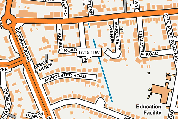
TW15 1DW lies on Barn Close in Ashford. TW15 1DW is located in the Ashford East electoral ward, within the local authority district of Spelthorne and the English Parliamentary constituency of Spelthorne. The Sub Integrated Care Board (ICB) Location is NHS Surrey Heartlands ICB - 92A and the police force is Surrey. This postcode has been in use since January 1980.


GetTheData
Source: OS OpenMap – Local (Ordnance Survey)
Source: OS VectorMap District (Ordnance Survey)
Licence: Open Government Licence (requires attribution)
| Easting | 507726 |
| Northing | 171404 |
| Latitude | 51.431408 |
| Longitude | -0.451755 |
GetTheData
Source: Open Postcode Geo
Licence: Open Government Licence
| Street | Barn Close |
| Town/City | Ashford |
| Country | England |
| Postcode District | TW15 |
➜ See where TW15 is on a map ➜ Where is Ashford? | |
GetTheData
Source: Land Registry Price Paid Data
Licence: Open Government Licence
Elevation or altitude of TW15 1DW as distance above sea level:
| Metres | Feet | |
|---|---|---|
| Elevation | 20m | 66ft |
Elevation is measured from the approximate centre of the postcode, to the nearest point on an OS contour line from OS Terrain 50, which has contour spacing of ten vertical metres.
➜ How high above sea level am I? Find the elevation of your current position using your device's GPS.
GetTheData
Source: Open Postcode Elevation
Licence: Open Government Licence
| Ward | Ashford East |
| Constituency | Spelthorne |
GetTheData
Source: ONS Postcode Database
Licence: Open Government Licence
| Chattern Hill (Feltham Road) | Chattern Hill | 142m |
| Chattern Hill (Feltham Road) | Chattern Hill | 152m |
| Convent Road (Feltham Road) | Ashford | 208m |
| Convent Road (Feltham Road) | Ashford | 224m |
| Town Tree Road (Convent Road) | Ashford | 240m |
| Ashford (Surrey) Station | 1.3km |
| Upper Halliford Station | 2.5km |
| Sunbury Station | 2.8km |
GetTheData
Source: NaPTAN
Licence: Open Government Licence
| Percentage of properties with Next Generation Access | 100.0% |
| Percentage of properties with Superfast Broadband | 100.0% |
| Percentage of properties with Ultrafast Broadband | 100.0% |
| Percentage of properties with Full Fibre Broadband | 100.0% |
Superfast Broadband is between 30Mbps and 300Mbps
Ultrafast Broadband is > 300Mbps
| Percentage of properties unable to receive 2Mbps | 0.0% |
| Percentage of properties unable to receive 5Mbps | 0.0% |
| Percentage of properties unable to receive 10Mbps | 0.0% |
| Percentage of properties unable to receive 30Mbps | 0.0% |
GetTheData
Source: Ofcom
Licence: Ofcom Terms of Use (requires attribution)
GetTheData
Source: ONS Postcode Database
Licence: Open Government Licence


➜ Get more ratings from the Food Standards Agency
GetTheData
Source: Food Standards Agency
Licence: FSA terms & conditions
| Last Collection | |||
|---|---|---|---|
| Location | Mon-Fri | Sat | Distance |
| Chattern Hill, Feltham Road | 18:30 | 11:30 | 219m |
| Outside P.o. 131 Convent Road | 18:30 | 11:45 | 313m |
| Park Road | 18:30 | 11:45 | 321m |
GetTheData
Source: Dracos
Licence: Creative Commons Attribution-ShareAlike
The below table lists the International Territorial Level (ITL) codes (formerly Nomenclature of Territorial Units for Statistics (NUTS) codes) and Local Administrative Units (LAU) codes for TW15 1DW:
| ITL 1 Code | Name |
|---|---|
| TLJ | South East (England) |
| ITL 2 Code | Name |
| TLJ2 | Surrey, East and West Sussex |
| ITL 3 Code | Name |
| TLJ25 | West Surrey |
| LAU 1 Code | Name |
| E07000213 | Spelthorne |
GetTheData
Source: ONS Postcode Directory
Licence: Open Government Licence
The below table lists the Census Output Area (OA), Lower Layer Super Output Area (LSOA), and Middle Layer Super Output Area (MSOA) for TW15 1DW:
| Code | Name | |
|---|---|---|
| OA | E00156576 | |
| LSOA | E01030703 | Spelthorne 005C |
| MSOA | E02006407 | Spelthorne 005 |
GetTheData
Source: ONS Postcode Directory
Licence: Open Government Licence
| TW15 1DN | Oakfield Road | 70m |
| TW15 2HL | Muncaster Road | 79m |
| TW15 1DR | St Margarets Avenue | 90m |
| TW15 1HA | Metcalf Road | 135m |
| TW15 1DP | Feltham Road | 145m |
| TW15 1DH | Feltham Road | 153m |
| TW15 1DB | Feltham Road | 158m |
| TW15 2AQ | Abbey Gardens | 165m |
| TW15 1HB | Metcalf Road | 174m |
| TW15 2HN | Convent Road | 179m |
GetTheData
Source: Open Postcode Geo; Land Registry Price Paid Data
Licence: Open Government Licence