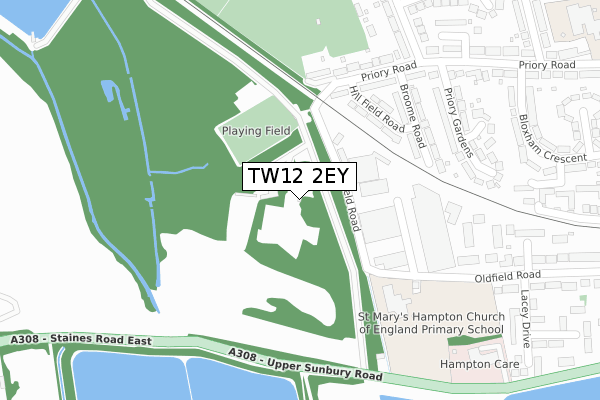
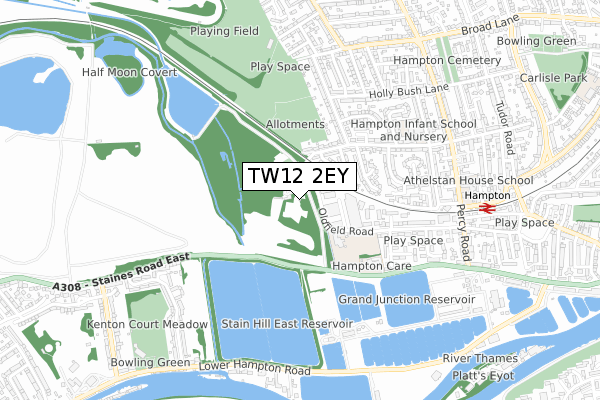
TW12 2EY is located in the Hampton electoral ward, within the London borough of Richmond upon Thames and the English Parliamentary constituency of Twickenham. The Sub Integrated Care Board (ICB) Location is NHS South West London ICB - 36L and the police force is Metropolitan Police. This postcode has been in use since January 2020.


GetTheData
Source: OS Open Zoomstack (Ordnance Survey)
Licence: Open Government Licence (requires attribution)
Attribution: Contains OS data © Crown copyright and database right 2024
Source: Open Postcode Geo
Licence: Open Government Licence (requires attribution)
Attribution: Contains OS data © Crown copyright and database right 2024; Contains Royal Mail data © Royal Mail copyright and database right 2024; Source: Office for National Statistics licensed under the Open Government Licence v.3.0
| Easting | 512540 |
| Northing | 169842 |
| Latitude | 51.416435 |
| Longitude | -0.383009 |
GetTheData
Source: Open Postcode Geo
Licence: Open Government Licence
| Country | England |
| Postcode District | TW12 |
| ➜ TW12 open data dashboard ➜ See where TW12 is on a map ➜ Where is Hampton? | |
GetTheData
Source: Land Registry Price Paid Data
Licence: Open Government Licence
| Ward | Hampton |
| Constituency | Twickenham |
GetTheData
Source: ONS Postcode Database
Licence: Open Government Licence
| June 2022 | Burglary | On or near Hill Field Road | 196m |
| June 2022 | Violence and sexual offences | On or near Broome Road | 234m |
| June 2022 | Public order | On or near Markhole Close | 376m |
| ➜ Get more crime data in our Crime section | |||
GetTheData
Source: data.police.uk
Licence: Open Government Licence
| Stain Hill Reservoir | Hampton | 288m |
| Hampton Care Nursing Home | Hampton | 456m |
| Hampton Care Nursing Home | Hampton | 476m |
| Staines Hill West Reservoir (Staines Road East) | Sunbury | 576m |
| Priory Road (Tw12) (Percy Road) | Hampton | 674m |
| Hampton (London) Station | 0.8km |
| Kempton Park Station | 1.9km |
| Sunbury Station | 2.4km |
GetTheData
Source: NaPTAN
Licence: Open Government Licence
GetTheData
Source: ONS Postcode Database
Licence: Open Government Licence


➜ Get more ratings from the Food Standards Agency
GetTheData
Source: Food Standards Agency
Licence: FSA terms & conditions
| Last Collection | |||
|---|---|---|---|
| Location | Mon-Fri | Sat | Distance |
| Bloxham Crescent | 18:30 | 12:00 | 365m |
| Hollybush Lane | 18:30 | 12:00 | 659m |
| Kenton Avenue | 17:30 | 11:30 | 689m |
GetTheData
Source: Dracos
Licence: Creative Commons Attribution-ShareAlike
| Facility | Distance |
|---|---|
| Hampton Rangers Jfc (Denis Chaplin Training Ground) Priory Road, Hampton Grass Pitches, Artificial Grass Pitch | 153m |
| St Mary's Hampton Ce Primary School Oldfield Road, Hampton Grass Pitches | 318m |
| Hampton Rangers Juniors Football Club Hatherop Road, Hampton Grass Pitches | 482m |
GetTheData
Source: Active Places
Licence: Open Government Licence
| School | Phase of Education | Distance |
|---|---|---|
| St Mary's Hampton Church of England Primary Oldfield Road, Hampton, TW12 2HP | Primary | 515m |
| Hampton Infant School and Nursery Ripley Road, Hampton, TW12 2JH | Primary | 570m |
| Hampton Junior School Percy Road, Hampton, TW12 2LA | Primary | 695m |
GetTheData
Source: Edubase
Licence: Open Government Licence
| Risk of TW12 2EY flooding from rivers and sea | Medium |
| ➜ TW12 2EY flood map | |
GetTheData
Source: Open Flood Risk by Postcode
Licence: Open Government Licence
The below table lists the International Territorial Level (ITL) codes (formerly Nomenclature of Territorial Units for Statistics (NUTS) codes) and Local Administrative Units (LAU) codes for TW12 2EY:
| ITL 1 Code | Name |
|---|---|
| TLI | London |
| ITL 2 Code | Name |
| TLI7 | Outer London - West and North West |
| ITL 3 Code | Name |
| TLI75 | Hounslow and Richmond upon Thames |
| LAU 1 Code | Name |
| E09000027 | Richmond upon Thames |
GetTheData
Source: ONS Postcode Directory
Licence: Open Government Licence
The below table lists the Census Output Area (OA), Lower Layer Super Output Area (LSOA), and Middle Layer Super Output Area (MSOA) for TW12 2EY:
| Code | Name | |
|---|---|---|
| OA | E00019209 | |
| LSOA | E01003826 | Richmond upon Thames 023E |
| MSOA | E02000806 | Richmond upon Thames 023 |
GetTheData
Source: ONS Postcode Directory
Licence: Open Government Licence
| TW12 2AF | Kempton Gate Business Centre | 135m |
| TW12 2PX | Hillfield Road | 182m |
| TW12 2PS | Priory Road | 236m |
| TW12 2PT | Priory Road | 240m |
| TW12 2PU | Broome Road | 242m |
| TW12 2HD | Kingsway Business Park | 289m |
| TW12 2PZ | Priory Gardens | 304m |
| TW12 2PP | Priory Road | 336m |
| TW12 2QA | Priory Close | 341m |
| TW12 2RG | Hatherop Road | 354m |
GetTheData
Source: Open Postcode Geo; Land Registry Price Paid Data
Licence: Open Government Licence