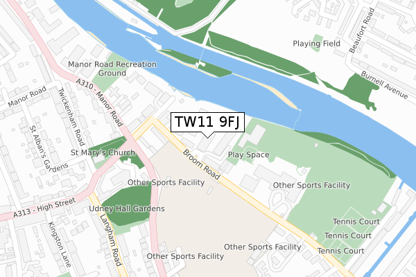
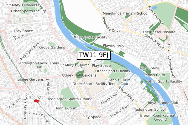
TW11 9FJ is located in the Teddington electoral ward, within the London borough of Richmond upon Thames and the English Parliamentary constituency of Twickenham. The Sub Integrated Care Board (ICB) Location is NHS South West London ICB - 36L and the police force is Metropolitan Police. This postcode has been in use since May 2019.


GetTheData
Source: OS Open Zoomstack (Ordnance Survey)
Licence: Open Government Licence (requires attribution)
Attribution: Contains OS data © Crown copyright and database right 2024
Source: Open Postcode Geo
Licence: Open Government Licence (requires attribution)
Attribution: Contains OS data © Crown copyright and database right 2024; Contains Royal Mail data © Royal Mail copyright and database right 2024; Source: Office for National Statistics licensed under the Open Government Licence v.3.0
| Easting | 516788 |
| Northing | 171328 |
| Latitude | 51.428932 |
| Longitude | -0.321460 |
GetTheData
Source: Open Postcode Geo
Licence: Open Government Licence
| Country | England |
| Postcode District | TW11 |
| ➜ TW11 open data dashboard ➜ See where TW11 is on a map ➜ Where is Teddington? | |
GetTheData
Source: Land Registry Price Paid Data
Licence: Open Government Licence
| Ward | Teddington |
| Constituency | Twickenham |
GetTheData
Source: ONS Postcode Database
Licence: Open Government Licence
| January 2024 | Public order | On or near Cloister Close | 207m |
| December 2023 | Vehicle crime | On or near Cloister Close | 207m |
| December 2023 | Violence and sexual offences | On or near Cloister Close | 207m |
| ➜ Get more crime data in our Crime section | |||
GetTheData
Source: data.police.uk
Licence: Open Government Licence
| Teddington Lock (Kingston Road) | Teddington | 175m |
| Teddington Lock (Ferry Road) | Teddington | 244m |
| Teddington Lock (Ferry Road) | Teddington | 259m |
| Marston Road (Kingston Road) | Teddington | 261m |
| Marston Road (Kingston Road) | Teddington | 313m |
| Teddington Station | 0.9km |
| Strawberry Hill Station | 1.7km |
| Hampton Wick Station | 1.7km |
GetTheData
Source: NaPTAN
Licence: Open Government Licence
GetTheData
Source: ONS Postcode Database
Licence: Open Government Licence


➜ Get more ratings from the Food Standards Agency
GetTheData
Source: Food Standards Agency
Licence: FSA terms & conditions
| Last Collection | |||
|---|---|---|---|
| Location | Mon-Fri | Sat | Distance |
| Ferry Road | 17:30 | 11:45 | 183m |
| High Street | 17:30 | 11:45 | 410m |
| Langham Road | 17:30 | 11:45 | 458m |
GetTheData
Source: Dracos
Licence: Creative Commons Attribution-ShareAlike
| Facility | Distance |
|---|---|
| Teddington Lock (Closed) Broom Road, Teddington Artificial Grass Pitch | 92m |
| Lensbury At Teddington Lock Broom Road, Teddington Swimming Pool, Health and Fitness Gym, Golf, Studio, Squash Courts, Outdoor Tennis Courts, Artificial Grass Pitch, Grass Pitches | 209m |
| Teddington Lock Playing Fields Broom Road, Teddington Grass Pitches, Artificial Grass Pitch | 301m |
GetTheData
Source: Active Places
Licence: Open Government Licence
| School | Phase of Education | Distance |
|---|---|---|
| Meadlands Primary School Broughton Avenue, Ham, Richmond, TW10 7TS | Primary | 733m |
| Collis Primary School Fairfax Road, Teddington, TW11 9BS | Primary | 779m |
| Malden Oaks School and Tuition Service The Dukes Centre, Dukes Avenue, Kingston upon Thames, KT2 5QY | Not applicable | 878m |
GetTheData
Source: Edubase
Licence: Open Government Licence
| Risk of TW11 9FJ flooding from rivers and sea | Medium |
| ➜ TW11 9FJ flood map | |
GetTheData
Source: Open Flood Risk by Postcode
Licence: Open Government Licence
The below table lists the International Territorial Level (ITL) codes (formerly Nomenclature of Territorial Units for Statistics (NUTS) codes) and Local Administrative Units (LAU) codes for TW11 9FJ:
| ITL 1 Code | Name |
|---|---|
| TLI | London |
| ITL 2 Code | Name |
| TLI7 | Outer London - West and North West |
| ITL 3 Code | Name |
| TLI75 | Hounslow and Richmond upon Thames |
| LAU 1 Code | Name |
| E09000027 | Richmond upon Thames |
GetTheData
Source: ONS Postcode Directory
Licence: Open Government Licence
The below table lists the Census Output Area (OA), Lower Layer Super Output Area (LSOA), and Middle Layer Super Output Area (MSOA) for TW11 9FJ:
| Code | Name | |
|---|---|---|
| OA | E00019579 | |
| LSOA | E01003891 | Richmond upon Thames 018D |
| MSOA | E02000801 | Richmond upon Thames 018 |
GetTheData
Source: ONS Postcode Directory
Licence: Open Government Licence
| TW11 9NR | Broom Road | 48m |
| TW11 9NN | Ferry Road | 165m |
| TW11 9NH | Ferry Road | 175m |
| TW11 8BG | Manor Road | 210m |
| TW11 8BE | Manor Road | 212m |
| TW11 8BN | Manor Road | 234m |
| TW11 8BP | Manor Road | 252m |
| TW11 8BQ | Manor Road | 253m |
| TW11 8BH | Manor Road | 269m |
| TW11 9ND | Cloister Close | 271m |
GetTheData
Source: Open Postcode Geo; Land Registry Price Paid Data
Licence: Open Government Licence