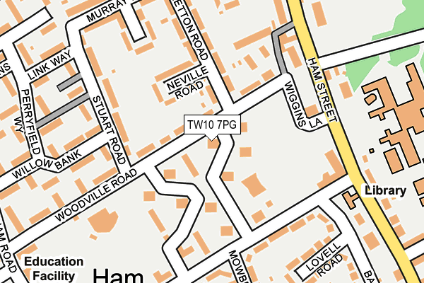
TW10 7PG lies on Ham Close in Richmond. TW10 7PG is located in the Ham, Petersham & Richmond Riverside electoral ward, within the London borough of Richmond upon Thames and the English Parliamentary constituency of Richmond Park. The Sub Integrated Care Board (ICB) Location is NHS South West London ICB - 36L and the police force is Metropolitan Police. This postcode has been in use since January 1980.


GetTheData
Source: OS OpenMap – Local (Ordnance Survey)
Source: OS VectorMap District (Ordnance Survey)
Licence: Open Government Licence (requires attribution)
| Easting | 517141 |
| Northing | 172419 |
| Latitude | 51.438665 |
| Longitude | -0.316046 |
GetTheData
Source: Open Postcode Geo
Licence: Open Government Licence
| Street | Ham Close |
| Town/City | Richmond |
| Country | England |
| Postcode District | TW10 |
➜ See where TW10 is on a map ➜ Where is London? | |
GetTheData
Source: Land Registry Price Paid Data
Licence: Open Government Licence
Elevation or altitude of TW10 7PG as distance above sea level:
| Metres | Feet | |
|---|---|---|
| Elevation | 10m | 33ft |
Elevation is measured from the approximate centre of the postcode, to the nearest point on an OS contour line from OS Terrain 50, which has contour spacing of ten vertical metres.
➜ How high above sea level am I? Find the elevation of your current position using your device's GPS.
GetTheData
Source: Open Postcode Elevation
Licence: Open Government Licence
| Ward | Ham, Petersham & Richmond Riverside |
| Constituency | Richmond Park |
GetTheData
Source: ONS Postcode Database
Licence: Open Government Licence
| Ashburnham Road | Ham | 153m |
| Ashburnham Road | Ham | 157m |
| Ham Street (Sandy Lane) | Ham | 222m |
| Ham Street (Sandy Lane) | Ham | 327m |
| Mariner Gardens (Broughton Avenue) | Ham | 395m |
| Twickenham Station | 1.6km |
| Strawberry Hill Station | 1.6km |
| St Margarets (London) Station | 1.9km |
GetTheData
Source: NaPTAN
Licence: Open Government Licence
| Percentage of properties with Next Generation Access | 100.0% |
| Percentage of properties with Superfast Broadband | 100.0% |
| Percentage of properties with Ultrafast Broadband | 100.0% |
| Percentage of properties with Full Fibre Broadband | 0.0% |
Superfast Broadband is between 30Mbps and 300Mbps
Ultrafast Broadband is > 300Mbps
| Median download speed | 100.0Mbps |
| Average download speed | 106.0Mbps |
| Maximum download speed | 350.00Mbps |
| Median upload speed | 9.8Mbps |
| Average upload speed | 9.8Mbps |
| Maximum upload speed | 9.76Mbps |
| Percentage of properties unable to receive 2Mbps | 0.0% |
| Percentage of properties unable to receive 5Mbps | 0.0% |
| Percentage of properties unable to receive 10Mbps | 0.0% |
| Percentage of properties unable to receive 30Mbps | 0.0% |
GetTheData
Source: Ofcom
Licence: Ofcom Terms of Use (requires attribution)
Estimated total energy consumption in TW10 7PG by fuel type, 2015.
| Consumption (kWh) | 74,336 |
|---|---|
| Meter count | 11 |
| Mean (kWh/meter) | 6,758 |
| Median (kWh/meter) | 6,026 |
| Consumption (kWh) | 23,725 |
|---|---|
| Meter count | 10 |
| Mean (kWh/meter) | 2,373 |
| Median (kWh/meter) | 2,024 |
GetTheData
Source: Postcode level gas estimates: 2015 (experimental)
Source: Postcode level electricity estimates: 2015 (experimental)
Licence: Open Government Licence
GetTheData
Source: ONS Postcode Database
Licence: Open Government Licence

➜ Get more ratings from the Food Standards Agency
GetTheData
Source: Food Standards Agency
Licence: FSA terms & conditions
| Last Collection | |||
|---|---|---|---|
| Location | Mon-Fri | Sat | Distance |
| Mowbray Road | 17:15 | 11:00 | 161m |
| Royal Oak, Back Lane | 17:15 | 11:00 | 197m |
| Ferrymoor, Ham | 17:15 | 11:00 | 337m |
GetTheData
Source: Dracos
Licence: Creative Commons Attribution-ShareAlike
The below table lists the International Territorial Level (ITL) codes (formerly Nomenclature of Territorial Units for Statistics (NUTS) codes) and Local Administrative Units (LAU) codes for TW10 7PG:
| ITL 1 Code | Name |
|---|---|
| TLI | London |
| ITL 2 Code | Name |
| TLI7 | Outer London - West and North West |
| ITL 3 Code | Name |
| TLI75 | Hounslow and Richmond upon Thames |
| LAU 1 Code | Name |
| E09000027 | Richmond upon Thames |
GetTheData
Source: ONS Postcode Directory
Licence: Open Government Licence
The below table lists the Census Output Area (OA), Lower Layer Super Output Area (LSOA), and Middle Layer Super Output Area (MSOA) for TW10 7PG:
| Code | Name | |
|---|---|---|
| OA | E00019204 | |
| LSOA | E01003819 | Richmond upon Thames 017B |
| MSOA | E02000800 | Richmond upon Thames 017 |
GetTheData
Source: ONS Postcode Directory
Licence: Open Government Licence
| TW10 7QL | Woodville Road | 38m |
| TW10 7PF | Ham Close | 46m |
| TW10 7PQ | Ham Close | 46m |
| TW10 7PH | Ham Close | 50m |
| TW10 7PJ | Ham Close | 51m |
| TW10 7PE | Ham Close | 78m |
| TW10 7PD | Ham Close | 94m |
| TW10 7PB | Ham Close | 96m |
| TW10 7QJ | Neville Road | 116m |
| TW10 7NT | Ham Close | 120m |
GetTheData
Source: Open Postcode Geo; Land Registry Price Paid Data
Licence: Open Government Licence