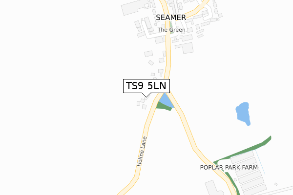
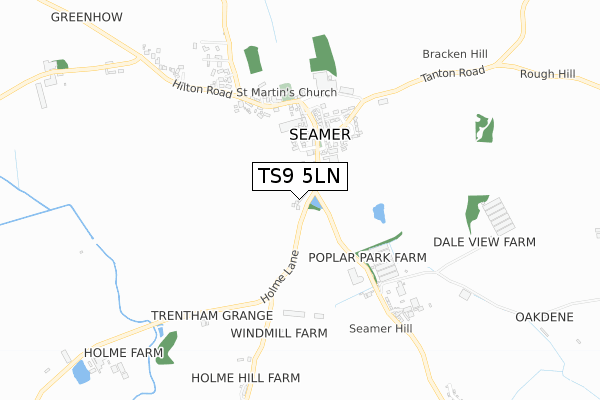
TS9 5LN lies on Holme Lane in Seamer, Middlesbrough. TS9 5LN is located in the Hutton Rudby & Osmotherley electoral ward, within the unitary authority of North Yorkshire and the English Parliamentary constituency of Richmond (Yorks). The Sub Integrated Care Board (ICB) Location is NHS Humber and North Yorkshire ICB - 42D and the police force is North Yorkshire. This postcode has been in use since January 1980.


GetTheData
Source: OS Open Zoomstack (Ordnance Survey)
Licence: Open Government Licence (requires attribution)
Attribution: Contains OS data © Crown copyright and database right 2025
Source: Open Postcode Geo
Licence: Open Government Licence (requires attribution)
Attribution: Contains OS data © Crown copyright and database right 2025; Contains Royal Mail data © Royal Mail copyright and database right 2025; Source: Office for National Statistics licensed under the Open Government Licence v.3.0
| Easting | 449904 |
| Northing | 509859 |
| Latitude | 54.481648 |
| Longitude | -1.231303 |
GetTheData
Source: Open Postcode Geo
Licence: Open Government Licence
| Street | Holme Lane |
| Locality | Seamer |
| Town/City | Middlesbrough |
| Country | England |
| Postcode District | TS9 |
➜ See where TS9 is on a map ➜ Where is Seamer? | |
GetTheData
Source: Land Registry Price Paid Data
Licence: Open Government Licence
Elevation or altitude of TS9 5LN as distance above sea level:
| Metres | Feet | |
|---|---|---|
| Elevation | 90m | 295ft |
Elevation is measured from the approximate centre of the postcode, to the nearest point on an OS contour line from OS Terrain 50, which has contour spacing of ten vertical metres.
➜ How high above sea level am I? Find the elevation of your current position using your device's GPS.
GetTheData
Source: Open Postcode Elevation
Licence: Open Government Licence
| Ward | Hutton Rudby & Osmotherley |
| Constituency | Richmond (Yorks) |
GetTheData
Source: ONS Postcode Database
Licence: Open Government Licence
THE PADDOCK, 1, HOLME LANE, SEAMER, MIDDLESBROUGH, TS9 5LN 2022 16 SEP £735,000 |
THE PADDOCK, 1, HOLME LANE, SEAMER, MIDDLESBROUGH, TS9 5LN 2018 7 SEP £595,000 |
2011 30 SEP £420,000 |
3, HOLME LANE, SEAMER, MIDDLESBROUGH, TS9 5LN 2010 28 MAY £450,000 |
5A, HOLME LANE, SEAMER, MIDDLESBROUGH, TS9 5LN 2007 26 JAN £440,000 |
2002 22 JUL £250,000 |
GetTheData
Source: HM Land Registry Price Paid Data
Licence: Contains HM Land Registry data © Crown copyright and database right 2025. This data is licensed under the Open Government Licence v3.0.
| Leconfield | Seamer | 225m |
| Leconfield (The Green) | Seamer | 228m |
| Depot (Tanton Road) | Seamer | 289m |
| Depot (Tanton Road) | Seamer | 299m |
GetTheData
Source: NaPTAN
Licence: Open Government Licence
| Percentage of properties with Next Generation Access | 100.0% |
| Percentage of properties with Superfast Broadband | 0.0% |
| Percentage of properties with Ultrafast Broadband | 0.0% |
| Percentage of properties with Full Fibre Broadband | 0.0% |
Superfast Broadband is between 30Mbps and 300Mbps
Ultrafast Broadband is > 300Mbps
| Percentage of properties unable to receive 2Mbps | 0.0% |
| Percentage of properties unable to receive 5Mbps | 20.0% |
| Percentage of properties unable to receive 10Mbps | 100.0% |
| Percentage of properties unable to receive 30Mbps | 100.0% |
GetTheData
Source: Ofcom
Licence: Ofcom Terms of Use (requires attribution)
GetTheData
Source: ONS Postcode Database
Licence: Open Government Licence
| Last Collection | |||
|---|---|---|---|
| Location | Mon-Fri | Sat | Distance |
| Newby | 16:15 | 10:00 | 2,484m |
| Queens Drive | 17:30 | 09:15 | 2,682m |
| Stokesley Post Office | 17:30 | 12:30 | 2,767m |
GetTheData
Source: Dracos
Licence: Creative Commons Attribution-ShareAlike
The below table lists the International Territorial Level (ITL) codes (formerly Nomenclature of Territorial Units for Statistics (NUTS) codes) and Local Administrative Units (LAU) codes for TS9 5LN:
| ITL 1 Code | Name |
|---|---|
| TLE | Yorkshire and The Humber |
| ITL 2 Code | Name |
| TLE2 | North Yorkshire |
| ITL 3 Code | Name |
| TLE22 | North Yorkshire CC |
| LAU 1 Code | Name |
| E07000164 | Hambleton |
GetTheData
Source: ONS Postcode Directory
Licence: Open Government Licence
The below table lists the Census Output Area (OA), Lower Layer Super Output Area (LSOA), and Middle Layer Super Output Area (MSOA) for TS9 5LN:
| Code | Name | |
|---|---|---|
| OA | E00140663 | |
| LSOA | E01027626 | Hambleton 002D |
| MSOA | E02005751 | Hambleton 002 |
GetTheData
Source: ONS Postcode Directory
Licence: Open Government Licence
| TS9 5LW | Stokesley Road | 135m |
| TS9 5PP | Leconfield | 235m |
| TS9 5GD | Manor Garth | 297m |
| TS9 5LS | The Green | 323m |
| TS9 5NN | Bracken Hill Walk | 332m |
| TS9 5LP | The Green | 337m |
| TS9 5NP | Tanton Close | 369m |
| TS9 5LT | Hilton Road | 379m |
| TS9 5LU | Hilton Road | 455m |
| TS9 5NA | Stainton Road | 631m |
GetTheData
Source: Open Postcode Geo; Land Registry Price Paid Data
Licence: Open Government Licence