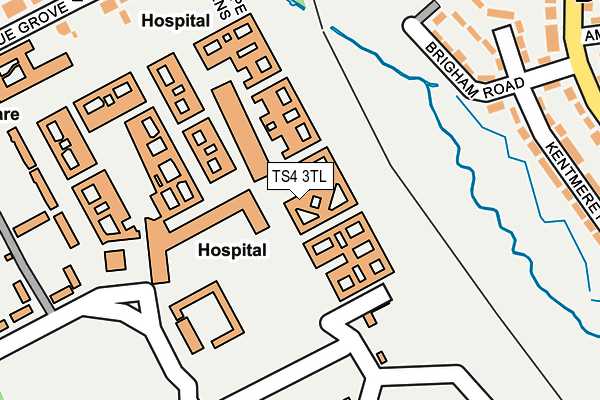
TS4 3TL is located in the Longlands & Beechwood electoral ward, within the unitary authority of Middlesbrough and the English Parliamentary constituency of Middlesbrough. The Sub Integrated Care Board (ICB) Location is NHS North East and North Cumbria ICB - 16C and the police force is Cleveland. This postcode has been in use since January 1991.


GetTheData
Source: OS OpenMap – Local (Ordnance Survey)
Source: OS VectorMap District (Ordnance Survey)
Licence: Open Government Licence (requires attribution)
| Easting | 450836 |
| Northing | 518153 |
| Latitude | 54.556073 |
| Longitude | -1.215480 |
GetTheData
Source: Open Postcode Geo
Licence: Open Government Licence
| Country | England |
| Postcode District | TS4 |
➜ See where TS4 is on a map ➜ Where is Middlesbrough? | |
GetTheData
Source: Land Registry Price Paid Data
Licence: Open Government Licence
Elevation or altitude of TS4 3TL as distance above sea level:
| Metres | Feet | |
|---|---|---|
| Elevation | 10m | 33ft |
Elevation is measured from the approximate centre of the postcode, to the nearest point on an OS contour line from OS Terrain 50, which has contour spacing of ten vertical metres.
➜ How high above sea level am I? Find the elevation of your current position using your device's GPS.
GetTheData
Source: Open Postcode Elevation
Licence: Open Government Licence
| Ward | Longlands & Beechwood |
| Constituency | Middlesbrough |
GetTheData
Source: ONS Postcode Database
Licence: Open Government Licence
| James Cook Hospital (James Cook Uni Hospital) | James Cook University Hospital | 308m |
| Crossfell Road (Overdale Road) | Berwick Hills | 335m |
| Kirkstone Road (Overdale Road) | Berwick Hills | 353m |
| Roseberry Park (Marton Road) | James Cook University Hospital | 374m |
| Kirkstone Road (Overdale Road) | Berwick Hills | 391m |
| James Cook University Hospital Station | 0.6km |
| Marton Station | 1.7km |
| Middlesbrough Station | 2.8km |
GetTheData
Source: NaPTAN
Licence: Open Government Licence
GetTheData
Source: ONS Postcode Database
Licence: Open Government Licence


➜ Get more ratings from the Food Standards Agency
GetTheData
Source: Food Standards Agency
Licence: FSA terms & conditions
| Last Collection | |||
|---|---|---|---|
| Location | Mon-Fri | Sat | Distance |
| Norfolk Place Post Office | 17:00 | 11:45 | 870m |
| Eastbourne Road Post Office | 17:15 | 11:15 | 1,204m |
| Southwell Road | 17:15 | 11:15 | 1,320m |
GetTheData
Source: Dracos
Licence: Creative Commons Attribution-ShareAlike
The below table lists the International Territorial Level (ITL) codes (formerly Nomenclature of Territorial Units for Statistics (NUTS) codes) and Local Administrative Units (LAU) codes for TS4 3TL:
| ITL 1 Code | Name |
|---|---|
| TLC | North East (England) |
| ITL 2 Code | Name |
| TLC1 | Tees Valley and Durham |
| ITL 3 Code | Name |
| TLC12 | South Teesside |
| LAU 1 Code | Name |
| E06000002 | Middlesbrough |
GetTheData
Source: ONS Postcode Directory
Licence: Open Government Licence
The below table lists the Census Output Area (OA), Lower Layer Super Output Area (LSOA), and Middle Layer Super Output Area (MSOA) for TS4 3TL:
| Code | Name | |
|---|---|---|
| OA | E00060625 | |
| LSOA | E01012018 | Middlesbrough 011A |
| MSOA | E02002506 | Middlesbrough 011 |
GetTheData
Source: ONS Postcode Directory
Licence: Open Government Licence
| TS3 7DG | Brigham Road | 218m |
| TS3 7DQ | Brogden Green | 243m |
| TS4 2PZ | Belle Vue Grove | 265m |
| TS3 7DH | Kentmere Road | 268m |
| TS4 2QA | Stanhope Gardens | 287m |
| TS3 7DJ | Kentmere Road | 291m |
| TS3 7DF | Overdale Road | 306m |
| TS3 7PY | Crossfell Road | 309m |
| TS3 7DP | Overdale Road | 317m |
| TS3 7DL | Kepple Avenue | 319m |
GetTheData
Source: Open Postcode Geo; Land Registry Price Paid Data
Licence: Open Government Licence