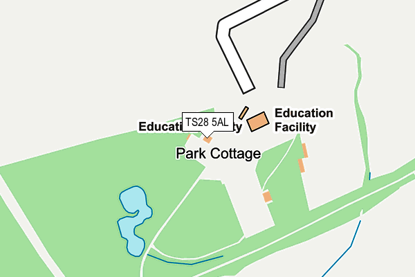
TS28 5AL is located in the Wingate electoral ward, within the unitary authority of County Durham and the English Parliamentary constituency of Sedgefield. The Sub Integrated Care Board (ICB) Location is NHS North East and North Cumbria ICB - 84H and the police force is Durham. This postcode has been in use since September 1991.


GetTheData
Source: OS OpenMap – Local (Ordnance Survey)
Source: OS VectorMap District (Ordnance Survey)
Licence: Open Government Licence (requires attribution)
| Easting | 439919 |
| Northing | 536477 |
| Latitude | 54.721712 |
| Longitude | -1.381776 |
GetTheData
Source: Open Postcode Geo
Licence: Open Government Licence
| Country | England |
| Postcode District | TS28 |
➜ See where TS28 is on a map | |
GetTheData
Source: Land Registry Price Paid Data
Licence: Open Government Licence
Elevation or altitude of TS28 5AL as distance above sea level:
| Metres | Feet | |
|---|---|---|
| Elevation | 120m | 394ft |
Elevation is measured from the approximate centre of the postcode, to the nearest point on an OS contour line from OS Terrain 50, which has contour spacing of ten vertical metres.
➜ How high above sea level am I? Find the elevation of your current position using your device's GPS.
GetTheData
Source: Open Postcode Elevation
Licence: Open Government Licence
| Ward | Wingate |
| Constituency | Sedgefield |
GetTheData
Source: ONS Postcode Database
Licence: Open Government Licence
| Job Centre (Front Street) | Wingate | 470m |
| Job Centre (Front Street) | Wingate | 475m |
| Victoria Inn (Front Street) | Wingate | 523m |
| Station Lane (Station Road) | Station Town | 540m |
| Victoria Inn (Front Street) | Wingate | 626m |
GetTheData
Source: NaPTAN
Licence: Open Government Licence
GetTheData
Source: ONS Postcode Database
Licence: Open Government Licence


➜ Get more ratings from the Food Standards Agency
GetTheData
Source: Food Standards Agency
Licence: FSA terms & conditions
| Last Collection | |||
|---|---|---|---|
| Location | Mon-Fri | Sat | Distance |
| Wellfield | 16:30 | 09:00 | 1,885m |
| Newlands Road | 16:30 | 09:30 | 3,084m |
| Hutton Henry | 16:45 | 12:00 | 3,369m |
GetTheData
Source: Dracos
Licence: Creative Commons Attribution-ShareAlike
The below table lists the International Territorial Level (ITL) codes (formerly Nomenclature of Territorial Units for Statistics (NUTS) codes) and Local Administrative Units (LAU) codes for TS28 5AL:
| ITL 1 Code | Name |
|---|---|
| TLC | North East (England) |
| ITL 2 Code | Name |
| TLC1 | Tees Valley and Durham |
| ITL 3 Code | Name |
| TLC14 | Durham |
| LAU 1 Code | Name |
| E06000047 | County Durham |
GetTheData
Source: ONS Postcode Directory
Licence: Open Government Licence
The below table lists the Census Output Area (OA), Lower Layer Super Output Area (LSOA), and Middle Layer Super Output Area (MSOA) for TS28 5AL:
| Code | Name | |
|---|---|---|
| OA | E00171878 | |
| LSOA | E01020795 | County Durham 043D |
| MSOA | E02004332 | County Durham 043 |
GetTheData
Source: ONS Postcode Directory
Licence: Open Government Licence
| TS28 5AJ | Market Crescent | 368m |
| TS28 5FB | Hadrian Court | 418m |
| TS28 5AD | The Rowlands | 449m |
| TS28 5AA | Front Street West | 454m |
| TS28 5AG | Front Street East | 490m |
| TS28 5DH | Lake Bank Terrace | 494m |
| TS28 5DQ | Lake View | 520m |
| TS28 5FD | Sandford Close | 534m |
| TS28 5FE | Chillerton Way | 544m |
| TS28 5DG | Station Lane | 566m |
GetTheData
Source: Open Postcode Geo; Land Registry Price Paid Data
Licence: Open Government Licence