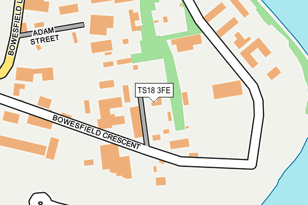
TS18 3FE is located in the Eaglescliffe East electoral ward, within the unitary authority of Stockton-on-Tees and the English Parliamentary constituency of Stockton South. The Sub Integrated Care Board (ICB) Location is NHS North East and North Cumbria ICB - 16C and the police force is Cleveland. This postcode has been in use since January 2015.


GetTheData
Source: OS OpenMap – Local (Ordnance Survey)
Source: OS VectorMap District (Ordnance Survey)
Licence: Open Government Licence (requires attribution)
| Easting | 444489 |
| Northing | 517090 |
| Latitude | 54.547117 |
| Longitude | -1.313770 |
GetTheData
Source: Open Postcode Geo
Licence: Open Government Licence
| Country | England |
| Postcode District | TS18 |
➜ See where TS18 is on a map ➜ Where is Stockton-on-Tees? | |
GetTheData
Source: Land Registry Price Paid Data
Licence: Open Government Licence
Elevation or altitude of TS18 3FE as distance above sea level:
| Metres | Feet | |
|---|---|---|
| Elevation | 10m | 33ft |
Elevation is measured from the approximate centre of the postcode, to the nearest point on an OS contour line from OS Terrain 50, which has contour spacing of ten vertical metres.
➜ How high above sea level am I? Find the elevation of your current position using your device's GPS.
GetTheData
Source: Open Postcode Elevation
Licence: Open Government Licence
| Ward | Eaglescliffe East |
| Constituency | Stockton South |
GetTheData
Source: ONS Postcode Database
Licence: Open Government Licence
| Bowesfield Crescent (Bowesfield Lane) | Bowesfield | 369m |
| Westland Way (Bowesfield Lane) | Bowesfield | 398m |
| Surtees Business Park (Bowesfield Crescent) | Bowesfield | 545m |
| Surtees Business Park (Bowesfield Crescent) | Bowesfield | 556m |
| Chestnut Grove (Thornaby Road) | Thornaby | 575m |
| Thornaby Station | 1.6km |
| Stockton Station | 2.5km |
| Eaglescliffe Station | 3km |
GetTheData
Source: NaPTAN
Licence: Open Government Licence
GetTheData
Source: ONS Postcode Database
Licence: Open Government Licence


➜ Get more ratings from the Food Standards Agency
GetTheData
Source: Food Standards Agency
Licence: FSA terms & conditions
| Last Collection | |||
|---|---|---|---|
| Location | Mon-Fri | Sat | Distance |
| Falcon Court | 16:45 | 12:45 | 468m |
| High Street West | 17:30 | 12:30 | 1,201m |
| Thorntree Road | 17:30 | 11:15 | 1,206m |
GetTheData
Source: Dracos
Licence: Creative Commons Attribution-ShareAlike
The below table lists the International Territorial Level (ITL) codes (formerly Nomenclature of Territorial Units for Statistics (NUTS) codes) and Local Administrative Units (LAU) codes for TS18 3FE:
| ITL 1 Code | Name |
|---|---|
| TLC | North East (England) |
| ITL 2 Code | Name |
| TLC1 | Tees Valley and Durham |
| ITL 3 Code | Name |
| TLC11 | Hartlepool and Stockton-on-Tees |
| LAU 1 Code | Name |
| E06000004 | Stockton-on-Tees |
GetTheData
Source: ONS Postcode Directory
Licence: Open Government Licence
The below table lists the Census Output Area (OA), Lower Layer Super Output Area (LSOA), and Middle Layer Super Output Area (MSOA) for TS18 3FE:
| Code | Name | |
|---|---|---|
| OA | E00174152 | |
| LSOA | E01012264 | Stockton-on-Tees 014C |
| MSOA | E02002548 | Stockton-on-Tees 014 |
GetTheData
Source: ONS Postcode Directory
Licence: Open Government Licence
| TS18 3HJ | Bowesfield Crescent | 94m |
| TS18 3HQ | Adam Street | 167m |
| TS18 3BL | Bowesfield Crescent | 199m |
| TS18 3DB | Halegrove Court | 362m |
| TS17 8QD | Holmes Close | 469m |
| TS18 3HP | Bowesfield Lane | 502m |
| TS17 8QA | Richardson Road | 504m |
| TS17 8QB | Shepherd Close | 538m |
| TS17 8PE | Thornaby Road | 563m |
| TS17 8PA | Thornaby Road | 564m |
GetTheData
Source: Open Postcode Geo; Land Registry Price Paid Data
Licence: Open Government Licence