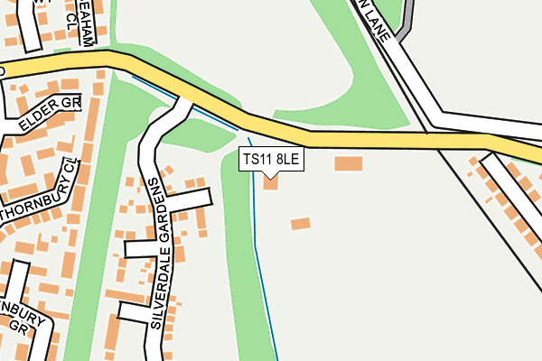
TS11 8LE is located in the Longbeck electoral ward, within the unitary authority of Redcar and Cleveland and the English Parliamentary constituency of Redcar. The Sub Integrated Care Board (ICB) Location is NHS North East and North Cumbria ICB - 16C and the police force is Cleveland. This postcode has been in use since January 1980.


GetTheData
Source: OS OpenMap – Local (Ordnance Survey)
Source: OS VectorMap District (Ordnance Survey)
Licence: Open Government Licence (requires attribution)
| Easting | 462131 |
| Northing | 522748 |
| Latitude | 54.596117 |
| Longitude | -1.039905 |
GetTheData
Source: Open Postcode Geo
Licence: Open Government Licence
| Country | England |
| Postcode District | TS11 |
➜ See where TS11 is on a map | |
GetTheData
Source: Land Registry Price Paid Data
Licence: Open Government Licence
Elevation or altitude of TS11 8LE as distance above sea level:
| Metres | Feet | |
|---|---|---|
| Elevation | 20m | 66ft |
Elevation is measured from the approximate centre of the postcode, to the nearest point on an OS contour line from OS Terrain 50, which has contour spacing of ten vertical metres.
➜ How high above sea level am I? Find the elevation of your current position using your device's GPS.
GetTheData
Source: Open Postcode Elevation
Licence: Open Government Licence
| Ward | Longbeck |
| Constituency | Redcar |
GetTheData
Source: ONS Postcode Database
Licence: Open Government Licence
| Cleveland View (Redcar Road) | Marske | 325m |
| Cleveland View (Redcar Road) | Marske | 432m |
| Cat Flatt (Redcar Road) | Marske | 610m |
| Cat Flatt (Redcar Road) | Marske | 638m |
| Wheatlands Farm (Redcar Road) | Redcar | 685m |
| Longbeck Station | 1km |
| Marske Station | 1.7km |
| Redcar East Station | 1.7km |
GetTheData
Source: NaPTAN
Licence: Open Government Licence
| Percentage of properties with Next Generation Access | 100.0% |
| Percentage of properties with Superfast Broadband | 0.0% |
| Percentage of properties with Ultrafast Broadband | 0.0% |
| Percentage of properties with Full Fibre Broadband | 0.0% |
Superfast Broadband is between 30Mbps and 300Mbps
Ultrafast Broadband is > 300Mbps
| Percentage of properties unable to receive 2Mbps | 0.0% |
| Percentage of properties unable to receive 5Mbps | 0.0% |
| Percentage of properties unable to receive 10Mbps | 0.0% |
| Percentage of properties unable to receive 30Mbps | 100.0% |
GetTheData
Source: Ofcom
Licence: Ofcom Terms of Use (requires attribution)
GetTheData
Source: ONS Postcode Database
Licence: Open Government Licence


➜ Get more ratings from the Food Standards Agency
GetTheData
Source: Food Standards Agency
Licence: FSA terms & conditions
| Last Collection | |||
|---|---|---|---|
| Location | Mon-Fri | Sat | Distance |
| Sheernes Way | 17:30 | 12:45 | 769m |
| Kirkwood Drive | 17:30 | 12:15 | 851m |
| The Hutments, Marske | 17:15 | 12:30 | 879m |
GetTheData
Source: Dracos
Licence: Creative Commons Attribution-ShareAlike
The below table lists the International Territorial Level (ITL) codes (formerly Nomenclature of Territorial Units for Statistics (NUTS) codes) and Local Administrative Units (LAU) codes for TS11 8LE:
| ITL 1 Code | Name |
|---|---|
| TLC | North East (England) |
| ITL 2 Code | Name |
| TLC1 | Tees Valley and Durham |
| ITL 3 Code | Name |
| TLC12 | South Teesside |
| LAU 1 Code | Name |
| E06000003 | Redcar and Cleveland |
GetTheData
Source: ONS Postcode Directory
Licence: Open Government Licence
The below table lists the Census Output Area (OA), Lower Layer Super Output Area (LSOA), and Middle Layer Super Output Area (MSOA) for TS11 8LE:
| Code | Name | |
|---|---|---|
| OA | E00165770 | |
| LSOA | E01012138 | Redcar and Cleveland 006A |
| MSOA | E02002520 | Redcar and Cleveland 006 |
GetTheData
Source: ONS Postcode Directory
Licence: Open Government Licence
| TS11 6EU | Cleveland View | 306m |
| TS11 6ER | Cleveland View | 344m |
| TS11 6ET | Cleveland View | 361m |
| TS10 2RW | Porthleven Way | 381m |
| TS11 6NB | De Havilland Drive | 385m |
| TS10 2RS | Seaham Close | 395m |
| TS10 2RP | St Ives Close | 403m |
| TS10 2RN | Newlyn Way | 409m |
| TS11 6ND | Vickers Close | 421m |
| TS10 2QP | Hythe Close | 422m |
GetTheData
Source: Open Postcode Geo; Land Registry Price Paid Data
Licence: Open Government Licence