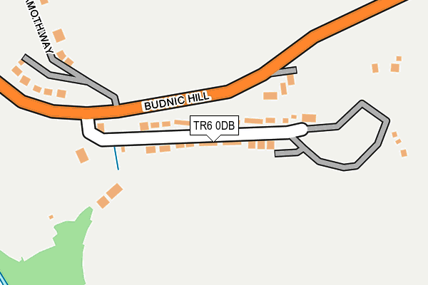
TR6 0DB lies on Budnic Estate in Perranporth. TR6 0DB is located in the Perranporth electoral ward, within the unitary authority of Cornwall and the English Parliamentary constituency of Truro and Falmouth. The Sub Integrated Care Board (ICB) Location is NHS Cornwall and the Isles of Scilly ICB - 11N and the police force is Devon & Cornwall. This postcode has been in use since January 1980.


GetTheData
Source: OS OpenMap – Local (Ordnance Survey)
Source: OS VectorMap District (Ordnance Survey)
Licence: Open Government Licence (requires attribution)
| Easting | 176467 |
| Northing | 54221 |
| Latitude | 50.345369 |
| Longitude | -5.143208 |
GetTheData
Source: Open Postcode Geo
Licence: Open Government Licence
| Street | Budnic Estate |
| Town/City | Perranporth |
| Country | England |
| Postcode District | TR6 |
➜ See where TR6 is on a map ➜ Where is Perranporth? | |
GetTheData
Source: Land Registry Price Paid Data
Licence: Open Government Licence
Elevation or altitude of TR6 0DB as distance above sea level:
| Metres | Feet | |
|---|---|---|
| Elevation | 20m | 66ft |
Elevation is measured from the approximate centre of the postcode, to the nearest point on an OS contour line from OS Terrain 50, which has contour spacing of ten vertical metres.
➜ How high above sea level am I? Find the elevation of your current position using your device's GPS.
GetTheData
Source: Open Postcode Elevation
Licence: Open Government Licence
| Ward | Perranporth |
| Constituency | Truro And Falmouth |
GetTheData
Source: ONS Postcode Database
Licence: Open Government Licence
| Football Ground (Budnic Hill) | Perranporth | 128m |
| Football Ground | Perranporth | 207m |
| Fire Station (Wheal Leisure) | Perranporth | 518m |
| Fire Station | Perranporth | 520m |
| Atlantic Bay Flats (St Pirans Road) | Perranporth | 541m |
GetTheData
Source: NaPTAN
Licence: Open Government Licence
| Percentage of properties with Next Generation Access | 88.2% |
| Percentage of properties with Superfast Broadband | 88.2% |
| Percentage of properties with Ultrafast Broadband | 0.0% |
| Percentage of properties with Full Fibre Broadband | 0.0% |
Superfast Broadband is between 30Mbps and 300Mbps
Ultrafast Broadband is > 300Mbps
| Median download speed | 36.1Mbps |
| Average download speed | 36.3Mbps |
| Maximum download speed | 80.00Mbps |
| Median upload speed | 10.0Mbps |
| Average upload speed | 8.6Mbps |
| Maximum upload speed | 20.00Mbps |
| Percentage of properties unable to receive 2Mbps | 0.0% |
| Percentage of properties unable to receive 5Mbps | 0.0% |
| Percentage of properties unable to receive 10Mbps | 0.0% |
| Percentage of properties unable to receive 30Mbps | 11.8% |
GetTheData
Source: Ofcom
Licence: Ofcom Terms of Use (requires attribution)
Estimated total energy consumption in TR6 0DB by fuel type, 2015.
| Consumption (kWh) | 197,462 |
|---|---|
| Meter count | 34 |
| Mean (kWh/meter) | 5,808 |
| Median (kWh/meter) | 4,326 |
GetTheData
Source: Postcode level gas estimates: 2015 (experimental)
Source: Postcode level electricity estimates: 2015 (experimental)
Licence: Open Government Licence
GetTheData
Source: ONS Postcode Database
Licence: Open Government Licence


➜ Get more ratings from the Food Standards Agency
GetTheData
Source: Food Standards Agency
Licence: FSA terms & conditions
| Last Collection | |||
|---|---|---|---|
| Location | Mon-Fri | Sat | Distance |
| Goonhavern Post Office | 17:00 | 11:30 | 2,464m |
| Ellenglaze | 09:30 | 09:30 | 3,763m |
| Hendra Croft | 16:15 | 10:50 | 3,794m |
GetTheData
Source: Dracos
Licence: Creative Commons Attribution-ShareAlike
The below table lists the International Territorial Level (ITL) codes (formerly Nomenclature of Territorial Units for Statistics (NUTS) codes) and Local Administrative Units (LAU) codes for TR6 0DB:
| ITL 1 Code | Name |
|---|---|
| TLK | South West (England) |
| ITL 2 Code | Name |
| TLK3 | Cornwall and Isles of Scilly |
| ITL 3 Code | Name |
| TLK30 | Cornwall and Isles of Scilly |
| LAU 1 Code | Name |
| E06000052 | Cornwall |
GetTheData
Source: ONS Postcode Directory
Licence: Open Government Licence
The below table lists the Census Output Area (OA), Lower Layer Super Output Area (LSOA), and Middle Layer Super Output Area (MSOA) for TR6 0DB:
| Code | Name | |
|---|---|---|
| OA | E00095126 | |
| LSOA | E01018842 | Cornwall 033B |
| MSOA | E02003906 | Cornwall 033 |
GetTheData
Source: ONS Postcode Directory
Licence: Open Government Licence
| TR6 0DW | Morwenna Gardens | 68m |
| TR6 0DA | Budnic Estate | 79m |
| TR6 0BZ | Fernleigh Villas | 157m |
| TR6 0AA | Budnic Hill | 252m |
| TR6 0BY | Ramoth Way | 337m |
| TR6 0BU | Budnic Hill | 380m |
| TR6 0DL | New Road | 413m |
| TR6 0DD | Station Road | 430m |
| TR6 0AB | Budnic Hill | 432m |
| TR6 0BX | Budnic Hill | 454m |
GetTheData
Source: Open Postcode Geo; Land Registry Price Paid Data
Licence: Open Government Licence