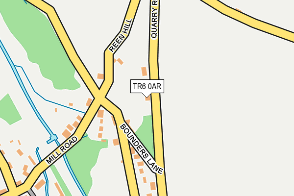
TR6 0AR is in Bolingey, Perranporth. TR6 0AR is located in the Perranporth electoral ward, within the unitary authority of Cornwall and the English Parliamentary constituency of Truro and Falmouth. The Sub Integrated Care Board (ICB) Location is NHS Cornwall and the Isles of Scilly ICB - 11N and the police force is Devon & Cornwall. This postcode has been in use since January 1980.


GetTheData
Source: OS OpenMap – Local (Ordnance Survey)
Source: OS VectorMap District (Ordnance Survey)
Licence: Open Government Licence (requires attribution)
| Easting | 176686 |
| Northing | 53420 |
| Latitude | 50.338269 |
| Longitude | -5.139615 |
GetTheData
Source: Open Postcode Geo
Licence: Open Government Licence
| Locality | Bolingey |
| Town/City | Perranporth |
| Country | England |
| Postcode District | TR6 |
➜ See where TR6 is on a map ➜ Where is Bolingey? | |
GetTheData
Source: Land Registry Price Paid Data
Licence: Open Government Licence
Elevation or altitude of TR6 0AR as distance above sea level:
| Metres | Feet | |
|---|---|---|
| Elevation | 30m | 98ft |
Elevation is measured from the approximate centre of the postcode, to the nearest point on an OS contour line from OS Terrain 50, which has contour spacing of ten vertical metres.
➜ How high above sea level am I? Find the elevation of your current position using your device's GPS.
GetTheData
Source: Open Postcode Elevation
Licence: Open Government Licence
| Ward | Perranporth |
| Constituency | Truro And Falmouth |
GetTheData
Source: ONS Postcode Database
Licence: Open Government Licence
2018 21 JUN £530,000 |
SEA WINDS, BOLINGEY, PERRANPORTH, TR6 0AR 2017 17 MAR £240,000 |
2012 14 DEC £420,000 |
2009 31 JUL £340,000 |
2006 25 AUG £305,000 |
2002 19 JUL £199,950 |
1996 14 OCT £79,950 |
GetTheData
Source: HM Land Registry Price Paid Data
Licence: Contains HM Land Registry data © Crown copyright and database right 2025. This data is licensed under the Open Government Licence v3.0.
| Bottom Reen Hill | Bolingey | 124m |
| Bottom Reen Hill | Bolingey | 126m |
| Post Office (Mill Road) | Bolingey | 155m |
| Post Office (Mill Road) | Bolingey | 155m |
| Millbrook (Hendrawna Lane) | Bolingey | 329m |
GetTheData
Source: NaPTAN
Licence: Open Government Licence
| Percentage of properties with Next Generation Access | 100.0% |
| Percentage of properties with Superfast Broadband | 100.0% |
| Percentage of properties with Ultrafast Broadband | 100.0% |
| Percentage of properties with Full Fibre Broadband | 100.0% |
Superfast Broadband is between 30Mbps and 300Mbps
Ultrafast Broadband is > 300Mbps
| Percentage of properties unable to receive 2Mbps | 0.0% |
| Percentage of properties unable to receive 5Mbps | 0.0% |
| Percentage of properties unable to receive 10Mbps | 0.0% |
| Percentage of properties unable to receive 30Mbps | 0.0% |
GetTheData
Source: Ofcom
Licence: Ofcom Terms of Use (requires attribution)
GetTheData
Source: ONS Postcode Database
Licence: Open Government Licence


➜ Get more ratings from the Food Standards Agency
GetTheData
Source: Food Standards Agency
Licence: FSA terms & conditions
| Last Collection | |||
|---|---|---|---|
| Location | Mon-Fri | Sat | Distance |
| Goonhavern Post Office | 17:00 | 11:30 | 2,215m |
| Hendra Croft | 16:15 | 10:50 | 3,928m |
| Rejerrah | 16:10 | 10:30 | 4,270m |
GetTheData
Source: Dracos
Licence: Creative Commons Attribution-ShareAlike
The below table lists the International Territorial Level (ITL) codes (formerly Nomenclature of Territorial Units for Statistics (NUTS) codes) and Local Administrative Units (LAU) codes for TR6 0AR:
| ITL 1 Code | Name |
|---|---|
| TLK | South West (England) |
| ITL 2 Code | Name |
| TLK3 | Cornwall and Isles of Scilly |
| ITL 3 Code | Name |
| TLK30 | Cornwall and Isles of Scilly |
| LAU 1 Code | Name |
| E06000052 | Cornwall |
GetTheData
Source: ONS Postcode Directory
Licence: Open Government Licence
The below table lists the Census Output Area (OA), Lower Layer Super Output Area (LSOA), and Middle Layer Super Output Area (MSOA) for TR6 0AR:
| Code | Name | |
|---|---|---|
| OA | E00095128 | |
| LSOA | E01018843 | Cornwall 033C |
| MSOA | E02003906 | Cornwall 033 |
GetTheData
Source: ONS Postcode Directory
Licence: Open Government Licence
| TR6 0AW | Reen Hill | 103m |
| TR6 0AP | Mill Road | 114m |
| TR6 0AS | 167m | |
| TR6 0PE | Mill Road | 280m |
| TR6 0DF | Hendrawna Lane | 409m |
| TR6 0DQ | Chapel Hill | 409m |
| TR6 0AN | 419m | |
| TR6 0DH | Penwartha Road | 428m |
| TR6 0DG | Crow Hill | 442m |
| TR6 0AL | 453m |
GetTheData
Source: Open Postcode Geo; Land Registry Price Paid Data
Licence: Open Government Licence