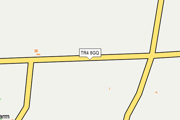
TR4 8GQ is located in the St Agnes electoral ward, within the unitary authority of Cornwall and the English Parliamentary constituency of Camborne and Redruth. The Sub Integrated Care Board (ICB) Location is NHS Cornwall and the Isles of Scilly ICB - 11N and the police force is Devon & Cornwall. This postcode has been in use since July 2007.


GetTheData
Source: OS OpenMap – Local (Ordnance Survey)
Source: OS VectorMap District (Ordnance Survey)
Licence: Open Government Licence (requires attribution)
| Easting | 171938 |
| Northing | 48415 |
| Latitude | 50.291508 |
| Longitude | -5.203205 |
GetTheData
Source: Open Postcode Geo
Licence: Open Government Licence
| Country | England |
| Postcode District | TR4 |
➜ See where TR4 is on a map | |
GetTheData
Source: Land Registry Price Paid Data
Licence: Open Government Licence
Elevation or altitude of TR4 8GQ as distance above sea level:
| Metres | Feet | |
|---|---|---|
| Elevation | 120m | 394ft |
Elevation is measured from the approximate centre of the postcode, to the nearest point on an OS contour line from OS Terrain 50, which has contour spacing of ten vertical metres.
➜ How high above sea level am I? Find the elevation of your current position using your device's GPS.
GetTheData
Source: Open Postcode Elevation
Licence: Open Government Licence
| Ward | St Agnes |
| Constituency | Camborne And Redruth |
GetTheData
Source: ONS Postcode Database
Licence: Open Government Licence
| Sevenmilestone Filling Station (B3277) | Mithian Downs | 802m |
| The Old Station (Penwinnick Road) | St Agnes | 803m |
| The Old Station (Penwinnick Road) | St Agnes | 810m |
| Sevenmilestone Filling Station (B3277) | Mithian Downs | 815m |
| Old School | Mount Hawke | 925m |
GetTheData
Source: NaPTAN
Licence: Open Government Licence
GetTheData
Source: ONS Postcode Database
Licence: Open Government Licence


➜ Get more ratings from the Food Standards Agency
GetTheData
Source: Food Standards Agency
Licence: FSA terms & conditions
| Last Collection | |||
|---|---|---|---|
| Location | Mon-Fri | Sat | Distance |
| Quay | 16:15 | 10:30 | 2,991m |
| Treleigh | 16:05 | 08:45 | 5,048m |
| Chacewater Post Office | 17:00 | 11:15 | 5,071m |
GetTheData
Source: Dracos
Licence: Creative Commons Attribution-ShareAlike
The below table lists the International Territorial Level (ITL) codes (formerly Nomenclature of Territorial Units for Statistics (NUTS) codes) and Local Administrative Units (LAU) codes for TR4 8GQ:
| ITL 1 Code | Name |
|---|---|
| TLK | South West (England) |
| ITL 2 Code | Name |
| TLK3 | Cornwall and Isles of Scilly |
| ITL 3 Code | Name |
| TLK30 | Cornwall and Isles of Scilly |
| LAU 1 Code | Name |
| E06000052 | Cornwall |
GetTheData
Source: ONS Postcode Directory
Licence: Open Government Licence
The below table lists the Census Output Area (OA), Lower Layer Super Output Area (LSOA), and Middle Layer Super Output Area (MSOA) for TR4 8GQ:
| Code | Name | |
|---|---|---|
| OA | E00095037 | |
| LSOA | E01018826 | Cornwall 040B |
| MSOA | E02003907 | Cornwall 040 |
GetTheData
Source: ONS Postcode Directory
Licence: Open Government Licence
| TR4 8BH | Gover Hill | 393m |
| TR4 8BT | 459m | |
| TR4 8BL | 500m | |
| TR5 0PE | Scoll Bridge | 539m |
| TR4 8BJ | Trenithick | 586m |
| TR4 8BW | Banns Road | 727m |
| TR4 8BS | 764m | |
| TR4 8TL | Old Church Cottages | 795m |
| TR5 0PF | 821m | |
| TR4 8DR | Fore Street | 849m |
GetTheData
Source: Open Postcode Geo; Land Registry Price Paid Data
Licence: Open Government Licence