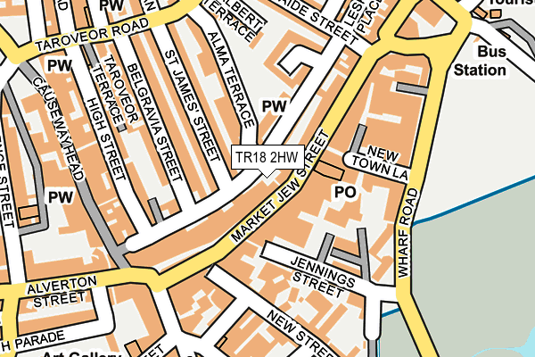
TR18 2HW lies on The Arcade in Penzance. TR18 2HW is located in the Penzance Promenade electoral ward, within the unitary authority of Cornwall and the English Parliamentary constituency of St Ives. The Sub Integrated Care Board (ICB) Location is NHS Cornwall and the Isles of Scilly ICB - 11N and the police force is Devon & Cornwall. This postcode has been in use since January 1980.


GetTheData
Source: OS OpenMap – Local (Ordnance Survey)
Source: OS VectorMap District (Ordnance Survey)
Licence: Open Government Licence (requires attribution)
| Easting | 147371 |
| Northing | 30388 |
| Latitude | 50.119676 |
| Longitude | -5.535509 |
GetTheData
Source: Open Postcode Geo
Licence: Open Government Licence
| Street | The Arcade |
| Town/City | Penzance |
| Country | England |
| Postcode District | TR18 |
➜ See where TR18 is on a map ➜ Where is Penzance? | |
GetTheData
Source: Land Registry Price Paid Data
Licence: Open Government Licence
Elevation or altitude of TR18 2HW as distance above sea level:
| Metres | Feet | |
|---|---|---|
| Elevation | 20m | 66ft |
Elevation is measured from the approximate centre of the postcode, to the nearest point on an OS contour line from OS Terrain 50, which has contour spacing of ten vertical metres.
➜ How high above sea level am I? Find the elevation of your current position using your device's GPS.
GetTheData
Source: Open Postcode Elevation
Licence: Open Government Licence
| Ward | Penzance Promenade |
| Constituency | St Ives |
GetTheData
Source: ONS Postcode Database
Licence: Open Government Licence
| Town Centre (Market Jew Street) | Penzance | 34m |
| Town Centre (Market Jew Street) | Penzance | 44m |
| Adelaide Street | Penzance | 183m |
| Green Market (Alverton Street) | Penzance | 213m |
| Albert Pier Road | Penzance | 288m |
| Penzance Station | 0.3km |
GetTheData
Source: NaPTAN
Licence: Open Government Licence
GetTheData
Source: ONS Postcode Database
Licence: Open Government Licence


➜ Get more ratings from the Food Standards Agency
GetTheData
Source: Food Standards Agency
Licence: FSA terms & conditions
| Last Collection | |||
|---|---|---|---|
| Location | Mon-Fri | Sat | Distance |
| Penzance Post Office | 18:00 | 12:30 | 80m |
| Queens Square | 17:45 | 11:30 | 215m |
| Taroveor Road | 17:40 | 11:30 | 232m |
GetTheData
Source: Dracos
Licence: Creative Commons Attribution-ShareAlike
The below table lists the International Territorial Level (ITL) codes (formerly Nomenclature of Territorial Units for Statistics (NUTS) codes) and Local Administrative Units (LAU) codes for TR18 2HW:
| ITL 1 Code | Name |
|---|---|
| TLK | South West (England) |
| ITL 2 Code | Name |
| TLK3 | Cornwall and Isles of Scilly |
| ITL 3 Code | Name |
| TLK30 | Cornwall and Isles of Scilly |
| LAU 1 Code | Name |
| E06000052 | Cornwall |
GetTheData
Source: ONS Postcode Directory
Licence: Open Government Licence
The below table lists the Census Output Area (OA), Lower Layer Super Output Area (LSOA), and Middle Layer Super Output Area (MSOA) for TR18 2HW:
| Code | Name | |
|---|---|---|
| OA | E00095986 | |
| LSOA | E01018999 | Cornwall 068C |
| MSOA | E02003949 | Cornwall 068 |
GetTheData
Source: ONS Postcode Directory
Licence: Open Government Licence
| TR18 2EJ | The Arcade | 14m |
| TR18 2EG | Bread Street | 18m |
| TR18 2HN | Market Jew Street | 32m |
| TR18 2LE | Market Jew Street | 40m |
| TR18 2BX | Alma Place | 54m |
| TR18 2EH | Bread Street | 55m |
| TR18 2HR | Market Jew Street | 61m |
| TR18 2FE | Bread Street | 68m |
| TR18 2EQ | Bread Street | 93m |
| TR18 2LD | Market Jew Street | 104m |
GetTheData
Source: Open Postcode Geo; Land Registry Price Paid Data
Licence: Open Government Licence