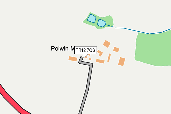
TR12 7QS is in Helston. TR12 7QS is located in the Mullion & St Keverne electoral ward, within the unitary authority of Cornwall and the English Parliamentary constituency of St Ives. The Sub Integrated Care Board (ICB) Location is NHS Cornwall and the Isles of Scilly ICB - 11N and the police force is Devon & Cornwall. This postcode has been in use since January 1980.


GetTheData
Source: OS OpenMap – Local (Ordnance Survey)
Source: OS VectorMap District (Ordnance Survey)
Licence: Open Government Licence (requires attribution)
| Easting | 168962 |
| Northing | 23339 |
| Latitude | 50.065189 |
| Longitude | -5.229683 |
GetTheData
Source: Open Postcode Geo
Licence: Open Government Licence
| Town/City | Helston |
| Country | England |
| Postcode District | TR12 |
➜ See where TR12 is on a map | |
GetTheData
Source: Land Registry Price Paid Data
Licence: Open Government Licence
Elevation or altitude of TR12 7QS as distance above sea level:
| Metres | Feet | |
|---|---|---|
| Elevation | 60m | 197ft |
Elevation is measured from the approximate centre of the postcode, to the nearest point on an OS contour line from OS Terrain 50, which has contour spacing of ten vertical metres.
➜ How high above sea level am I? Find the elevation of your current position using your device's GPS.
GetTheData
Source: Open Postcode Elevation
Licence: Open Government Licence
| Ward | Mullion & St Keverne |
| Constituency | St Ives |
GetTheData
Source: ONS Postcode Database
Licence: Open Government Licence
| Treloskan Farm | Nantithet | 885m |
| Treloskan Farm | Nantithet | 893m |
| The Bridge | Nantithet | 1,090m |
| The Bridge (Gilly Hill) | Nantithet | 1,090m |
| Culdrose Roundabout | Culdrose | 1,101m |
GetTheData
Source: NaPTAN
Licence: Open Government Licence
| Percentage of properties with Next Generation Access | 100.0% |
| Percentage of properties with Superfast Broadband | 20.0% |
| Percentage of properties with Ultrafast Broadband | 20.0% |
| Percentage of properties with Full Fibre Broadband | 20.0% |
Superfast Broadband is between 30Mbps and 300Mbps
Ultrafast Broadband is > 300Mbps
| Median download speed | 9.0Mbps |
| Average download speed | 7.1Mbps |
| Maximum download speed | 11.13Mbps |
| Median upload speed | 0.5Mbps |
| Average upload speed | 0.6Mbps |
| Maximum upload speed | 0.69Mbps |
| Percentage of properties unable to receive 2Mbps | 0.0% |
| Percentage of properties unable to receive 5Mbps | 0.0% |
| Percentage of properties unable to receive 10Mbps | 0.0% |
| Percentage of properties unable to receive 30Mbps | 80.0% |
GetTheData
Source: Ofcom
Licence: Ofcom Terms of Use (requires attribution)
GetTheData
Source: ONS Postcode Database
Licence: Open Government Licence

➜ Get more ratings from the Food Standards Agency
GetTheData
Source: Food Standards Agency
Licence: FSA terms & conditions
| Last Collection | |||
|---|---|---|---|
| Location | Mon-Fri | Sat | Distance |
| Gunwalloe | 16:50 | 08:30 | 3,405m |
| Meneage Street | 17:45 | 11:30 | 4,782m |
| Grange Road | 17:25 | 10:00 | 4,917m |
GetTheData
Source: Dracos
Licence: Creative Commons Attribution-ShareAlike
The below table lists the International Territorial Level (ITL) codes (formerly Nomenclature of Territorial Units for Statistics (NUTS) codes) and Local Administrative Units (LAU) codes for TR12 7QS:
| ITL 1 Code | Name |
|---|---|
| TLK | South West (England) |
| ITL 2 Code | Name |
| TLK3 | Cornwall and Isles of Scilly |
| ITL 3 Code | Name |
| TLK30 | Cornwall and Isles of Scilly |
| LAU 1 Code | Name |
| E06000052 | Cornwall |
GetTheData
Source: ONS Postcode Directory
Licence: Open Government Licence
The below table lists the Census Output Area (OA), Lower Layer Super Output Area (LSOA), and Middle Layer Super Output Area (MSOA) for TR12 7QS:
| Code | Name | |
|---|---|---|
| OA | E00095442 | |
| LSOA | E01018903 | Cornwall 073C |
| MSOA | E02003930 | Cornwall 073 |
GetTheData
Source: ONS Postcode Directory
Licence: Open Government Licence
| TR12 7QT | 505m | |
| TR12 7RA | 792m | |
| TR12 7QR | 843m | |
| TR12 6LP | 900m | |
| TR12 7RB | Nantithet | 1079m |
| TR12 6LR | 1081m | |
| TR12 7QU | 1087m | |
| TR12 6AZ | Rosevear Hill | 1348m |
| TR12 6AY | St Keverne Road | 1381m |
| TR12 6LW | Tregear Close | 1395m |
GetTheData
Source: Open Postcode Geo; Land Registry Price Paid Data
Licence: Open Government Licence