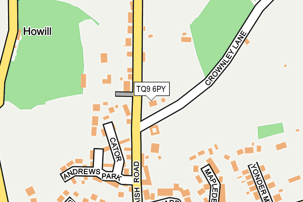
TQ9 6PY lies on Aish Road in Stoke Gabriel, Totnes. TQ9 6PY is located in the Dartmouth & East Dart electoral ward, within the local authority district of South Hams and the English Parliamentary constituency of Totnes. The Sub Integrated Care Board (ICB) Location is NHS Devon ICB - 15N and the police force is Devon & Cornwall. This postcode has been in use since January 1980.


GetTheData
Source: OS OpenMap – Local (Ordnance Survey)
Source: OS VectorMap District (Ordnance Survey)
Licence: Open Government Licence (requires attribution)
| Easting | 284754 |
| Northing | 57975 |
| Latitude | 50.410308 |
| Longitude | -3.623267 |
GetTheData
Source: Open Postcode Geo
Licence: Open Government Licence
| Street | Aish Road |
| Locality | Stoke Gabriel |
| Town/City | Totnes |
| Country | England |
| Postcode District | TQ9 |
➜ See where TQ9 is on a map ➜ Where is Stoke Gabriel? | |
GetTheData
Source: Land Registry Price Paid Data
Licence: Open Government Licence
Elevation or altitude of TQ9 6PY as distance above sea level:
| Metres | Feet | |
|---|---|---|
| Elevation | 50m | 164ft |
Elevation is measured from the approximate centre of the postcode, to the nearest point on an OS contour line from OS Terrain 50, which has contour spacing of ten vertical metres.
➜ How high above sea level am I? Find the elevation of your current position using your device's GPS.
GetTheData
Source: Open Postcode Elevation
Licence: Open Government Licence
| Ward | Dartmouth & East Dart |
| Constituency | Totnes |
GetTheData
Source: ONS Postcode Database
Licence: Open Government Licence
| The Yeolands | Stoke Gabriel | 265m |
| Rydon Cross (Paignton Road) | Stoke Gabriel | 308m |
| Rydon Cross (Paignton Road) | Stoke Gabriel | 318m |
| Four Cross Lanes (Paignton Road) | Stoke Gabriel | 597m |
| Four Cross Lanes (Paignton Road) | Stoke Gabriel | 603m |
| Paignton Station | 5km |
| Totnes Station | 5.4km |
GetTheData
Source: NaPTAN
Licence: Open Government Licence
| Percentage of properties with Next Generation Access | 100.0% |
| Percentage of properties with Superfast Broadband | 100.0% |
| Percentage of properties with Ultrafast Broadband | 0.0% |
| Percentage of properties with Full Fibre Broadband | 0.0% |
Superfast Broadband is between 30Mbps and 300Mbps
Ultrafast Broadband is > 300Mbps
| Percentage of properties unable to receive 2Mbps | 0.0% |
| Percentage of properties unable to receive 5Mbps | 0.0% |
| Percentage of properties unable to receive 10Mbps | 0.0% |
| Percentage of properties unable to receive 30Mbps | 0.0% |
GetTheData
Source: Ofcom
Licence: Ofcom Terms of Use (requires attribution)
GetTheData
Source: ONS Postcode Database
Licence: Open Government Licence


➜ Get more ratings from the Food Standards Agency
GetTheData
Source: Food Standards Agency
Licence: FSA terms & conditions
| Last Collection | |||
|---|---|---|---|
| Location | Mon-Fri | Sat | Distance |
| Stoke Gabriel Post Office | 17:15 | 10:00 | 767m |
| Aish Cross | 17:15 | 10:10 | 1,096m |
| Longcombe | 17:15 | 10:10 | 2,214m |
GetTheData
Source: Dracos
Licence: Creative Commons Attribution-ShareAlike
The below table lists the International Territorial Level (ITL) codes (formerly Nomenclature of Territorial Units for Statistics (NUTS) codes) and Local Administrative Units (LAU) codes for TQ9 6PY:
| ITL 1 Code | Name |
|---|---|
| TLK | South West (England) |
| ITL 2 Code | Name |
| TLK4 | Devon |
| ITL 3 Code | Name |
| TLK43 | Devon CC |
| LAU 1 Code | Name |
| E07000044 | South Hams |
GetTheData
Source: ONS Postcode Directory
Licence: Open Government Licence
The below table lists the Census Output Area (OA), Lower Layer Super Output Area (LSOA), and Middle Layer Super Output Area (MSOA) for TQ9 6PY:
| Code | Name | |
|---|---|---|
| OA | E00102073 | |
| LSOA | E01020156 | South Hams 004B |
| MSOA | E02004192 | South Hams 004 |
GetTheData
Source: ONS Postcode Directory
Licence: Open Government Licence
| TQ9 6PX | Aish Road | 99m |
| TQ9 6FG | Cator | 112m |
| TQ9 6RT | Aish Road | 153m |
| TQ9 6FF | Andrews Park | 189m |
| TQ9 6RP | Mapledene Close | 204m |
| TQ9 6PZ | Orchard Way | 219m |
| TQ9 6QE | Yonder Meadow | 242m |
| TQ9 6QA | Pound Field | 248m |
| TQ9 6SY | The Yeolands | 283m |
| TQ9 6QF | Paignton Road | 296m |
GetTheData
Source: Open Postcode Geo; Land Registry Price Paid Data
Licence: Open Government Licence