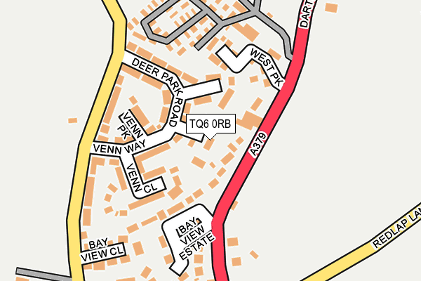
TQ6 0RB lies on Gratton Close in Stoke Fleming, Dartmouth. TQ6 0RB is located in the Blackawton & Stoke Fleming electoral ward, within the local authority district of South Hams and the English Parliamentary constituency of Totnes. The Sub Integrated Care Board (ICB) Location is NHS Devon ICB - 15N and the police force is Devon & Cornwall. This postcode has been in use since January 1980.


GetTheData
Source: OS OpenMap – Local (Ordnance Survey)
Source: OS VectorMap District (Ordnance Survey)
Licence: Open Government Licence (requires attribution)
| Easting | 286373 |
| Northing | 48987 |
| Latitude | 50.329824 |
| Longitude | -3.597775 |
GetTheData
Source: Open Postcode Geo
Licence: Open Government Licence
| Street | Gratton Close |
| Locality | Stoke Fleming |
| Town/City | Dartmouth |
| Country | England |
| Postcode District | TQ6 |
➜ See where TQ6 is on a map ➜ Where is Stoke Fleming? | |
GetTheData
Source: Land Registry Price Paid Data
Licence: Open Government Licence
Elevation or altitude of TQ6 0RB as distance above sea level:
| Metres | Feet | |
|---|---|---|
| Elevation | 120m | 394ft |
Elevation is measured from the approximate centre of the postcode, to the nearest point on an OS contour line from OS Terrain 50, which has contour spacing of ten vertical metres.
➜ How high above sea level am I? Find the elevation of your current position using your device's GPS.
GetTheData
Source: Open Postcode Elevation
Licence: Open Government Licence
| Ward | Blackawton & Stoke Fleming |
| Constituency | Totnes |
GetTheData
Source: ONS Postcode Database
Licence: Open Government Licence
| Beckaford (Dartmouth Road) | Stoke Fleming | 163m |
| Deer Park (Dartmouth Road) | Stoke Fleming | 193m |
| Deer Park (Dartmouth Road) | Stoke Fleming | 236m |
| Ravensbourne Lane (Dartmouth Road) | Stoke Fleming | 306m |
| Bidders Close (Dartmouth Hill) | Stoke Fleming | 453m |
GetTheData
Source: NaPTAN
Licence: Open Government Licence
| Percentage of properties with Next Generation Access | 100.0% |
| Percentage of properties with Superfast Broadband | 0.0% |
| Percentage of properties with Ultrafast Broadband | 0.0% |
| Percentage of properties with Full Fibre Broadband | 0.0% |
Superfast Broadband is between 30Mbps and 300Mbps
Ultrafast Broadband is > 300Mbps
| Median download speed | 20.0Mbps |
| Average download speed | 16.4Mbps |
| Maximum download speed | 25.52Mbps |
| Median upload speed | 1.1Mbps |
| Average upload speed | 0.9Mbps |
| Maximum upload speed | 1.23Mbps |
| Percentage of properties unable to receive 2Mbps | 0.0% |
| Percentage of properties unable to receive 5Mbps | 0.0% |
| Percentage of properties unable to receive 10Mbps | 0.0% |
| Percentage of properties unable to receive 30Mbps | 100.0% |
GetTheData
Source: Ofcom
Licence: Ofcom Terms of Use (requires attribution)
GetTheData
Source: ONS Postcode Database
Licence: Open Government Licence


➜ Get more ratings from the Food Standards Agency
GetTheData
Source: Food Standards Agency
Licence: FSA terms & conditions
| Last Collection | |||
|---|---|---|---|
| Location | Mon-Fri | Sat | Distance |
| Warfleet | 17:15 | 11:45 | 2,216m |
| South Town | 17:15 | 11:45 | 2,266m |
| Church Close | 17:15 | 11:45 | 2,707m |
GetTheData
Source: Dracos
Licence: Creative Commons Attribution-ShareAlike
The below table lists the International Territorial Level (ITL) codes (formerly Nomenclature of Territorial Units for Statistics (NUTS) codes) and Local Administrative Units (LAU) codes for TQ6 0RB:
| ITL 1 Code | Name |
|---|---|
| TLK | South West (England) |
| ITL 2 Code | Name |
| TLK4 | Devon |
| ITL 3 Code | Name |
| TLK43 | Devon CC |
| LAU 1 Code | Name |
| E07000044 | South Hams |
GetTheData
Source: ONS Postcode Directory
Licence: Open Government Licence
The below table lists the Census Output Area (OA), Lower Layer Super Output Area (LSOA), and Middle Layer Super Output Area (MSOA) for TQ6 0RB:
| Code | Name | |
|---|---|---|
| OA | E00102187 | |
| LSOA | E01020175 | South Hams 011B |
| MSOA | E02004199 | South Hams 011 |
GetTheData
Source: ONS Postcode Directory
Licence: Open Government Licence
| TQ6 0QY | Dartmouth Road | 44m |
| TQ6 0QJ | Venn Way | 89m |
| TQ6 0QW | Deer Park Road | 95m |
| TQ6 0QN | Venn Park | 118m |
| TQ6 0RZ | West Park | 123m |
| TQ6 0QL | Venn Close | 133m |
| TQ6 0RE | Dartmouth Road | 133m |
| TQ6 0SH | Deer Combe | 134m |
| TQ6 0RF | Dartmouth Road | 160m |
| TQ6 0QX | Bay View Estate | 162m |
GetTheData
Source: Open Postcode Geo; Land Registry Price Paid Data
Licence: Open Government Licence