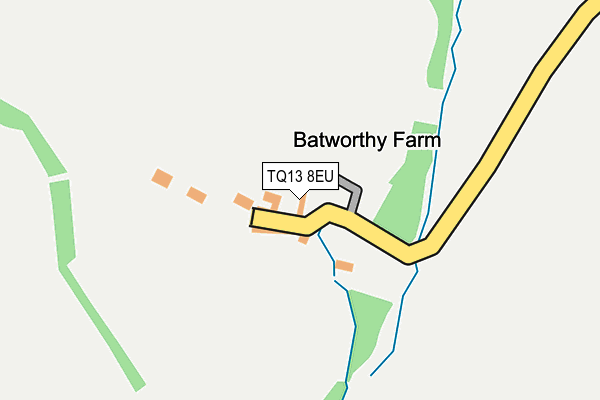
TQ13 8EU is in Chagford, Newton Abbot. TQ13 8EU is located in the Drewsteignton electoral ward, within the local authority district of West Devon and the English Parliamentary constituency of Central Devon. The Sub Integrated Care Board (ICB) Location is NHS Devon ICB - 15N and the police force is Devon & Cornwall. This postcode has been in use since January 1980.


GetTheData
Source: OS OpenMap – Local (Ordnance Survey)
Source: OS VectorMap District (Ordnance Survey)
Licence: Open Government Licence (requires attribution)
| Easting | 266086 |
| Northing | 86606 |
| Latitude | 50.663675 |
| Longitude | -3.896163 |
GetTheData
Source: Open Postcode Geo
Licence: Open Government Licence
| Locality | Chagford |
| Town/City | Newton Abbot |
| Country | England |
| Postcode District | TQ13 |
➜ See where TQ13 is on a map | |
GetTheData
Source: Land Registry Price Paid Data
Licence: Open Government Licence
Elevation or altitude of TQ13 8EU as distance above sea level:
| Metres | Feet | |
|---|---|---|
| Elevation | 370m | 1,214ft |
Elevation is measured from the approximate centre of the postcode, to the nearest point on an OS contour line from OS Terrain 50, which has contour spacing of ten vertical metres.
➜ How high above sea level am I? Find the elevation of your current position using your device's GPS.
GetTheData
Source: Open Postcode Elevation
Licence: Open Government Licence
| Ward | Drewsteignton |
| Constituency | Central Devon |
GetTheData
Source: ONS Postcode Database
Licence: Open Government Licence
| Percentage of properties with Next Generation Access | 100.0% |
| Percentage of properties with Superfast Broadband | 0.0% |
| Percentage of properties with Ultrafast Broadband | 0.0% |
| Percentage of properties with Full Fibre Broadband | 0.0% |
Superfast Broadband is between 30Mbps and 300Mbps
Ultrafast Broadband is > 300Mbps
| Median download speed | 2.2Mbps |
| Average download speed | 2.7Mbps |
| Maximum download speed | 3.68Mbps |
| Median upload speed | 0.5Mbps |
| Average upload speed | 0.6Mbps |
| Maximum upload speed | 0.87Mbps |
| Percentage of properties unable to receive 2Mbps | 33.3% |
| Percentage of properties unable to receive 5Mbps | 100.0% |
| Percentage of properties unable to receive 10Mbps | 100.0% |
| Percentage of properties unable to receive 30Mbps | 100.0% |
GetTheData
Source: Ofcom
Licence: Ofcom Terms of Use (requires attribution)
GetTheData
Source: ONS Postcode Database
Licence: Open Government Licence
The below table lists the International Territorial Level (ITL) codes (formerly Nomenclature of Territorial Units for Statistics (NUTS) codes) and Local Administrative Units (LAU) codes for TQ13 8EU:
| ITL 1 Code | Name |
|---|---|
| TLK | South West (England) |
| ITL 2 Code | Name |
| TLK4 | Devon |
| ITL 3 Code | Name |
| TLK43 | Devon CC |
| LAU 1 Code | Name |
| E07000047 | West Devon |
GetTheData
Source: ONS Postcode Directory
Licence: Open Government Licence
The below table lists the Census Output Area (OA), Lower Layer Super Output Area (LSOA), and Middle Layer Super Output Area (MSOA) for TQ13 8EU:
| Code | Name | |
|---|---|---|
| OA | E00102942 | |
| LSOA | E01020319 | West Devon 003B |
| MSOA | E02004231 | West Devon 003 |
GetTheData
Source: ONS Postcode Directory
Licence: Open Government Licence
| TQ13 8ET | 1138m | |
| TQ13 8HS | 1311m | |
| TQ13 8EX | 1559m | |
| TQ13 8ES | 1641m | |
| TQ13 8EY | 1915m | |
| TQ13 8HR | 2061m | |
| TQ13 8HH | 2299m | |
| TQ13 8DX | 2384m | |
| TQ13 8DY | 2578m | |
| TQ13 8HP | 2652m |
GetTheData
Source: Open Postcode Geo; Land Registry Price Paid Data
Licence: Open Government Licence