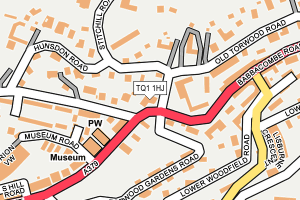
TQ1 1HJ lies on Babbacombe Road in Torquay. TQ1 1HJ is located in the Wellswood electoral ward, within the unitary authority of Torbay and the English Parliamentary constituency of Torbay. The Sub Integrated Care Board (ICB) Location is NHS Devon ICB - 15N and the police force is Devon & Cornwall. This postcode has been in use since January 1980.


GetTheData
Source: OS OpenMap – Local (Ordnance Survey)
Source: OS VectorMap District (Ordnance Survey)
Licence: Open Government Licence (requires attribution)
| Easting | 292430 |
| Northing | 63722 |
| Latitude | 50.463416 |
| Longitude | -3.516946 |
GetTheData
Source: Open Postcode Geo
Licence: Open Government Licence
| Street | Babbacombe Road |
| Town/City | Torquay |
| Country | England |
| Postcode District | TQ1 |
➜ See where TQ1 is on a map ➜ Where is Torquay? | |
GetTheData
Source: Land Registry Price Paid Data
Licence: Open Government Licence
Elevation or altitude of TQ1 1HJ as distance above sea level:
| Metres | Feet | |
|---|---|---|
| Elevation | 40m | 131ft |
Elevation is measured from the approximate centre of the postcode, to the nearest point on an OS contour line from OS Terrain 50, which has contour spacing of ten vertical metres.
➜ How high above sea level am I? Find the elevation of your current position using your device's GPS.
GetTheData
Source: Open Postcode Elevation
Licence: Open Government Licence
| Ward | Wellswood |
| Constituency | Torbay |
GetTheData
Source: ONS Postcode Database
Licence: Open Government Licence
517, BABBACOMBE ROAD, TORQUAY, TQ1 1HJ 1998 2 MAR £143,400 |
GetTheData
Source: HM Land Registry Price Paid Data
Licence: Contains HM Land Registry data © Crown copyright and database right 2025. This data is licensed under the Open Government Licence v3.0.
| Museum (Babbacombe Road) | Torquay | 115m |
| Museum (Babbacombe Road) | Torquay | 138m |
| Lisburne Place (Babbacombe Road) | Wellswood | 170m |
| Lisburne Square (Babbacombe Road) | Wellswood | 199m |
| Ten Pin Bowling Alley (Babbacombe Road) | Torquay | 279m |
| Torquay Station | 1.9km |
| Torre Station | 2.4km |
| Paignton Station | 4.7km |
GetTheData
Source: NaPTAN
Licence: Open Government Licence
| Percentage of properties with Next Generation Access | 100.0% |
| Percentage of properties with Superfast Broadband | 100.0% |
| Percentage of properties with Ultrafast Broadband | 100.0% |
| Percentage of properties with Full Fibre Broadband | 0.0% |
Superfast Broadband is between 30Mbps and 300Mbps
Ultrafast Broadband is > 300Mbps
| Percentage of properties unable to receive 2Mbps | 0.0% |
| Percentage of properties unable to receive 5Mbps | 0.0% |
| Percentage of properties unable to receive 10Mbps | 0.0% |
| Percentage of properties unable to receive 30Mbps | 0.0% |
GetTheData
Source: Ofcom
Licence: Ofcom Terms of Use (requires attribution)
GetTheData
Source: ONS Postcode Database
Licence: Open Government Licence


➜ Get more ratings from the Food Standards Agency
GetTheData
Source: Food Standards Agency
Licence: FSA terms & conditions
| Last Collection | |||
|---|---|---|---|
| Location | Mon-Fri | Sat | Distance |
| Torwood Gardens | 17:45 | 12:15 | 40m |
| Higher Lincombe Road | 17:15 | 12:30 | 356m |
| Lower Erith Road | 17:00 | 12:15 | 368m |
GetTheData
Source: Dracos
Licence: Creative Commons Attribution-ShareAlike
The below table lists the International Territorial Level (ITL) codes (formerly Nomenclature of Territorial Units for Statistics (NUTS) codes) and Local Administrative Units (LAU) codes for TQ1 1HJ:
| ITL 1 Code | Name |
|---|---|
| TLK | South West (England) |
| ITL 2 Code | Name |
| TLK4 | Devon |
| ITL 3 Code | Name |
| TLK42 | Torbay |
| LAU 1 Code | Name |
| E06000027 | Torbay |
GetTheData
Source: ONS Postcode Directory
Licence: Open Government Licence
The below table lists the Census Output Area (OA), Lower Layer Super Output Area (LSOA), and Middle Layer Super Output Area (MSOA) for TQ1 1HJ:
| Code | Name | |
|---|---|---|
| OA | E00077163 | |
| LSOA | E01015270 | Torbay 010D |
| MSOA | E02003163 | Torbay 010 |
GetTheData
Source: ONS Postcode Directory
Licence: Open Government Licence
| TQ1 1PX | Torwood Mount | 68m |
| TQ1 1HH | Babbacombe Road | 81m |
| TQ1 1HG | Babbacombe Road | 93m |
| TQ1 1PY | Stitchill Road | 95m |
| TQ1 1PU | Old Torwood Road | 114m |
| TQ1 1PT | Old Torwood Road | 125m |
| TQ1 1QA | Stitchill Road | 128m |
| TQ1 1EQ | Torwood Gardens Road | 129m |
| TQ1 1TZ | Torwood Gardens Road | 140m |
| TQ1 1HL | Babbacombe Road | 163m |
GetTheData
Source: Open Postcode Geo; Land Registry Price Paid Data
Licence: Open Government Licence