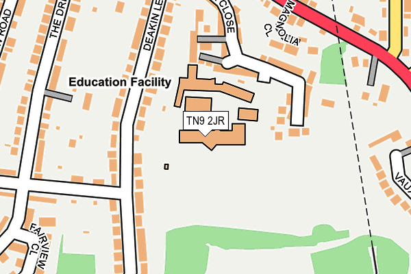
TN9 2JR is located in the Vauxhall electoral ward, within the local authority district of Tonbridge and Malling and the English Parliamentary constituency of Tonbridge and Malling. The Sub Integrated Care Board (ICB) Location is NHS Kent and Medway ICB - 91Q and the police force is Kent. This postcode has been in use since January 1980.


GetTheData
Source: OS OpenMap – Local (Ordnance Survey)
Source: OS VectorMap District (Ordnance Survey)
Licence: Open Government Licence (requires attribution)
| Easting | 559076 |
| Northing | 145198 |
| Latitude | 51.183881 |
| Longitude | 0.274710 |
GetTheData
Source: Open Postcode Geo
Licence: Open Government Licence
| Country | England |
| Postcode District | TN9 |
➜ See where TN9 is on a map ➜ Where is Tonbridge? | |
GetTheData
Source: Land Registry Price Paid Data
Licence: Open Government Licence
Elevation or altitude of TN9 2JR as distance above sea level:
| Metres | Feet | |
|---|---|---|
| Elevation | 70m | 230ft |
Elevation is measured from the approximate centre of the postcode, to the nearest point on an OS contour line from OS Terrain 50, which has contour spacing of ten vertical metres.
➜ How high above sea level am I? Find the elevation of your current position using your device's GPS.
GetTheData
Source: Open Postcode Elevation
Licence: Open Government Licence
| Ward | Vauxhall |
| Constituency | Tonbridge And Malling |
GetTheData
Source: ONS Postcode Database
Licence: Open Government Licence
| Deakin Leas (Baltic Road) | Tonbridge | 204m |
| Goldsmid Road (Pembury Road) | Tonbridge | 247m |
| Lavender Hill (Pembury Road) | Tonbridge | 263m |
| Tonbridge Grammar School For Girls (Deakin Leas) | Tonbridge | 271m |
| Goldsmid Road (Pembury Road) | Tonbridge | 283m |
| Tonbridge Station | 0.9km |
| High Brooms Station | 3.8km |
| Leigh (Kent) Station | 4.6km |
GetTheData
Source: NaPTAN
Licence: Open Government Licence
GetTheData
Source: ONS Postcode Database
Licence: Open Government Licence


➜ Get more ratings from the Food Standards Agency
GetTheData
Source: Food Standards Agency
Licence: FSA terms & conditions
| Last Collection | |||
|---|---|---|---|
| Location | Mon-Fri | Sat | Distance |
| 4 The Drive | 17:15 | 12:15 | 432m |
| 129 St Marys Road | 17:30 | 12:15 | 471m |
| Vale Road Meterbox | 543m | ||
GetTheData
Source: Dracos
Licence: Creative Commons Attribution-ShareAlike
The below table lists the International Territorial Level (ITL) codes (formerly Nomenclature of Territorial Units for Statistics (NUTS) codes) and Local Administrative Units (LAU) codes for TN9 2JR:
| ITL 1 Code | Name |
|---|---|
| TLJ | South East (England) |
| ITL 2 Code | Name |
| TLJ4 | Kent |
| ITL 3 Code | Name |
| TLJ46 | West Kent |
| LAU 1 Code | Name |
| E07000115 | Tonbridge and Malling |
GetTheData
Source: ONS Postcode Directory
Licence: Open Government Licence
The below table lists the Census Output Area (OA), Lower Layer Super Output Area (LSOA), and Middle Layer Super Output Area (MSOA) for TN9 2JR:
| Code | Name | |
|---|---|---|
| OA | E00125778 | |
| LSOA | E01024778 | Tonbridge and Malling 013C |
| MSOA | E02005161 | Tonbridge and Malling 013 |
GetTheData
Source: ONS Postcode Directory
Licence: Open Government Licence
| TN9 2JX | Deakin Leas | 139m |
| TN9 2FE | Taylor Close | 139m |
| TN9 2JS | Deakin Leas | 141m |
| TN9 2JH | Magnolia Close | 170m |
| TN9 2JT | Deakin Leas | 200m |
| TN9 2JG | Pembury Road | 223m |
| TN9 2JU | Deakin Leas | 234m |
| TN9 2LS | The Drive | 238m |
| TN9 2LT | Baltic Road | 242m |
| TN9 2JJ | Pembury Road | 242m |
GetTheData
Source: Open Postcode Geo; Land Registry Price Paid Data
Licence: Open Government Licence