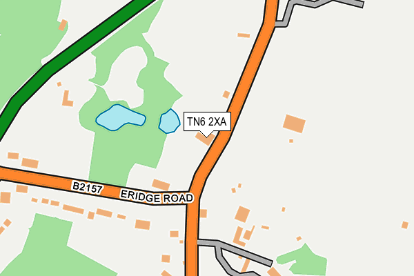
TN6 2XA lies on Eridge Road in Crowborough. TN6 2XA is located in the Crowborough North electoral ward, within the local authority district of Wealden and the English Parliamentary constituency of Wealden. The Sub Integrated Care Board (ICB) Location is NHS Sussex ICB - 97R and the police force is Sussex. This postcode has been in use since January 1980.


GetTheData
Source: OS OpenMap – Local (Ordnance Survey)
Source: OS VectorMap District (Ordnance Survey)
Licence: Open Government Licence (requires attribution)
| Easting | 553047 |
| Northing | 131752 |
| Latitude | 51.064704 |
| Longitude | 0.182839 |
GetTheData
Source: Open Postcode Geo
Licence: Open Government Licence
| Street | Eridge Road |
| Town/City | Crowborough |
| Country | England |
| Postcode District | TN6 |
➜ See where TN6 is on a map ➜ Where is Crowborough? | |
GetTheData
Source: Land Registry Price Paid Data
Licence: Open Government Licence
Elevation or altitude of TN6 2XA as distance above sea level:
| Metres | Feet | |
|---|---|---|
| Elevation | 160m | 525ft |
Elevation is measured from the approximate centre of the postcode, to the nearest point on an OS contour line from OS Terrain 50, which has contour spacing of ten vertical metres.
➜ How high above sea level am I? Find the elevation of your current position using your device's GPS.
GetTheData
Source: Open Postcode Elevation
Licence: Open Government Licence
| Ward | Crowborough North |
| Constituency | Wealden |
GetTheData
Source: ONS Postcode Database
Licence: Open Government Licence
CORNER HOUSE, ERIDGE ROAD, CROWBOROUGH, TN6 2XA 2024 15 OCT £890,000 |
THORFIELD HOUSE, ERIDGE ROAD, CROWBOROUGH, TN6 2XA 2024 11 OCT £950,000 |
GetTheData
Source: HM Land Registry Price Paid Data
Licence: Contains HM Land Registry data © Crown copyright and database right 2025. This data is licensed under the Open Government Licence v3.0.
| Steel Cross Farm (Eridge Road) | Steel Cross | 74m |
| Steel Cross Farm (Eridge Road) | Steel Cross | 123m |
| Eridge Road | Steel Cross | 286m |
| Lime Kiln Court (Palesgate Lane) | Steel Cross | 296m |
| Lime Kiln Court (Palesgate Lane) | Steel Cross | 297m |
| Crowborough Station | 2.1km |
| Eridge Station | 3km |
GetTheData
Source: NaPTAN
Licence: Open Government Licence
| Percentage of properties with Next Generation Access | 100.0% |
| Percentage of properties with Superfast Broadband | 100.0% |
| Percentage of properties with Ultrafast Broadband | 0.0% |
| Percentage of properties with Full Fibre Broadband | 0.0% |
Superfast Broadband is between 30Mbps and 300Mbps
Ultrafast Broadband is > 300Mbps
| Percentage of properties unable to receive 2Mbps | 0.0% |
| Percentage of properties unable to receive 5Mbps | 0.0% |
| Percentage of properties unable to receive 10Mbps | 0.0% |
| Percentage of properties unable to receive 30Mbps | 0.0% |
GetTheData
Source: Ofcom
Licence: Ofcom Terms of Use (requires attribution)
GetTheData
Source: ONS Postcode Database
Licence: Open Government Licence


➜ Get more ratings from the Food Standards Agency
GetTheData
Source: Food Standards Agency
Licence: FSA terms & conditions
| Last Collection | |||
|---|---|---|---|
| Location | Mon-Fri | Sat | Distance |
| Steel Cross | 17:15 | 12:30 | 144m |
| Boars Head | 16:00 | 09:00 | 866m |
| Poundfield Post Office | 17:15 | 12:30 | 1,028m |
GetTheData
Source: Dracos
Licence: Creative Commons Attribution-ShareAlike
The below table lists the International Territorial Level (ITL) codes (formerly Nomenclature of Territorial Units for Statistics (NUTS) codes) and Local Administrative Units (LAU) codes for TN6 2XA:
| ITL 1 Code | Name |
|---|---|
| TLJ | South East (England) |
| ITL 2 Code | Name |
| TLJ2 | Surrey, East and West Sussex |
| ITL 3 Code | Name |
| TLJ22 | East Sussex CC |
| LAU 1 Code | Name |
| E07000065 | Wealden |
GetTheData
Source: ONS Postcode Directory
Licence: Open Government Licence
The below table lists the Census Output Area (OA), Lower Layer Super Output Area (LSOA), and Middle Layer Super Output Area (MSOA) for TN6 2XA:
| Code | Name | |
|---|---|---|
| OA | E00107468 | |
| LSOA | E01021158 | Wealden 003C |
| MSOA | E02004405 | Wealden 003 |
GetTheData
Source: ONS Postcode Directory
Licence: Open Government Licence
| TN6 2SS | Steel Cross Road | 226m |
| TN6 2XB | Green Lane | 289m |
| TN6 2FH | Payne Close | 368m |
| TN6 3HF | Palesgate Lane | 509m |
| TN6 2SR | Eridge Road | 514m |
| TN6 3HD | 630m | |
| TN6 2JF | Pellings Farm | 710m |
| TN6 2RZ | Pellings Rise | 719m |
| TN6 2TA | Oakhurst Drive | 774m |
| TN6 3HG | Palesgate Lane | 828m |
GetTheData
Source: Open Postcode Geo; Land Registry Price Paid Data
Licence: Open Government Licence