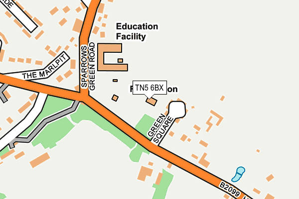
TN5 6BX is located in the Frant & Wadhurst electoral ward, within the local authority district of Wealden and the English Parliamentary constituency of Wealden. The Sub Integrated Care Board (ICB) Location is NHS Sussex ICB - 97R and the police force is Sussex. This postcode has been in use since January 1980.


GetTheData
Source: OS OpenMap – Local (Ordnance Survey)
Source: OS VectorMap District (Ordnance Survey)
Licence: Open Government Licence (requires attribution)
| Easting | 563705 |
| Northing | 132106 |
| Latitude | 51.064950 |
| Longitude | 0.334944 |
GetTheData
Source: Open Postcode Geo
Licence: Open Government Licence
| Country | England |
| Postcode District | TN5 |
➜ See where TN5 is on a map ➜ Where is Wadhurst? | |
GetTheData
Source: Land Registry Price Paid Data
Licence: Open Government Licence
Elevation or altitude of TN5 6BX as distance above sea level:
| Metres | Feet | |
|---|---|---|
| Elevation | 150m | 492ft |
Elevation is measured from the approximate centre of the postcode, to the nearest point on an OS contour line from OS Terrain 50, which has contour spacing of ten vertical metres.
➜ How high above sea level am I? Find the elevation of your current position using your device's GPS.
GetTheData
Source: Open Postcode Elevation
Licence: Open Government Licence
| Ward | Frant & Wadhurst |
| Constituency | Wealden |
GetTheData
Source: ONS Postcode Database
Licence: Open Government Licence
| War Memorial (High Street) | Wadhurst | 94m |
| War Memorial (High Street) | Wadhurst | 95m |
| Post Office (High Street) | Wadhurst | 284m |
| Post Office (High Street) | Wadhurst | 406m |
| South View Corner (Cousley Wood Road) | Sparrows Green | 425m |
| Wadhurst Station | 1.8km |
| Frant Station | 5.2km |
| Stonegate Station | 5.4km |
GetTheData
Source: NaPTAN
Licence: Open Government Licence
GetTheData
Source: ONS Postcode Database
Licence: Open Government Licence


➜ Get more ratings from the Food Standards Agency
GetTheData
Source: Food Standards Agency
Licence: FSA terms & conditions
| Last Collection | |||
|---|---|---|---|
| Location | Mon-Fri | Sat | Distance |
| Sparrows Green | 16:15 | 11:00 | 416m |
| Wadhurst Post Office | 17:30 | 11:00 | 467m |
| Fairhaven | 16:15 | 10:30 | 833m |
GetTheData
Source: Dracos
Licence: Creative Commons Attribution-ShareAlike
The below table lists the International Territorial Level (ITL) codes (formerly Nomenclature of Territorial Units for Statistics (NUTS) codes) and Local Administrative Units (LAU) codes for TN5 6BX:
| ITL 1 Code | Name |
|---|---|
| TLJ | South East (England) |
| ITL 2 Code | Name |
| TLJ2 | Surrey, East and West Sussex |
| ITL 3 Code | Name |
| TLJ22 | East Sussex CC |
| LAU 1 Code | Name |
| E07000065 | Wealden |
GetTheData
Source: ONS Postcode Directory
Licence: Open Government Licence
The below table lists the Census Output Area (OA), Lower Layer Super Output Area (LSOA), and Middle Layer Super Output Area (MSOA) for TN5 6BX:
| Code | Name | |
|---|---|---|
| OA | E00107832 | |
| LSOA | E01021231 | Wealden 005E |
| MSOA | E02004407 | Wealden 005 |
GetTheData
Source: ONS Postcode Directory
Licence: Open Government Licence
| TN5 6BU | Green Square | 63m |
| TN5 6SH | 145m | |
| TN5 6SR | Halls Cottages | 157m |
| TN5 6AH | High Street | 160m |
| TN5 6UP | The Marlpit | 172m |
| TN5 6SS | 178m | |
| TN5 6UW | The Marlpit | 197m |
| TN5 6ST | 214m | |
| TN5 6SJ | Sparrows Green Road | 230m |
| TN5 6UN | The Marlpit | 235m |
GetTheData
Source: Open Postcode Geo; Land Registry Price Paid Data
Licence: Open Government Licence