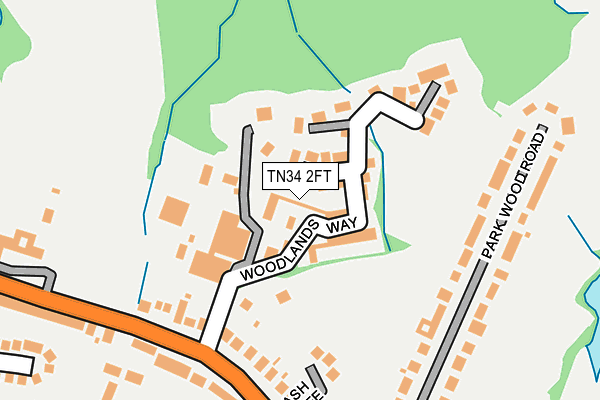
TN34 2FT is located in the Sedlescombe & Westfield electoral ward, within the local authority district of Rother and the English Parliamentary constituency of Hastings and Rye. The Sub Integrated Care Board (ICB) Location is NHS Sussex ICB - 97R and the police force is Sussex. This postcode has been in use since June 2016.


GetTheData
Source: OS OpenMap – Local (Ordnance Survey)
Source: OS VectorMap District (Ordnance Survey)
Licence: Open Government Licence (requires attribution)
| Easting | 581403 |
| Northing | 112753 |
| Latitude | 50.885780 |
| Longitude | 0.577642 |
GetTheData
Source: Open Postcode Geo
Licence: Open Government Licence
| Country | England |
| Postcode District | TN34 |
➜ See where TN34 is on a map ➜ Where is Hastings? | |
GetTheData
Source: Land Registry Price Paid Data
Licence: Open Government Licence
Elevation or altitude of TN34 2FT as distance above sea level:
| Metres | Feet | |
|---|---|---|
| Elevation | 110m | 361ft |
Elevation is measured from the approximate centre of the postcode, to the nearest point on an OS contour line from OS Terrain 50, which has contour spacing of ten vertical metres.
➜ How high above sea level am I? Find the elevation of your current position using your device's GPS.
GetTheData
Source: Open Postcode Elevation
Licence: Open Government Licence
| Ward | Sedlescombe & Westfield |
| Constituency | Hastings And Rye |
GetTheData
Source: ONS Postcode Database
Licence: Open Government Licence
2024 7 JUN £415,000 |
2024 14 FEB £527,500 |
2021 28 JUN £540,000 |
2021 9 JUN £420,000 |
2021 7 JAN £560,000 |
69, WOODLANDS WAY, HASTINGS, TN34 2FT 2018 2 JUL £470,000 |
57, WOODLANDS WAY, HASTINGS, TN34 2FT 2018 31 JAN £450,000 |
71, WOODLANDS WAY, HASTINGS, TN34 2FT 2018 29 JAN £580,000 |
55, WOODLANDS WAY, HASTINGS, TN34 2FT 2017 20 DEC £520,000 |
67, WOODLANDS WAY, HASTINGS, TN34 2FT 2017 16 NOV £575,000 |
GetTheData
Source: HM Land Registry Price Paid Data
Licence: Contains HM Land Registry data © Crown copyright and database right 2025. This data is licensed under the Open Government Licence v3.0.
| Maitland Close (The Ridge) | St Helens | 200m |
| Maitland Close (The Ridge) | St Helens | 205m |
| Grange Road (The Ridge) | St Helens | 278m |
| Grange Road (The Ridge) | St Helens | 289m |
| Sandrock Park (The Ridge) | St Helens | 363m |
| Ore Station | 2.3km |
| Three Oaks Station | 3km |
| Hastings Station | 3.1km |
GetTheData
Source: NaPTAN
Licence: Open Government Licence
| Percentage of properties with Next Generation Access | 100.0% |
| Percentage of properties with Superfast Broadband | 100.0% |
| Percentage of properties with Ultrafast Broadband | 0.0% |
| Percentage of properties with Full Fibre Broadband | 0.0% |
Superfast Broadband is between 30Mbps and 300Mbps
Ultrafast Broadband is > 300Mbps
| Median download speed | 35.2Mbps |
| Average download speed | 32.4Mbps |
| Maximum download speed | 54.61Mbps |
| Median upload speed | 9.8Mbps |
| Average upload speed | 8.8Mbps |
| Maximum upload speed | 19.90Mbps |
| Percentage of properties unable to receive 2Mbps | 0.0% |
| Percentage of properties unable to receive 5Mbps | 0.0% |
| Percentage of properties unable to receive 10Mbps | 0.0% |
| Percentage of properties unable to receive 30Mbps | 0.0% |
GetTheData
Source: Ofcom
Licence: Ofcom Terms of Use (requires attribution)
GetTheData
Source: ONS Postcode Database
Licence: Open Government Licence


➜ Get more ratings from the Food Standards Agency
GetTheData
Source: Food Standards Agency
Licence: FSA terms & conditions
| Last Collection | |||
|---|---|---|---|
| Location | Mon-Fri | Sat | Distance |
| Hillside Road | 17:00 | 12:00 | 567m |
| Peter James Lane | 16:30 | 09:30 | 681m |
| Conquest Hospital | 16:45 | 12:00 | 684m |
GetTheData
Source: Dracos
Licence: Creative Commons Attribution-ShareAlike
The below table lists the International Territorial Level (ITL) codes (formerly Nomenclature of Territorial Units for Statistics (NUTS) codes) and Local Administrative Units (LAU) codes for TN34 2FT:
| ITL 1 Code | Name |
|---|---|
| TLJ | South East (England) |
| ITL 2 Code | Name |
| TLJ2 | Surrey, East and West Sussex |
| ITL 3 Code | Name |
| TLJ22 | East Sussex CC |
| LAU 1 Code | Name |
| E07000064 | Rother |
GetTheData
Source: ONS Postcode Directory
Licence: Open Government Licence
The below table lists the Census Output Area (OA), Lower Layer Super Output Area (LSOA), and Middle Layer Super Output Area (MSOA) for TN34 2FT:
| Code | Name | |
|---|---|---|
| OA | E00107115 | |
| LSOA | E01021087 | Rother 005A |
| MSOA | E02004396 | Rother 005 |
GetTheData
Source: ONS Postcode Directory
Licence: Open Government Licence
| TN34 2FD | Ash Tree Close | 160m |
| TN34 2RN | Parkwood Road | 169m |
| TN34 2RY | The Ridge | 174m |
| TN34 2RR | The Ridge | 201m |
| TN34 2RW | Parkwood Road | 213m |
| TN34 2RS | Yew Tree Close | 244m |
| TN34 2RT | The Ridge | 260m |
| TN34 2TR | Maitland Close | 264m |
| TN34 2RJ | The Ridge | 292m |
| TN34 2RP | Wrotham Close | 313m |
GetTheData
Source: Open Postcode Geo; Land Registry Price Paid Data
Licence: Open Government Licence