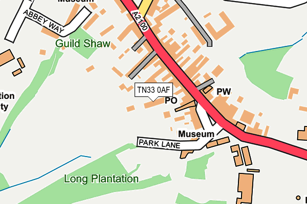
TN33 0AF is located in the North Battle, Netherfield & Whatlington electoral ward, within the local authority district of Rother and the English Parliamentary constituency of Bexhill and Battle. The Sub Integrated Care Board (ICB) Location is NHS Sussex ICB - 97R and the police force is Sussex. This postcode has been in use since January 1980.


GetTheData
Source: OS OpenMap – Local (Ordnance Survey)
Source: OS VectorMap District (Ordnance Survey)
Licence: Open Government Licence (requires attribution)
| Easting | 574724 |
| Northing | 115864 |
| Latitude | 50.915786 |
| Longitude | 0.484272 |
GetTheData
Source: Open Postcode Geo
Licence: Open Government Licence
| Country | England |
| Postcode District | TN33 |
➜ See where TN33 is on a map ➜ Where is Battle? | |
GetTheData
Source: Land Registry Price Paid Data
Licence: Open Government Licence
Elevation or altitude of TN33 0AF as distance above sea level:
| Metres | Feet | |
|---|---|---|
| Elevation | 80m | 262ft |
Elevation is measured from the approximate centre of the postcode, to the nearest point on an OS contour line from OS Terrain 50, which has contour spacing of ten vertical metres.
➜ How high above sea level am I? Find the elevation of your current position using your device's GPS.
GetTheData
Source: Open Postcode Elevation
Licence: Open Government Licence
| Ward | North Battle, Netherfield & Whatlington |
| Constituency | Bexhill And Battle |
GetTheData
Source: ONS Postcode Database
Licence: Open Government Licence
| Abbey (High Street) | Battle | 91m |
| Abbey (Upper Lake) | Battle | 119m |
| St Martins | Battle | 175m |
| High Street | Battle | 184m |
| Kings Head (Mount Street) | Battle | 194m |
| Battle Station | 0.8km |
| Crowhurst Station | 3.3km |
GetTheData
Source: NaPTAN
Licence: Open Government Licence
GetTheData
Source: ONS Postcode Database
Licence: Open Government Licence


➜ Get more ratings from the Food Standards Agency
GetTheData
Source: Food Standards Agency
Licence: FSA terms & conditions
| Last Collection | |||
|---|---|---|---|
| Location | Mon-Fri | Sat | Distance |
| Battle Post Office | 18:00 | 12:30 | 79m |
| Battle Post Office | 18:00 | 12:30 | 85m |
| Norman Close | 17:00 | 12:00 | 808m |
GetTheData
Source: Dracos
Licence: Creative Commons Attribution-ShareAlike
The below table lists the International Territorial Level (ITL) codes (formerly Nomenclature of Territorial Units for Statistics (NUTS) codes) and Local Administrative Units (LAU) codes for TN33 0AF:
| ITL 1 Code | Name |
|---|---|
| TLJ | South East (England) |
| ITL 2 Code | Name |
| TLJ2 | Surrey, East and West Sussex |
| ITL 3 Code | Name |
| TLJ22 | East Sussex CC |
| LAU 1 Code | Name |
| E07000064 | Rother |
GetTheData
Source: ONS Postcode Directory
Licence: Open Government Licence
The below table lists the Census Output Area (OA), Lower Layer Super Output Area (LSOA), and Middle Layer Super Output Area (MSOA) for TN33 0AF:
| Code | Name | |
|---|---|---|
| OA | E00107095 | |
| LSOA | E01021084 | Rother 006A |
| MSOA | E02004397 | Rother 006 |
GetTheData
Source: ONS Postcode Directory
Licence: Open Government Licence
| TN33 0AE | High Street | 60m |
| TN33 0AG | High Street | 85m |
| TN33 0ED | Parks Yard | 110m |
| TN33 0TZ | St Martins Way | 139m |
| TN33 0EN | High Street | 146m |
| TN33 0AQ | High Street | 155m |
| TN33 0EA | High Street | 158m |
| TN33 0AR | Old Mill Walk | 180m |
| TN33 0ES | Western Avenue | 202m |
| TN33 0EE | High Street | 233m |
GetTheData
Source: Open Postcode Geo; Land Registry Price Paid Data
Licence: Open Government Licence