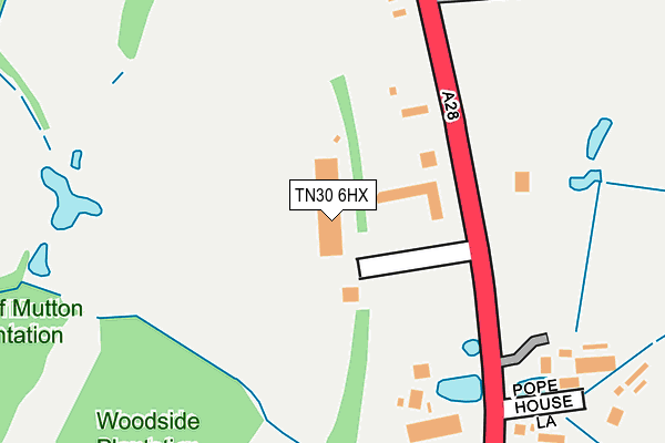
TN30 6HX is located in the Tenterden St Michael's electoral ward, within the local authority district of Ashford and the English Parliamentary constituency of Ashford. The Sub Integrated Care Board (ICB) Location is NHS Kent and Medway ICB - 91Q and the police force is Kent. This postcode has been in use since June 1998.


GetTheData
Source: OS OpenMap – Local (Ordnance Survey)
Source: OS VectorMap District (Ordnance Survey)
Licence: Open Government Licence (requires attribution)
| Easting | 588370 |
| Northing | 135811 |
| Latitude | 51.090673 |
| Longitude | 0.688493 |
GetTheData
Source: Open Postcode Geo
Licence: Open Government Licence
| Country | England |
| Postcode District | TN30 |
➜ See where TN30 is on a map ➜ Where is Tenterden? | |
GetTheData
Source: Land Registry Price Paid Data
Licence: Open Government Licence
Elevation or altitude of TN30 6HX as distance above sea level:
| Metres | Feet | |
|---|---|---|
| Elevation | 60m | 197ft |
Elevation is measured from the approximate centre of the postcode, to the nearest point on an OS contour line from OS Terrain 50, which has contour spacing of ten vertical metres.
➜ How high above sea level am I? Find the elevation of your current position using your device's GPS.
GetTheData
Source: Open Postcode Elevation
Licence: Open Government Licence
| Ward | Tenterden St Michael's |
| Constituency | Ashford |
GetTheData
Source: ONS Postcode Database
Licence: Open Government Licence
| Shoreham Lane (Ashford Road) | St Michaels | 272m |
| Shoreham Lane (Ashford Road) | St Michaels | 302m |
| The Crown (Ashford Road) | St Michaels | 634m |
| The Crown (Ashford Road) | St Michaels | 700m |
| Wayside Avenue (Ashford Road) | St Michaels | 1,005m |
GetTheData
Source: NaPTAN
Licence: Open Government Licence
GetTheData
Source: ONS Postcode Database
Licence: Open Government Licence


➜ Get more ratings from the Food Standards Agency
GetTheData
Source: Food Standards Agency
Licence: FSA terms & conditions
| Last Collection | |||
|---|---|---|---|
| Location | Mon-Fri | Sat | Distance |
| The Dairy | 16:00 | 09:00 | 1,072m |
| Henley Meadows | 16:30 | 09:00 | 1,179m |
| Tenterden Sorting Office | 17:30 | 11:30 | 2,167m |
GetTheData
Source: Dracos
Licence: Creative Commons Attribution-ShareAlike
The below table lists the International Territorial Level (ITL) codes (formerly Nomenclature of Territorial Units for Statistics (NUTS) codes) and Local Administrative Units (LAU) codes for TN30 6HX:
| ITL 1 Code | Name |
|---|---|
| TLJ | South East (England) |
| ITL 2 Code | Name |
| TLJ4 | Kent |
| ITL 3 Code | Name |
| TLJ45 | Mid Kent |
| LAU 1 Code | Name |
| E07000105 | Ashford |
GetTheData
Source: ONS Postcode Directory
Licence: Open Government Licence
The below table lists the Census Output Area (OA), Lower Layer Super Output Area (LSOA), and Middle Layer Super Output Area (MSOA) for TN30 6HX:
| Code | Name | |
|---|---|---|
| OA | E00121900 | |
| LSOA | E01024011 | Ashford 013C |
| MSOA | E02005008 | Ashford 013 |
GetTheData
Source: ONS Postcode Directory
Licence: Open Government Licence
| TN30 6SP | Ashford Road | 124m |
| TN30 6EH | Shoreham Lane | 260m |
| TN30 6SS | Ashford Road | 263m |
| TN30 6EJ | Ashford Road | 319m |
| TN30 6PY | Ashford Road | 338m |
| TN30 6EG | Shoreham Lane | 452m |
| TN30 6ED | Orchard Road | 470m |
| TN30 6SR | Ashford Road | 478m |
| TN30 6PU | Ashford Road | 483m |
| TN30 6PP | Heather Drive | 530m |
GetTheData
Source: Open Postcode Geo; Land Registry Price Paid Data
Licence: Open Government Licence