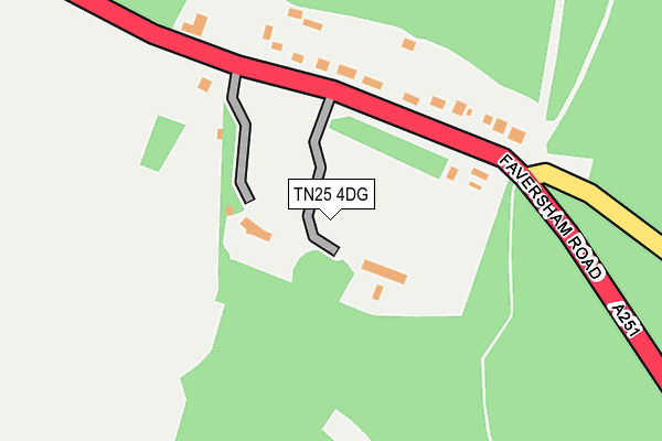
TN25 4DG is located in the Downs West electoral ward, within the local authority district of Ashford and the English Parliamentary constituency of Ashford. The Sub Integrated Care Board (ICB) Location is NHS Kent and Medway ICB - 91Q and the police force is Kent. This postcode has been in use since January 1980.


GetTheData
Source: OS OpenMap – Local (Ordnance Survey)
Source: OS VectorMap District (Ordnance Survey)
Licence: Open Government Licence (requires attribution)
| Easting | 601820 |
| Northing | 150168 |
| Latitude | 51.215036 |
| Longitude | 0.888347 |
GetTheData
Source: Open Postcode Geo
Licence: Open Government Licence
| Country | England |
| Postcode District | TN25 |
➜ See where TN25 is on a map ➜ Where is Challock? | |
GetTheData
Source: Land Registry Price Paid Data
Licence: Open Government Licence
Elevation or altitude of TN25 4DG as distance above sea level:
| Metres | Feet | |
|---|---|---|
| Elevation | 170m | 558ft |
Elevation is measured from the approximate centre of the postcode, to the nearest point on an OS contour line from OS Terrain 50, which has contour spacing of ten vertical metres.
➜ How high above sea level am I? Find the elevation of your current position using your device's GPS.
GetTheData
Source: Open Postcode Elevation
Licence: Open Government Licence
| Ward | Downs West |
| Constituency | Ashford |
GetTheData
Source: ONS Postcode Database
Licence: Open Government Licence
| Halfway House (Faversham Road) | Challock | 908m |
| Halfway House (Faversham Road) | Challock | 929m |
| Halfway House (Canterbury Road) | Challock | 988m |
| Wye Station | 4.4km |
GetTheData
Source: NaPTAN
Licence: Open Government Licence
GetTheData
Source: ONS Postcode Database
Licence: Open Government Licence


➜ Get more ratings from the Food Standards Agency
GetTheData
Source: Food Standards Agency
Licence: FSA terms & conditions
| Last Collection | |||
|---|---|---|---|
| Location | Mon-Fri | Sat | Distance |
| Challock Post Office | 17:00 | 10:30 | 1,131m |
| Pested | 16:15 | 09:00 | 1,557m |
| Molash | 16:15 | 09:00 | 1,839m |
GetTheData
Source: Dracos
Licence: Creative Commons Attribution-ShareAlike
The below table lists the International Territorial Level (ITL) codes (formerly Nomenclature of Territorial Units for Statistics (NUTS) codes) and Local Administrative Units (LAU) codes for TN25 4DG:
| ITL 1 Code | Name |
|---|---|
| TLJ | South East (England) |
| ITL 2 Code | Name |
| TLJ4 | Kent |
| ITL 3 Code | Name |
| TLJ45 | Mid Kent |
| LAU 1 Code | Name |
| E07000105 | Ashford |
GetTheData
Source: ONS Postcode Directory
Licence: Open Government Licence
The below table lists the Census Output Area (OA), Lower Layer Super Output Area (LSOA), and Middle Layer Super Output Area (MSOA) for TN25 4DG:
| Code | Name | |
|---|---|---|
| OA | E00121797 | |
| LSOA | E01023989 | Ashford 002C |
| MSOA | E02004997 | Ashford 002 |
GetTheData
Source: ONS Postcode Directory
Licence: Open Government Licence
| TN25 4AR | Buck Street | 313m |
| TN25 4AT | Buck Street | 743m |
| TN25 4DA | Kiln Close | 805m |
| TN25 4AU | Blind Lane | 848m |
| TN25 4BU | Church Lane | 887m |
| TN25 4AX | Chapmans Close | 887m |
| TN25 4DD | Church Lane | 935m |
| TN25 4BX | St Cosmus Close | 947m |
| TN25 4BB | Canterbury Road | 967m |
| TN25 4BT | Church Lane | 975m |
GetTheData
Source: Open Postcode Geo; Land Registry Price Paid Data
Licence: Open Government Licence