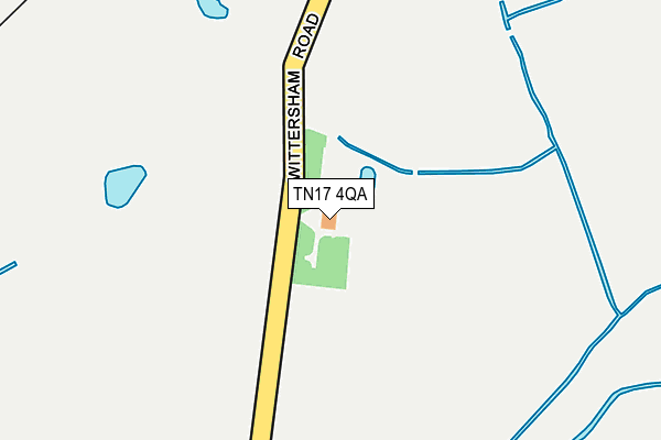
TN17 4QA lies on Maytham Road in Rolvenden, Cranbrook. TN17 4QA is located in the Rolvenden & Tenterden West electoral ward, within the local authority district of Ashford and the English Parliamentary constituency of Ashford. The Sub Integrated Care Board (ICB) Location is NHS Kent and Medway ICB - 91Q and the police force is Kent. This postcode has been in use since January 1980.


GetTheData
Source: OS OpenMap – Local (Ordnance Survey)
Source: OS VectorMap District (Ordnance Survey)
Licence: Open Government Licence (requires attribution)
| Easting | 586592 |
| Northing | 128431 |
| Latitude | 51.024960 |
| Longitude | 0.659362 |
GetTheData
Source: Open Postcode Geo
Licence: Open Government Licence
| Street | Maytham Road |
| Locality | Rolvenden |
| Town/City | Cranbrook |
| Country | England |
| Postcode District | TN17 |
➜ See where TN17 is on a map | |
GetTheData
Source: Land Registry Price Paid Data
Licence: Open Government Licence
Elevation or altitude of TN17 4QA as distance above sea level:
| Metres | Feet | |
|---|---|---|
| Elevation | 10m | 33ft |
Elevation is measured from the approximate centre of the postcode, to the nearest point on an OS contour line from OS Terrain 50, which has contour spacing of ten vertical metres.
➜ How high above sea level am I? Find the elevation of your current position using your device's GPS.
GetTheData
Source: Open Postcode Elevation
Licence: Open Government Licence
| Ward | Rolvenden & Tenterden West |
| Constituency | Ashford |
GetTheData
Source: ONS Postcode Database
Licence: Open Government Licence
| Wittersham Road Rail Station (Kesr) | Rolvenden Layne | 287m |
GetTheData
Source: NaPTAN
Licence: Open Government Licence
| Percentage of properties with Next Generation Access | 100.0% |
| Percentage of properties with Superfast Broadband | 0.0% |
| Percentage of properties with Ultrafast Broadband | 0.0% |
| Percentage of properties with Full Fibre Broadband | 0.0% |
Superfast Broadband is between 30Mbps and 300Mbps
Ultrafast Broadband is > 300Mbps
| Median download speed | 2.3Mbps |
| Average download speed | 2.3Mbps |
| Maximum download speed | 3.17Mbps |
| Median upload speed | 0.5Mbps |
| Average upload speed | 0.6Mbps |
| Maximum upload speed | 1.04Mbps |
| Percentage of properties unable to receive 2Mbps | 0.0% |
| Percentage of properties unable to receive 5Mbps | 85.7% |
| Percentage of properties unable to receive 10Mbps | 85.7% |
| Percentage of properties unable to receive 30Mbps | 100.0% |
GetTheData
Source: Ofcom
Licence: Ofcom Terms of Use (requires attribution)
GetTheData
Source: ONS Postcode Database
Licence: Open Government Licence
| Last Collection | |||
|---|---|---|---|
| Location | Mon-Fri | Sat | Distance |
| Rolvenden Layne | 16:15 | 09:30 | 2,035m |
| Newenden Old Post Office | 16:30 | 09:00 | 3,384m |
| Gybbons Road | 16:00 | 09:00 | 3,417m |
GetTheData
Source: Dracos
Licence: Creative Commons Attribution-ShareAlike
The below table lists the International Territorial Level (ITL) codes (formerly Nomenclature of Territorial Units for Statistics (NUTS) codes) and Local Administrative Units (LAU) codes for TN17 4QA:
| ITL 1 Code | Name |
|---|---|
| TLJ | South East (England) |
| ITL 2 Code | Name |
| TLJ4 | Kent |
| ITL 3 Code | Name |
| TLJ45 | Mid Kent |
| LAU 1 Code | Name |
| E07000105 | Ashford |
GetTheData
Source: ONS Postcode Directory
Licence: Open Government Licence
The below table lists the Census Output Area (OA), Lower Layer Super Output Area (LSOA), and Middle Layer Super Output Area (MSOA) for TN17 4QA:
| Code | Name | |
|---|---|---|
| OA | E00121892 | |
| LSOA | E01024009 | Ashford 013A |
| MSOA | E02005008 | Ashford 013 |
GetTheData
Source: ONS Postcode Directory
Licence: Open Government Licence
| TN17 4PX | Maytham Road | 1242m |
| TN30 7PT | 1321m | |
| TN30 7PS | 1778m | |
| TN30 7PX | 1857m | |
| TN17 4NT | Maytham Road | 1946m |
| TN17 4PT | Freezingham Lane | 1967m |
| TN31 6TX | Hobbs Lane | 1983m |
| TN17 4NR | Maytham Road | 1989m |
| TN17 4PS | Thornden Lane | 2051m |
| TN17 4PR | Thornden Lane | 2071m |
GetTheData
Source: Open Postcode Geo; Land Registry Price Paid Data
Licence: Open Government Licence