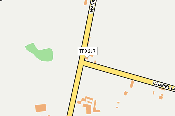
TF9 2JR lies on Warrant Road in Stoke Heath, Market Drayton. TF9 2JR is located in the Hodnet electoral ward, within the unitary authority of Shropshire and the English Parliamentary constituency of North Shropshire. The Sub Integrated Care Board (ICB) Location is NHS Shropshire, Telford and Wrekin ICB - M2L0M and the police force is West Mercia. This postcode has been in use since January 1980.


GetTheData
Source: OS OpenMap – Local (Ordnance Survey)
Source: OS VectorMap District (Ordnance Survey)
Licence: Open Government Licence (requires attribution)
| Easting | 364441 |
| Northing | 329514 |
| Latitude | 52.861929 |
| Longitude | -2.529605 |
GetTheData
Source: Open Postcode Geo
Licence: Open Government Licence
| Street | Warrant Road |
| Locality | Stoke Heath |
| Town/City | Market Drayton |
| Country | England |
| Postcode District | TF9 |
➜ See where TF9 is on a map ➜ Where is Rosehill? | |
GetTheData
Source: Land Registry Price Paid Data
Licence: Open Government Licence
Elevation or altitude of TF9 2JR as distance above sea level:
| Metres | Feet | |
|---|---|---|
| Elevation | 80m | 262ft |
Elevation is measured from the approximate centre of the postcode, to the nearest point on an OS contour line from OS Terrain 50, which has contour spacing of ten vertical metres.
➜ How high above sea level am I? Find the elevation of your current position using your device's GPS.
GetTheData
Source: Open Postcode Elevation
Licence: Open Government Licence
| Ward | Hodnet |
| Constituency | North Shropshire |
GetTheData
Source: ONS Postcode Database
Licence: Open Government Licence
| Chapel Lane Jct (Warrant Road) | Stoke Heath | 16m |
| Warrant Road Jct (Chapel Lane) | Stoke Heath | 30m |
| Dutton Close Jct (Warrant Road) | Stoke Heath | 480m |
| Dutton Close Jct (Warrant Road) | Rosehill | 509m |
| Prison Entrance (Warrant Road) | Warren | 1,015m |
GetTheData
Source: NaPTAN
Licence: Open Government Licence
| Percentage of properties with Next Generation Access | 100.0% |
| Percentage of properties with Superfast Broadband | 100.0% |
| Percentage of properties with Ultrafast Broadband | 100.0% |
| Percentage of properties with Full Fibre Broadband | 100.0% |
Superfast Broadband is between 30Mbps and 300Mbps
Ultrafast Broadband is > 300Mbps
| Percentage of properties unable to receive 2Mbps | 0.0% |
| Percentage of properties unable to receive 5Mbps | 0.0% |
| Percentage of properties unable to receive 10Mbps | 0.0% |
| Percentage of properties unable to receive 30Mbps | 0.0% |
GetTheData
Source: Ofcom
Licence: Ofcom Terms of Use (requires attribution)
GetTheData
Source: ONS Postcode Database
Licence: Open Government Licence


➜ Get more ratings from the Food Standards Agency
GetTheData
Source: Food Standards Agency
Licence: FSA terms & conditions
| Last Collection | |||
|---|---|---|---|
| Location | Mon-Fri | Sat | Distance |
| Wistanswick | 16:45 | 10:30 | 2,576m |
| Longslow Road | 17:00 | 11:30 | 2,793m |
| Hinstock Post Office | 16:15 | 11:15 | 5,588m |
GetTheData
Source: Dracos
Licence: Creative Commons Attribution-ShareAlike
The below table lists the International Territorial Level (ITL) codes (formerly Nomenclature of Territorial Units for Statistics (NUTS) codes) and Local Administrative Units (LAU) codes for TF9 2JR:
| ITL 1 Code | Name |
|---|---|
| TLG | West Midlands (England) |
| ITL 2 Code | Name |
| TLG2 | Shropshire and Staffordshire |
| ITL 3 Code | Name |
| TLG22 | Shropshire |
| LAU 1 Code | Name |
| E06000051 | Shropshire |
GetTheData
Source: ONS Postcode Directory
Licence: Open Government Licence
The below table lists the Census Output Area (OA), Lower Layer Super Output Area (LSOA), and Middle Layer Super Output Area (MSOA) for TF9 2JR:
| Code | Name | |
|---|---|---|
| OA | E00174564 | |
| LSOA | E01028885 | Shropshire 009D |
| MSOA | E02006020 | Shropshire 009 |
GetTheData
Source: ONS Postcode Directory
Licence: Open Government Licence
| TF9 2JS | Warrant Road | 465m |
| TF9 2JP | Warrant Road | 490m |
| TF9 2JW | Dutton Close | 502m |
| TF9 2JN | Dutton Close | 510m |
| TF9 2JT | Chapel Lane | 523m |
| TF9 2DZ | Warrant Road | 651m |
| TF9 2LG | Sandy Lane | 1060m |
| TF9 2JU | Rosehill Road | 1127m |
| TF9 2JY | Rosehill Road | 1135m |
| TF9 2LF | Rosehill Road | 1311m |
GetTheData
Source: Open Postcode Geo; Land Registry Price Paid Data
Licence: Open Government Licence