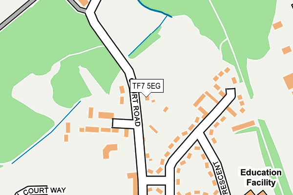
TF7 5EG lies on Court Street in Madeley, Telford. TF7 5EG is located in the Madeley & Sutton Hill electoral ward, within the unitary authority of Telford and Wrekin and the English Parliamentary constituency of Telford. The Sub Integrated Care Board (ICB) Location is NHS Shropshire, Telford and Wrekin ICB - M2L0M and the police force is West Mercia. This postcode has been in use since October 1985.


GetTheData
Source: OS OpenMap – Local (Ordnance Survey)
Source: OS VectorMap District (Ordnance Survey)
Licence: Open Government Licence (requires attribution)
| Easting | 369677 |
| Northing | 304779 |
| Latitude | 52.639916 |
| Longitude | -2.449540 |
GetTheData
Source: Open Postcode Geo
Licence: Open Government Licence
| Street | Court Street |
| Locality | Madeley |
| Town/City | Telford |
| Country | England |
| Postcode District | TF7 |
➜ See where TF7 is on a map ➜ Where is Telford? | |
GetTheData
Source: Land Registry Price Paid Data
Licence: Open Government Licence
Elevation or altitude of TF7 5EG as distance above sea level:
| Metres | Feet | |
|---|---|---|
| Elevation | 110m | 361ft |
Elevation is measured from the approximate centre of the postcode, to the nearest point on an OS contour line from OS Terrain 50, which has contour spacing of ten vertical metres.
➜ How high above sea level am I? Find the elevation of your current position using your device's GPS.
GetTheData
Source: Open Postcode Elevation
Licence: Open Government Licence
| Ward | Madeley & Sutton Hill |
| Constituency | Telford |
GetTheData
Source: ONS Postcode Database
Licence: Open Government Licence
2017 30 JUN £220,000 |
2016 29 JUN £220,000 |
2007 12 DEC £249,995 |
GetTheData
Source: HM Land Registry Price Paid Data
Licence: Contains HM Land Registry data © Crown copyright and database right 2025. This data is licensed under the Open Government Licence v3.0.
| Court Centre (Parkway) | Madeley | 215m |
| Court Centre (Parkway) | Madeley | 239m |
| St Marys School (Parkway) | Madeley | 299m |
| Madeley Centre (Court Street) | Madeley | 319m |
| St. Marys Church (High Street) | Madeley | 375m |
| Telford Central Station | 4.6km |
GetTheData
Source: NaPTAN
Licence: Open Government Licence
| Percentage of properties with Next Generation Access | 100.0% |
| Percentage of properties with Superfast Broadband | 100.0% |
| Percentage of properties with Ultrafast Broadband | 66.7% |
| Percentage of properties with Full Fibre Broadband | 0.0% |
Superfast Broadband is between 30Mbps and 300Mbps
Ultrafast Broadband is > 300Mbps
| Percentage of properties unable to receive 2Mbps | 0.0% |
| Percentage of properties unable to receive 5Mbps | 0.0% |
| Percentage of properties unable to receive 10Mbps | 0.0% |
| Percentage of properties unable to receive 30Mbps | 0.0% |
GetTheData
Source: Ofcom
Licence: Ofcom Terms of Use (requires attribution)
GetTheData
Source: ONS Postcode Database
Licence: Open Government Licence


➜ Get more ratings from the Food Standards Agency
GetTheData
Source: Food Standards Agency
Licence: FSA terms & conditions
| Last Collection | |||
|---|---|---|---|
| Location | Mon-Fri | Sat | Distance |
| High Street | 16:45 | 11:00 | 407m |
| Madeley Post Office | 17:15 | 11:15 | 412m |
| Tweedale Industrial Estate | 18:15 | 12:00 | 512m |
GetTheData
Source: Dracos
Licence: Creative Commons Attribution-ShareAlike
The below table lists the International Territorial Level (ITL) codes (formerly Nomenclature of Territorial Units for Statistics (NUTS) codes) and Local Administrative Units (LAU) codes for TF7 5EG:
| ITL 1 Code | Name |
|---|---|
| TLG | West Midlands (England) |
| ITL 2 Code | Name |
| TLG2 | Shropshire and Staffordshire |
| ITL 3 Code | Name |
| TLG21 | Telford and Wrekin |
| LAU 1 Code | Name |
| E06000020 | Telford and Wrekin |
GetTheData
Source: ONS Postcode Directory
Licence: Open Government Licence
The below table lists the Census Output Area (OA), Lower Layer Super Output Area (LSOA), and Middle Layer Super Output Area (MSOA) for TF7 5EG:
| Code | Name | |
|---|---|---|
| OA | E00071503 | |
| LSOA | E01014162 | Telford and Wrekin 022D |
| MSOA | E02002949 | Telford and Wrekin 022 |
GetTheData
Source: ONS Postcode Directory
Licence: Open Government Licence
| TF7 5EE | Court Street | 67m |
| TF7 5EL | Coronation Crescent | 94m |
| TF7 5EQ | Coronation Crescent | 98m |
| TF7 5ED | Court Street | 125m |
| TF7 5EN | Coronation Crescent | 143m |
| TF7 5EH | Coronation Crescent | 150m |
| TF7 5EW | Coronation Crescent | 163m |
| TF7 5EJ | Coronation Crescent | 169m |
| TF7 5FF | Russell Court | 265m |
| TF7 5EP | Court Street | 270m |
GetTheData
Source: Open Postcode Geo; Land Registry Price Paid Data
Licence: Open Government Licence