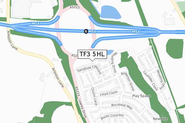
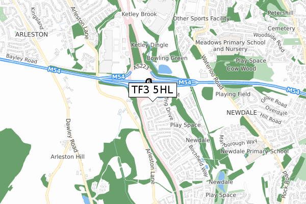
TF3 5HL is located in the Lawley electoral ward, within the unitary authority of Telford and Wrekin and the English Parliamentary constituency of Telford. The Sub Integrated Care Board (ICB) Location is NHS Shropshire, Telford and Wrekin ICB - M2L0M and the police force is West Mercia. This postcode has been in use since January 2018.


GetTheData
Source: OS Open Zoomstack (Ordnance Survey)
Licence: Open Government Licence (requires attribution)
Attribution: Contains OS data © Crown copyright and database right 2024
Source: Open Postcode Geo
Licence: Open Government Licence (requires attribution)
Attribution: Contains OS data © Crown copyright and database right 2024; Contains Royal Mail data © Royal Mail copyright and database right 2024; Source: Office for National Statistics licensed under the Open Government Licence v.3.0
| Easting | 367152 |
| Northing | 310030 |
| Latitude | 52.686971 |
| Longitude | -2.487376 |
GetTheData
Source: Open Postcode Geo
Licence: Open Government Licence
| Country | England |
| Postcode District | TF3 |
| ➜ TF3 open data dashboard ➜ See where TF3 is on a map ➜ Where is Telford? | |
GetTheData
Source: Land Registry Price Paid Data
Licence: Open Government Licence
| Ward | Lawley |
| Constituency | Telford |
GetTheData
Source: ONS Postcode Database
Licence: Open Government Licence
| June 2022 | Violence and sexual offences | On or near A5223 | 79m |
| June 2022 | Violence and sexual offences | On or near A5223 | 79m |
| June 2022 | Violence and sexual offences | On or near A5223 | 79m |
| ➜ Get more crime data in our Crime section | |||
GetTheData
Source: data.police.uk
Licence: Open Government Licence
| Tesco Store (Wrekin Retail Park) | Wrekin Retail Park | 382m |
| Newdale Halt (Synders Way) | Lawley | 534m |
| Sinclair Gardens (Waterloo Road) | Ketley | 583m |
| Sinclair Gardens (Waterloo Road) | Ketley | 593m |
| Harris Terrace (Rock Road) | Overdale | 682m |
| Wellington (Shropshire) Station | 2.6km |
| Oakengates Station | 2.6km |
| Telford Central Station | 3.2km |
GetTheData
Source: NaPTAN
Licence: Open Government Licence
GetTheData
Source: ONS Postcode Database
Licence: Open Government Licence


➜ Get more ratings from the Food Standards Agency
GetTheData
Source: Food Standards Agency
Licence: FSA terms & conditions
| Last Collection | |||
|---|---|---|---|
| Location | Mon-Fri | Sat | Distance |
| Tesco | 18:00 | 12:00 | 471m |
| Overdale Post Office | 17:15 | 11:00 | 858m |
| Holyhead Road | 16:45 | 11:15 | 1,122m |
GetTheData
Source: Dracos
Licence: Creative Commons Attribution-ShareAlike
| Facility | Distance |
|---|---|
| Sinclair Social Club Off Hollyhead Road, Ketley, Telford Grass Pitches | 375m |
| Meadows Primary School And Nursery Riddings Close, Ketley, Telford Grass Pitches | 788m |
| Lawley Primary School Lawley Village, Telford Grass Pitches | 934m |
GetTheData
Source: Active Places
Licence: Open Government Licence
| School | Phase of Education | Distance |
|---|---|---|
| Meadows Primary School and Nursery Riddings Close, Ketley, Telford, TF1 5HF | Primary | 809m |
| Newdale Primary School & Nursery Marlborough Way, Rock Road, Newdale, Telford, TF3 5HA | Primary | 883m |
| Lawley Primary School Off Arleston Lane, Lawley, Telford, TF4 2PR | Primary | 928m |
GetTheData
Source: Edubase
Licence: Open Government Licence
The below table lists the International Territorial Level (ITL) codes (formerly Nomenclature of Territorial Units for Statistics (NUTS) codes) and Local Administrative Units (LAU) codes for TF3 5HL:
| ITL 1 Code | Name |
|---|---|
| TLG | West Midlands (England) |
| ITL 2 Code | Name |
| TLG2 | Shropshire and Staffordshire |
| ITL 3 Code | Name |
| TLG21 | Telford and Wrekin |
| LAU 1 Code | Name |
| E06000020 | Telford and Wrekin |
GetTheData
Source: ONS Postcode Directory
Licence: Open Government Licence
The below table lists the Census Output Area (OA), Lower Layer Super Output Area (LSOA), and Middle Layer Super Output Area (MSOA) for TF3 5HL:
| Code | Name | |
|---|---|---|
| OA | E00173129 | |
| LSOA | E01014156 | Telford and Wrekin 016C |
| MSOA | E02002943 | Telford and Wrekin 016 |
GetTheData
Source: ONS Postcode Directory
Licence: Open Government Licence
| TF1 2LA | Arleston Brook | 218m |
| TF1 5HP | Sinclair Gardens | 502m |
| TF1 2JZ | 551m | |
| TF3 5GE | Synders Way | 563m |
| TF1 5HR | Sinclair Gardens | 568m |
| TF3 5GG | Cottom Way | 610m |
| TF1 2NN | Arleston Manor Drive | 623m |
| TF1 2HS | Arleston Manor Mews | 634m |
| TF3 5GF | Newdale Halt | 640m |
| TF1 5JH | Teamore Close | 640m |
GetTheData
Source: Open Postcode Geo; Land Registry Price Paid Data
Licence: Open Government Licence