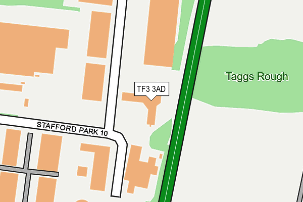
TF3 3AD is located in the The Nedge electoral ward, within the unitary authority of Telford and Wrekin and the English Parliamentary constituency of Telford. The Sub Integrated Care Board (ICB) Location is NHS Shropshire, Telford and Wrekin ICB - M2L0M and the police force is West Mercia. This postcode has been in use since December 2000.


GetTheData
Source: OS OpenMap – Local (Ordnance Survey)
Source: OS VectorMap District (Ordnance Survey)
Licence: Open Government Licence (requires attribution)
| Easting | 372374 |
| Northing | 308718 |
| Latitude | 52.675455 |
| Longitude | -2.410018 |
GetTheData
Source: Open Postcode Geo
Licence: Open Government Licence
| Country | England |
| Postcode District | TF3 |
➜ See where TF3 is on a map ➜ Where is Telford? | |
GetTheData
Source: Land Registry Price Paid Data
Licence: Open Government Licence
Elevation or altitude of TF3 3AD as distance above sea level:
| Metres | Feet | |
|---|---|---|
| Elevation | 130m | 427ft |
Elevation is measured from the approximate centre of the postcode, to the nearest point on an OS contour line from OS Terrain 50, which has contour spacing of ten vertical metres.
➜ How high above sea level am I? Find the elevation of your current position using your device's GPS.
GetTheData
Source: Open Postcode Elevation
Licence: Open Government Licence
| Ward | The Nedge |
| Constituency | Telford |
GetTheData
Source: ONS Postcode Database
Licence: Open Government Licence
| Kwik Fit (Stafford Park 11) | Stafford Park | 356m |
| Kwik Fit (Stafford Park 11) | Stafford Park | 377m |
| Naird Roundabout (Stafford Park 11) | Stafford Park | 504m |
| Telford Services (Priorslee Road) | Priorslee | 532m |
| Naird Roundabout (Stafford Park 11) | Stafford Park | 539m |
| Telford Central Station | 2.2km |
| Shifnal Station | 2.8km |
| Oakengates Station | 3.4km |
GetTheData
Source: NaPTAN
Licence: Open Government Licence
| Percentage of properties with Next Generation Access | 100.0% |
| Percentage of properties with Superfast Broadband | 100.0% |
| Percentage of properties with Ultrafast Broadband | 0.0% |
| Percentage of properties with Full Fibre Broadband | 0.0% |
Superfast Broadband is between 30Mbps and 300Mbps
Ultrafast Broadband is > 300Mbps
| Percentage of properties unable to receive 2Mbps | 0.0% |
| Percentage of properties unable to receive 5Mbps | 0.0% |
| Percentage of properties unable to receive 10Mbps | 0.0% |
| Percentage of properties unable to receive 30Mbps | 0.0% |
GetTheData
Source: Ofcom
Licence: Ofcom Terms of Use (requires attribution)
GetTheData
Source: ONS Postcode Database
Licence: Open Government Licence


➜ Get more ratings from the Food Standards Agency
GetTheData
Source: Food Standards Agency
Licence: FSA terms & conditions
| Last Collection | |||
|---|---|---|---|
| Location | Mon-Fri | Sat | Distance |
| Stafford Park 4 Meter Box | 18:15 | 909m | |
| Stafford Park 4 | 18:15 | 11:30 | 917m |
| Stafford Park 17 | 18:15 | 11:30 | 1,123m |
GetTheData
Source: Dracos
Licence: Creative Commons Attribution-ShareAlike
The below table lists the International Territorial Level (ITL) codes (formerly Nomenclature of Territorial Units for Statistics (NUTS) codes) and Local Administrative Units (LAU) codes for TF3 3AD:
| ITL 1 Code | Name |
|---|---|
| TLG | West Midlands (England) |
| ITL 2 Code | Name |
| TLG2 | Shropshire and Staffordshire |
| ITL 3 Code | Name |
| TLG21 | Telford and Wrekin |
| LAU 1 Code | Name |
| E06000020 | Telford and Wrekin |
GetTheData
Source: ONS Postcode Directory
Licence: Open Government Licence
The below table lists the Census Output Area (OA), Lower Layer Super Output Area (LSOA), and Middle Layer Super Output Area (MSOA) for TF3 3AD:
| Code | Name | |
|---|---|---|
| OA | E00071666 | |
| LSOA | E01014192 | Telford and Wrekin 018B |
| MSOA | E02002945 | Telford and Wrekin 018 |
GetTheData
Source: ONS Postcode Directory
Licence: Open Government Licence
| TF3 3AY | Stafford Park 11 | 354m |
| TF3 3AT | Stafford Park 6 | 408m |
| TF11 9PQ | 613m | |
| TF3 3BA | Stafford Park 4 | 749m |
| TF3 3BN | Stafford Park 18 | 837m |
| TF3 3BJ | Stafford Park 12 | 879m |
| TF3 3DN | Queensway Link Industrial Estate | 1023m |
| TF11 9PG | Knowles Bank | 1235m |
| TF2 9SF | Gough Close | 1254m |
| TF3 3BQ | Stafford Park 7 | 1267m |
GetTheData
Source: Open Postcode Geo; Land Registry Price Paid Data
Licence: Open Government Licence