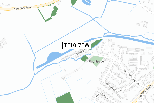
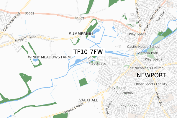
TF10 7FW is located in the Newport North electoral ward, within the unitary authority of Telford and Wrekin and the English Parliamentary constituency of The Wrekin. The Sub Integrated Care Board (ICB) Location is NHS Shropshire, Telford and Wrekin ICB - M2L0M and the police force is West Mercia. This postcode has been in use since April 2019.


GetTheData
Source: OS Open Zoomstack (Ordnance Survey)
Licence: Open Government Licence (requires attribution)
Attribution: Contains OS data © Crown copyright and database right 2024
Source: Open Postcode Geo
Licence: Open Government Licence (requires attribution)
Attribution: Contains OS data © Crown copyright and database right 2024; Contains Royal Mail data © Royal Mail copyright and database right 2024; Source: Office for National Statistics licensed under the Open Government Licence v.3.0
| Easting | 373673 |
| Northing | 319319 |
| Latitude | 52.770831 |
| Longitude | -2.391659 |
GetTheData
Source: Open Postcode Geo
Licence: Open Government Licence
| Country | England |
| Postcode District | TF10 |
| ➜ TF10 open data dashboard ➜ See where TF10 is on a map ➜ Where is Newport? | |
GetTheData
Source: Land Registry Price Paid Data
Licence: Open Government Licence
| Ward | Newport North |
| Constituency | The Wrekin |
GetTheData
Source: ONS Postcode Database
Licence: Open Government Licence
| October 2023 | Other theft | On or near Greenacres Way | 324m |
| January 2023 | Violence and sexual offences | On or near Greenacres Way | 324m |
| December 2022 | Anti-social behaviour | On or near Greenacres Way | 324m |
| ➜ Get more crime data in our Crime section | |||
GetTheData
Source: data.police.uk
Licence: Open Government Licence
| Greenacres Way | Newport | 289m |
| Hallcroft Gardens (Broomfield Road) | Newport | 379m |
| Vauxhall Crescent (Longford Road) | Newport | 493m |
| Broomfield Road (Salters Lane) | Newport | 526m |
| Moorland Road (Boughey Road) | Newport | 563m |
GetTheData
Source: NaPTAN
Licence: Open Government Licence
| Percentage of properties with Next Generation Access | 100.0% |
| Percentage of properties with Superfast Broadband | 100.0% |
| Percentage of properties with Ultrafast Broadband | 100.0% |
| Percentage of properties with Full Fibre Broadband | 100.0% |
Superfast Broadband is between 30Mbps and 300Mbps
Ultrafast Broadband is > 300Mbps
| Percentage of properties unable to receive 2Mbps | 0.0% |
| Percentage of properties unable to receive 5Mbps | 0.0% |
| Percentage of properties unable to receive 10Mbps | 0.0% |
| Percentage of properties unable to receive 30Mbps | 0.0% |
GetTheData
Source: Ofcom
Licence: Ofcom Terms of Use (requires attribution)
GetTheData
Source: ONS Postcode Database
Licence: Open Government Licence


➜ Get more ratings from the Food Standards Agency
GetTheData
Source: Food Standards Agency
Licence: FSA terms & conditions
| Last Collection | |||
|---|---|---|---|
| Location | Mon-Fri | Sat | Distance |
| Newport Road | 10:30 | 10:30 | 764m |
| Chetwynd End | 17:00 | 11:30 | 782m |
| Upper Bar | 17:30 | 11:30 | 1,007m |
GetTheData
Source: Dracos
Licence: Creative Commons Attribution-ShareAlike
| Facility | Distance |
|---|---|
| Haberdashers Adams Grammar School High Street, Newport Sports Hall, Health and Fitness Gym, Swimming Pool | 685m |
| Newport Swimming And Fitness Centre Victoria Park, Newport Swimming Pool, Health and Fitness Gym | 933m |
| Newport Girls High School Academy Trust Wellington Road, Newport Grass Pitches, Sports Hall, Artificial Grass Pitch | 1.1km |
GetTheData
Source: Active Places
Licence: Open Government Licence
| School | Phase of Education | Distance |
|---|---|---|
| Haberdashers' Adams High Street, Newport, TF10 7BD | Secondary | 686m |
| Castle House School Chetwynd End, Newport, TF10 7JE | Not applicable | 794m |
| Newport Girls' High School Academy Wellington Road, Newport, TF10 7HL | Secondary | 1.1km |
GetTheData
Source: Edubase
Licence: Open Government Licence
| Risk of TF10 7FW flooding from rivers and sea | High |
| ➜ TF10 7FW flood map | |
GetTheData
Source: Open Flood Risk by Postcode
Licence: Open Government Licence
The below table lists the International Territorial Level (ITL) codes (formerly Nomenclature of Territorial Units for Statistics (NUTS) codes) and Local Administrative Units (LAU) codes for TF10 7FW:
| ITL 1 Code | Name |
|---|---|
| TLG | West Midlands (England) |
| ITL 2 Code | Name |
| TLG2 | Shropshire and Staffordshire |
| ITL 3 Code | Name |
| TLG21 | Telford and Wrekin |
| LAU 1 Code | Name |
| E06000020 | Telford and Wrekin |
GetTheData
Source: ONS Postcode Directory
Licence: Open Government Licence
The below table lists the Census Output Area (OA), Lower Layer Super Output Area (LSOA), and Middle Layer Super Output Area (MSOA) for TF10 7FW:
| Code | Name | |
|---|---|---|
| OA | E00071568 | |
| LSOA | E01014173 | Telford and Wrekin 001C |
| MSOA | E02002928 | Telford and Wrekin 001 |
GetTheData
Source: ONS Postcode Directory
Licence: Open Government Licence
| TF10 7PN | Broomfield Road | 138m |
| TF10 7TS | Broomfield Place | 165m |
| TF10 7PW | Broomfield Road | 274m |
| TF10 7PH | Greenacres Way | 277m |
| TF10 7PL | Broomfield Road | 301m |
| TF10 7PJ | Greenacres Way | 316m |
| TF10 7PR | Hallcroft Gardens | 359m |
| TF10 7PX | Farm Grove | 369m |
| TF10 8HD | Newport Road | 371m |
| TF10 7PQ | Greenacres Way | 412m |
GetTheData
Source: Open Postcode Geo; Land Registry Price Paid Data
Licence: Open Government Licence