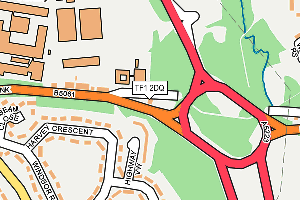
TF1 2DQ is located in the Arleston & College electoral ward, within the unitary authority of Telford and Wrekin and the English Parliamentary constituency of The Wrekin. The Sub Integrated Care Board (ICB) Location is NHS Shropshire, Telford and Wrekin ICB - M2L0M and the police force is West Mercia. This postcode has been in use since June 2000.


GetTheData
Source: OS OpenMap – Local (Ordnance Survey)
Source: OS VectorMap District (Ordnance Survey)
Licence: Open Government Licence (requires attribution)
| Easting | 366706 |
| Northing | 311075 |
| Latitude | 52.696323 |
| Longitude | -2.494082 |
GetTheData
Source: Open Postcode Geo
Licence: Open Government Licence
| Country | England |
| Postcode District | TF1 |
➜ See where TF1 is on a map ➜ Where is Telford? | |
GetTheData
Source: Land Registry Price Paid Data
Licence: Open Government Licence
Elevation or altitude of TF1 2DQ as distance above sea level:
| Metres | Feet | |
|---|---|---|
| Elevation | 110m | 361ft |
Elevation is measured from the approximate centre of the postcode, to the nearest point on an OS contour line from OS Terrain 50, which has contour spacing of ten vertical metres.
➜ How high above sea level am I? Find the elevation of your current position using your device's GPS.
GetTheData
Source: Open Postcode Elevation
Licence: Open Government Licence
| Ward | Arleston & College |
| Constituency | The Wrekin |
GetTheData
Source: ONS Postcode Database
Licence: Open Government Licence
| Bennetts Bank | Wellington | 51m |
| Bennetts Bank | Wellington | 101m |
| Windsor Road | Arleston | 269m |
| Windsor Road | Arleston | 280m |
| Harvey Crescent (Windsor Road) | Arleston | 312m |
| Wellington (Shropshire) Station | 1.7km |
| Oakengates Station | 3km |
| Telford Central Station | 4km |
GetTheData
Source: NaPTAN
Licence: Open Government Licence
GetTheData
Source: ONS Postcode Database
Licence: Open Government Licence


➜ Get more ratings from the Food Standards Agency
GetTheData
Source: Food Standards Agency
Licence: FSA terms & conditions
| Last Collection | |||
|---|---|---|---|
| Location | Mon-Fri | Sat | Distance |
| Kingsland Post Office | 17:00 | 12:15 | 709m |
| Tesco | 18:00 | 12:00 | 734m |
| Holyhead Road | 16:45 | 11:15 | 1,086m |
GetTheData
Source: Dracos
Licence: Creative Commons Attribution-ShareAlike
The below table lists the International Territorial Level (ITL) codes (formerly Nomenclature of Territorial Units for Statistics (NUTS) codes) and Local Administrative Units (LAU) codes for TF1 2DQ:
| ITL 1 Code | Name |
|---|---|
| TLG | West Midlands (England) |
| ITL 2 Code | Name |
| TLG2 | Shropshire and Staffordshire |
| ITL 3 Code | Name |
| TLG21 | Telford and Wrekin |
| LAU 1 Code | Name |
| E06000020 | Telford and Wrekin |
GetTheData
Source: ONS Postcode Directory
Licence: Open Government Licence
The below table lists the Census Output Area (OA), Lower Layer Super Output Area (LSOA), and Middle Layer Super Output Area (MSOA) for TF1 2DQ:
| Code | Name | |
|---|---|---|
| OA | E00071278 | |
| LSOA | E01014113 | Telford and Wrekin 011C |
| MSOA | E02002938 | Telford and Wrekin 011 |
GetTheData
Source: ONS Postcode Directory
Licence: Open Government Licence
| TF1 2NY | Highway View | 80m |
| TF1 2NR | Bennetts Bank | 133m |
| TF1 2NZ | Harvey Crescent | 153m |
| TF1 2PA | Harvey Crescent | 248m |
| TF1 2PE | Windsor Road | 250m |
| TF1 2PB | Arleston Avenue | 251m |
| TF1 2PD | Windsor Road | 294m |
| TF1 2ND | Manor Rise | 339m |
| TF1 2LP | Woollam Road | 350m |
| TF1 5BS | Western Rise | 356m |
GetTheData
Source: Open Postcode Geo; Land Registry Price Paid Data
Licence: Open Government Licence