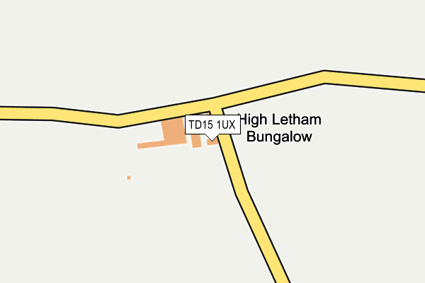
TD15 1UX is in Berwick-upon-tweed. TD15 1UX is located in the Berwick North electoral ward, within the unitary authority of Northumberland and the English Parliamentary constituency of Berwick-upon-Tweed. The Sub Integrated Care Board (ICB) Location is NHS North East and North Cumbria ICB - 00L and the police force is Northumbria. This postcode has been in use since January 1980.


GetTheData
Source: OS OpenMap – Local (Ordnance Survey)
Source: OS VectorMap District (Ordnance Survey)
Licence: Open Government Licence (requires attribution)
| Easting | 397069 |
| Northing | 653718 |
| Latitude | 55.776776 |
| Longitude | -2.048303 |
GetTheData
Source: Open Postcode Geo
Licence: Open Government Licence
| Town/City | Berwick-upon-tweed |
| Country | England |
| Postcode District | TD15 |
➜ See where TD15 is on a map | |
GetTheData
Source: Land Registry Price Paid Data
Licence: Open Government Licence
Elevation or altitude of TD15 1UX as distance above sea level:
| Metres | Feet | |
|---|---|---|
| Elevation | 70m | 230ft |
Elevation is measured from the approximate centre of the postcode, to the nearest point on an OS contour line from OS Terrain 50, which has contour spacing of ten vertical metres.
➜ How high above sea level am I? Find the elevation of your current position using your device's GPS.
GetTheData
Source: Open Postcode Elevation
Licence: Open Government Licence
| Ward | Berwick North |
| Constituency | Berwick-upon-tweed |
GetTheData
Source: ONS Postcode Database
Licence: Open Government Licence
| Brow Of The Hill (A6105) | Halidon Hill | 943m |
| Brow Of The Hill (A6105) | Halidon Hill | 961m |
| Canty's Terrace (B6461) | Canty's Brig | 1,043m |
| Canty's Terrace (B6461) | Canty's Brig | 1,054m |
| Camphill (A6105) | Halidon Hill | 1,113m |
| Berwick-upon-Tweed Station | 2.4km |
GetTheData
Source: NaPTAN
Licence: Open Government Licence
| Percentage of properties with Next Generation Access | 100.0% |
| Percentage of properties with Superfast Broadband | 0.0% |
| Percentage of properties with Ultrafast Broadband | 0.0% |
| Percentage of properties with Full Fibre Broadband | 0.0% |
Superfast Broadband is between 30Mbps and 300Mbps
Ultrafast Broadband is > 300Mbps
| Percentage of properties unable to receive 2Mbps | 0.0% |
| Percentage of properties unable to receive 5Mbps | 20.0% |
| Percentage of properties unable to receive 10Mbps | 80.0% |
| Percentage of properties unable to receive 30Mbps | 100.0% |
GetTheData
Source: Ofcom
Licence: Ofcom Terms of Use (requires attribution)
Estimated total energy consumption in TD15 1UX by fuel type, 2015.
| Consumption (kWh) | 34,413 |
|---|---|
| Meter count | 7 |
| Mean (kWh/meter) | 4,916 |
| Median (kWh/meter) | 4,248 |
GetTheData
Source: Postcode level gas estimates: 2015 (experimental)
Source: Postcode level electricity estimates: 2015 (experimental)
Licence: Open Government Licence
GetTheData
Source: ONS Postcode Database
Licence: Open Government Licence


➜ Get more ratings from the Food Standards Agency
GetTheData
Source: Food Standards Agency
Licence: FSA terms & conditions
| Last Collection | |||
|---|---|---|---|
| Location | Mon-Fri | Sat | Distance |
| Cantys Terrace | 17:45 | 11:00 | 1,041m |
| Berwick Delivery Office | 18:15 | 13:00 | 1,306m |
| Railway Station | 17:00 | 11:30 | 2,387m |
GetTheData
Source: Dracos
Licence: Creative Commons Attribution-ShareAlike
The below table lists the International Territorial Level (ITL) codes (formerly Nomenclature of Territorial Units for Statistics (NUTS) codes) and Local Administrative Units (LAU) codes for TD15 1UX:
| ITL 1 Code | Name |
|---|---|
| TLC | North East (England) |
| ITL 2 Code | Name |
| TLC2 | Northumberland, and Tyne and Wear |
| ITL 3 Code | Name |
| TLC21 | Northumberland |
| LAU 1 Code | Name |
| E06000057 | Northumberland |
GetTheData
Source: ONS Postcode Directory
Licence: Open Government Licence
The below table lists the Census Output Area (OA), Lower Layer Super Output Area (LSOA), and Middle Layer Super Output Area (MSOA) for TD15 1UX:
| Code | Name | |
|---|---|---|
| OA | E00139318 | |
| LSOA | E01027378 | Northumberland 002A |
| MSOA | E02005707 | Northumberland 002 |
GetTheData
Source: ONS Postcode Directory
Licence: Open Government Licence
| TD15 1SX | Cantys Terrace | 1075m |
| TD15 1UE | 1088m | |
| TD15 1UD | Halidon Terrace | 1250m |
| TD15 1UU | Camphill Cottages | 1315m |
| TD15 1UB | Duns Road | 1352m |
| TD15 1PE | 1397m | |
| TD15 1SY | 1404m | |
| TD15 1PF | Paxton Road | 1473m |
| TD15 1PB | Castle Hills Farm Cottages | 1477m |
| TD15 1NL | The Elms | 1649m |
GetTheData
Source: Open Postcode Geo; Land Registry Price Paid Data
Licence: Open Government Licence