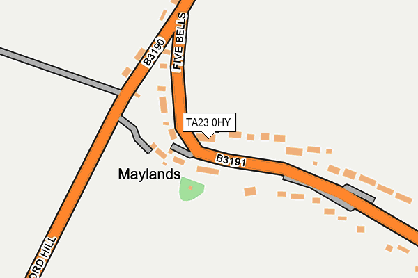
TA23 0HY lies on Five Bells in Watchet. TA23 0HY is located in the Watchet & Stogursey electoral ward, within the unitary authority of Somerset and the English Parliamentary constituency of Bridgwater and West Somerset. The Sub Integrated Care Board (ICB) Location is NHS Somerset ICB - 11X and the police force is Avon and Somerset. This postcode has been in use since January 1980.


GetTheData
Source: OS OpenMap – Local (Ordnance Survey)
Source: OS VectorMap District (Ordnance Survey)
Licence: Open Government Licence (requires attribution)
| Easting | 306606 |
| Northing | 142165 |
| Latitude | 51.171073 |
| Longitude | -3.337261 |
GetTheData
Source: Open Postcode Geo
Licence: Open Government Licence
| Street | Five Bells |
| Town/City | Watchet |
| Country | England |
| Postcode District | TA23 |
➜ See where TA23 is on a map | |
GetTheData
Source: Land Registry Price Paid Data
Licence: Open Government Licence
Elevation or altitude of TA23 0HY as distance above sea level:
| Metres | Feet | |
|---|---|---|
| Elevation | 50m | 164ft |
Elevation is measured from the approximate centre of the postcode, to the nearest point on an OS contour line from OS Terrain 50, which has contour spacing of ten vertical metres.
➜ How high above sea level am I? Find the elevation of your current position using your device's GPS.
GetTheData
Source: Open Postcode Elevation
Licence: Open Government Licence
| Ward | Watchet & Stogursey |
| Constituency | Bridgwater And West Somerset |
GetTheData
Source: ONS Postcode Database
Licence: Open Government Licence
| Five Bells | Five Bells | 36m |
| Five Bells | Five Bells | 45m |
| Brendon Road Church | St Decuman's | 453m |
| Brendon Road Church (Brendon Road) | St Decuman's | 457m |
| Woodland Road | Watchet | 776m |
| Watchet (West Somerset Railway) | Watchet | 1,187m |
GetTheData
Source: NaPTAN
Licence: Open Government Licence
| Percentage of properties with Next Generation Access | 100.0% |
| Percentage of properties with Superfast Broadband | 100.0% |
| Percentage of properties with Ultrafast Broadband | 0.0% |
| Percentage of properties with Full Fibre Broadband | 0.0% |
Superfast Broadband is between 30Mbps and 300Mbps
Ultrafast Broadband is > 300Mbps
| Median download speed | 47.5Mbps |
| Average download speed | 46.6Mbps |
| Maximum download speed | 80.00Mbps |
| Median upload speed | 11.6Mbps |
| Average upload speed | 11.6Mbps |
| Maximum upload speed | 20.00Mbps |
| Percentage of properties unable to receive 2Mbps | 0.0% |
| Percentage of properties unable to receive 5Mbps | 0.0% |
| Percentage of properties unable to receive 10Mbps | 0.0% |
| Percentage of properties unable to receive 30Mbps | 0.0% |
GetTheData
Source: Ofcom
Licence: Ofcom Terms of Use (requires attribution)
Estimated total energy consumption in TA23 0HY by fuel type, 2015.
| Consumption (kWh) | 264,465 |
|---|---|
| Meter count | 17 |
| Mean (kWh/meter) | 15,557 |
| Median (kWh/meter) | 13,655 |
| Consumption (kWh) | 40,586 |
|---|---|
| Meter count | 13 |
| Mean (kWh/meter) | 3,122 |
| Median (kWh/meter) | 2,731 |
GetTheData
Source: Postcode level gas estimates: 2015 (experimental)
Source: Postcode level electricity estimates: 2015 (experimental)
Licence: Open Government Licence
GetTheData
Source: ONS Postcode Database
Licence: Open Government Licence


➜ Get more ratings from the Food Standards Agency
GetTheData
Source: Food Standards Agency
Licence: FSA terms & conditions
| Last Collection | |||
|---|---|---|---|
| Location | Mon-Fri | Sat | Distance |
| Parsonage | 16:00 | 11:30 | 409m |
| Liddymore | 16:00 | 09:00 | 663m |
| The Pound | 15:30 | 11:30 | 1,141m |
GetTheData
Source: Dracos
Licence: Creative Commons Attribution-ShareAlike
The below table lists the International Territorial Level (ITL) codes (formerly Nomenclature of Territorial Units for Statistics (NUTS) codes) and Local Administrative Units (LAU) codes for TA23 0HY:
| ITL 1 Code | Name |
|---|---|
| TLK | South West (England) |
| ITL 2 Code | Name |
| TLK2 | Dorset and Somerset |
| ITL 3 Code | Name |
| TLK23 | Somerset CC |
| LAU 1 Code | Name |
| E07000246 | Somerset West and Taunton |
GetTheData
Source: ONS Postcode Directory
Licence: Open Government Licence
The below table lists the Census Output Area (OA), Lower Layer Super Output Area (LSOA), and Middle Layer Super Output Area (MSOA) for TA23 0HY:
| Code | Name | |
|---|---|---|
| OA | E00149518 | |
| LSOA | E01029343 | West Somerset 004E |
| MSOA | E02006116 | West Somerset 004 |
GetTheData
Source: ONS Postcode Directory
Licence: Open Government Licence
| TA23 0JA | Washford Hill | 81m |
| TA23 0HX | Brendon Road | 205m |
| TA23 0HZ | Five Bells | 319m |
| TA23 0HU | Brendon Road | 497m |
| TA23 0HT | Brendon Road | 557m |
| TA23 0JG | Courtlands Close | 701m |
| TA23 0AX | Brendon Road | 709m |
| TA23 0HH | Woodland Road | 740m |
| TA23 0JQ | Churchill Way | 774m |
| TA23 0HQ | Woodland Road | 787m |
GetTheData
Source: Open Postcode Geo; Land Registry Price Paid Data
Licence: Open Government Licence