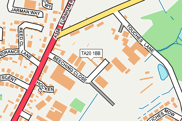
TA20 1BB is located in the Chard North electoral ward, within the unitary authority of Somerset and the English Parliamentary constituency of Yeovil. The Sub Integrated Care Board (ICB) Location is NHS Somerset ICB - 11X and the police force is Avon and Somerset. This postcode has been in use since January 1980.


GetTheData
Source: OS OpenMap – Local (Ordnance Survey)
Source: OS VectorMap District (Ordnance Survey)
Licence: Open Government Licence (requires attribution)
| Easting | 333121 |
| Northing | 109625 |
| Latitude | 50.882220 |
| Longitude | -2.952057 |
GetTheData
Source: Open Postcode Geo
Licence: Open Government Licence
| Country | England |
| Postcode District | TA20 |
➜ See where TA20 is on a map ➜ Where is Chard? | |
GetTheData
Source: Land Registry Price Paid Data
Licence: Open Government Licence
Elevation or altitude of TA20 1BB as distance above sea level:
| Metres | Feet | |
|---|---|---|
| Elevation | 80m | 262ft |
Elevation is measured from the approximate centre of the postcode, to the nearest point on an OS contour line from OS Terrain 50, which has contour spacing of ten vertical metres.
➜ How high above sea level am I? Find the elevation of your current position using your device's GPS.
GetTheData
Source: Open Postcode Elevation
Licence: Open Government Licence
| Ward | Chard North |
| Constituency | Yeovil |
GetTheData
Source: ONS Postcode Database
Licence: Open Government Licence
| Ship Inn (Furnham Road) | Chard | 114m |
| Ship Inn (Furnham Road) | Chard | 126m |
| Thorndun Park Drive (Leach Road) | Chard | 277m |
| Thorndun Park Drive (Leach Road) | Chard | 287m |
| Oscar Meyer | Chard | 296m |
GetTheData
Source: NaPTAN
Licence: Open Government Licence
GetTheData
Source: ONS Postcode Database
Licence: Open Government Licence


➜ Get more ratings from the Food Standards Agency
GetTheData
Source: Food Standards Agency
Licence: FSA terms & conditions
| Last Collection | |||
|---|---|---|---|
| Location | Mon-Fri | Sat | Distance |
| Thorndun Park | 16:30 | 12:00 | 336m |
| Glynswood | 16:30 | 12:00 | 764m |
| Elizabeth Way | 16:15 | 12:00 | 1,039m |
GetTheData
Source: Dracos
Licence: Creative Commons Attribution-ShareAlike
The below table lists the International Territorial Level (ITL) codes (formerly Nomenclature of Territorial Units for Statistics (NUTS) codes) and Local Administrative Units (LAU) codes for TA20 1BB:
| ITL 1 Code | Name |
|---|---|
| TLK | South West (England) |
| ITL 2 Code | Name |
| TLK2 | Dorset and Somerset |
| ITL 3 Code | Name |
| TLK23 | Somerset CC |
| LAU 1 Code | Name |
| E07000189 | South Somerset |
GetTheData
Source: ONS Postcode Directory
Licence: Open Government Licence
The below table lists the Census Output Area (OA), Lower Layer Super Output Area (LSOA), and Middle Layer Super Output Area (MSOA) for TA20 1BB:
| Code | Name | |
|---|---|---|
| OA | E00148593 | |
| LSOA | E01029169 | South Somerset 022A |
| MSOA | E02006096 | South Somerset 022 |
GetTheData
Source: ONS Postcode Directory
Licence: Open Government Licence
| TA20 1RP | Chaffcombe Road | 116m |
| TA20 1BD | Furnham Road | 138m |
| TA20 1BE | Furnham Road | 164m |
| TA20 1DZ | Mount Hindrance Close | 213m |
| TA20 1SY | Reed Close | 215m |
| TA20 1DA | Furnham Close | 215m |
| TA20 1AX | Furnham Road | 230m |
| TA20 1FD | Jarman Way | 232m |
| TA20 1ND | Samuel Vickery Way | 253m |
| TA20 1FB | Jarman Way | 265m |
GetTheData
Source: Open Postcode Geo; Land Registry Price Paid Data
Licence: Open Government Licence